Set a battery reserve.
Include the dirt road in both directions. Then add the paved distance to a compatible charger.
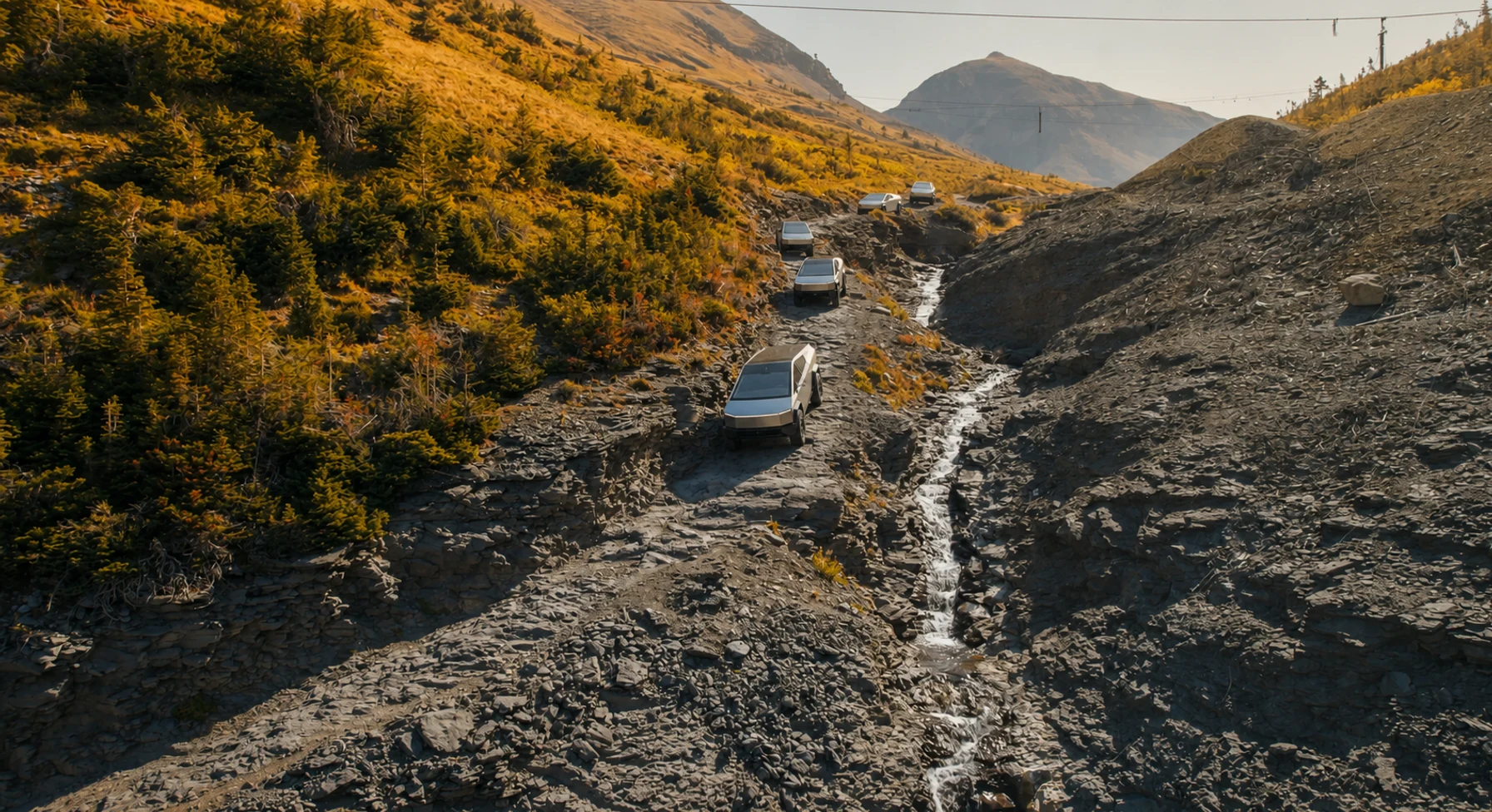
A national field atlas
Explore 50 scenic routes. Each entry has a full trail path, practical notes, and an interactive map.
HOW THE LIST WORKS
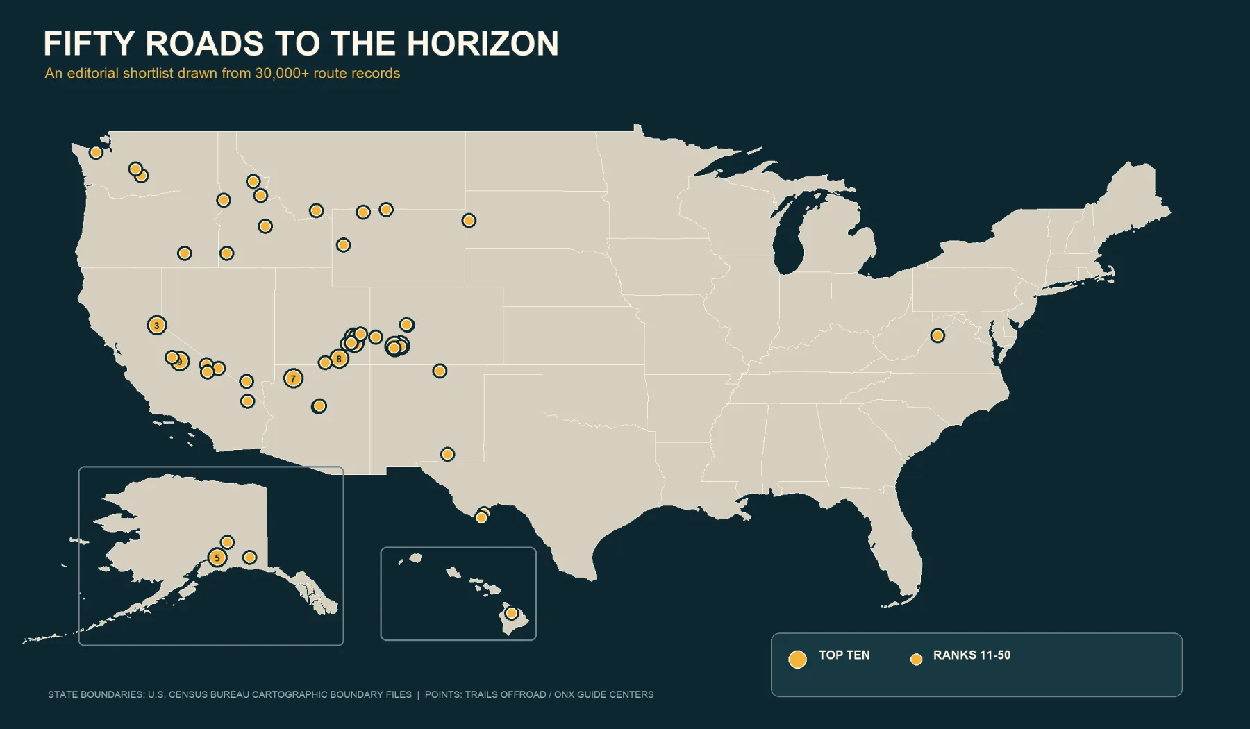
Offroad America is an atlas of 50 scenic roads. The routes include alpine shelves, desert benches, glacial valleys, red-rock ledges, and forest roads.
We rank the view first. Each entry also gives distance, high point, difficulty, season, current sources, and links to specialist trail guides.
See alpine roads, desert benches, glacial valleys, and forest routes. We rank the view, not the obstacle.
Use the route list to move through the atlas. It shows your current place in the story.
BEFORE THE TRAILHEAD
Include the paved approach and the dirt road in both directions. Add a reserve for weather and detours. Include the drive to a charger that you have verified.
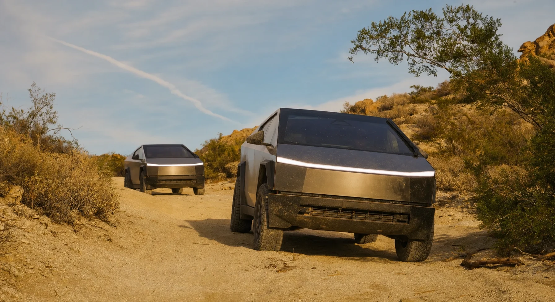
Include the dirt road in both directions. Then add the paved distance to a compatible charger.
Check it with the operator before you leave. Choose a backup station that fits inside your reserve.
Cold, wind, climbs, sand, and low tire pressure can increase energy use.
Set a turnaround time, a battery limit, and an exit route. Follow these limits during the trip.
#01 / COLORADO
One-way into Telluride, with no casual mile
Source photo: Trails Offroad / Ryan Boudreau
WHY IT RANKS
Black Bear Pass reaches 12,831 feet and descends into Telluride. The route passes the Steps, Bridal Veil Falls, and old mining sites. The narrow road and exposure require an experienced driver.
SIGNATURE VIEWTelluride, Bridal Veil Falls, and three stacked alpine basins
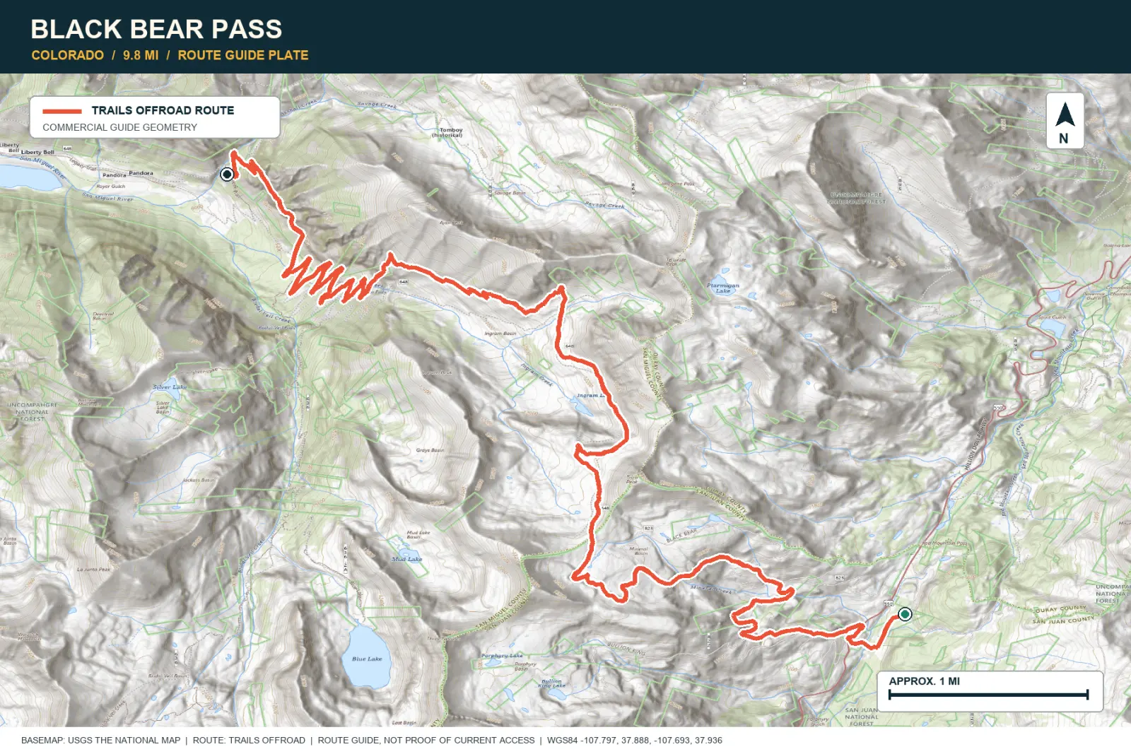
TOPOGRAPHIC PROFILE
Elevation sampled from AWS Terrain Tiles along the published route. Small terrain and GPS differences are normal.
#02 / UTAH
Four days on a sandstone bench
Source photo: Trails Offroad / Jasmine & Jon Hughes
WHY IT RANKS
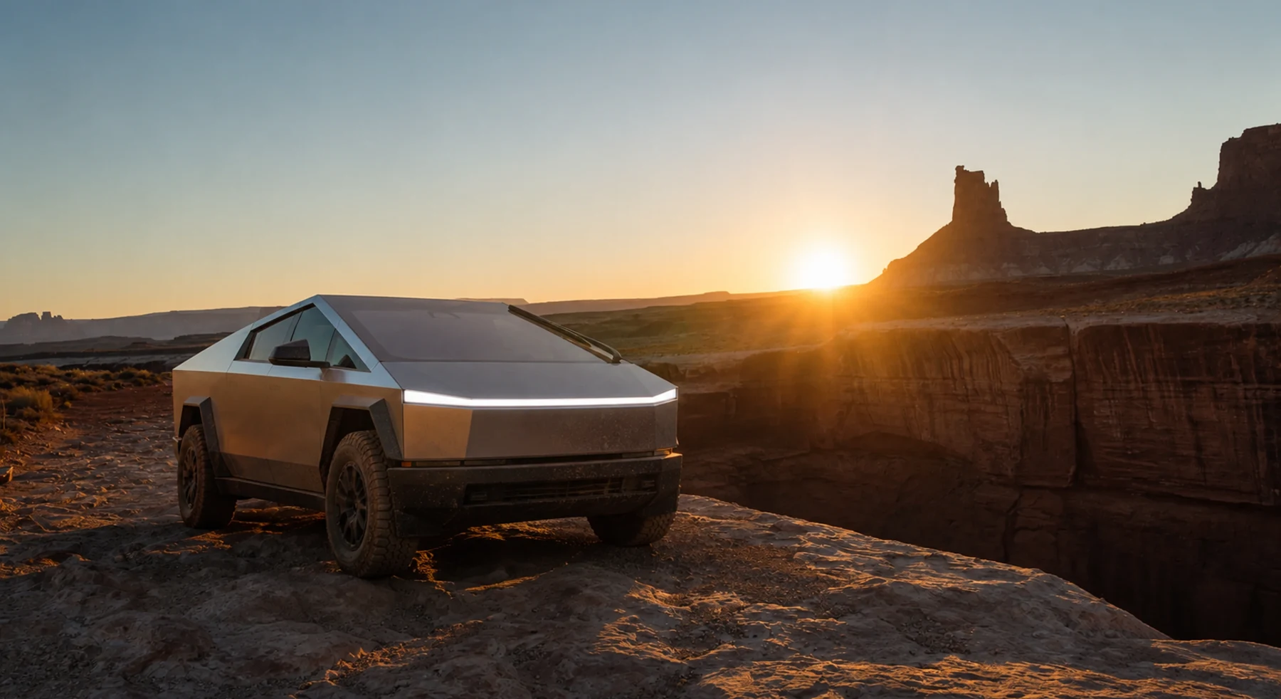
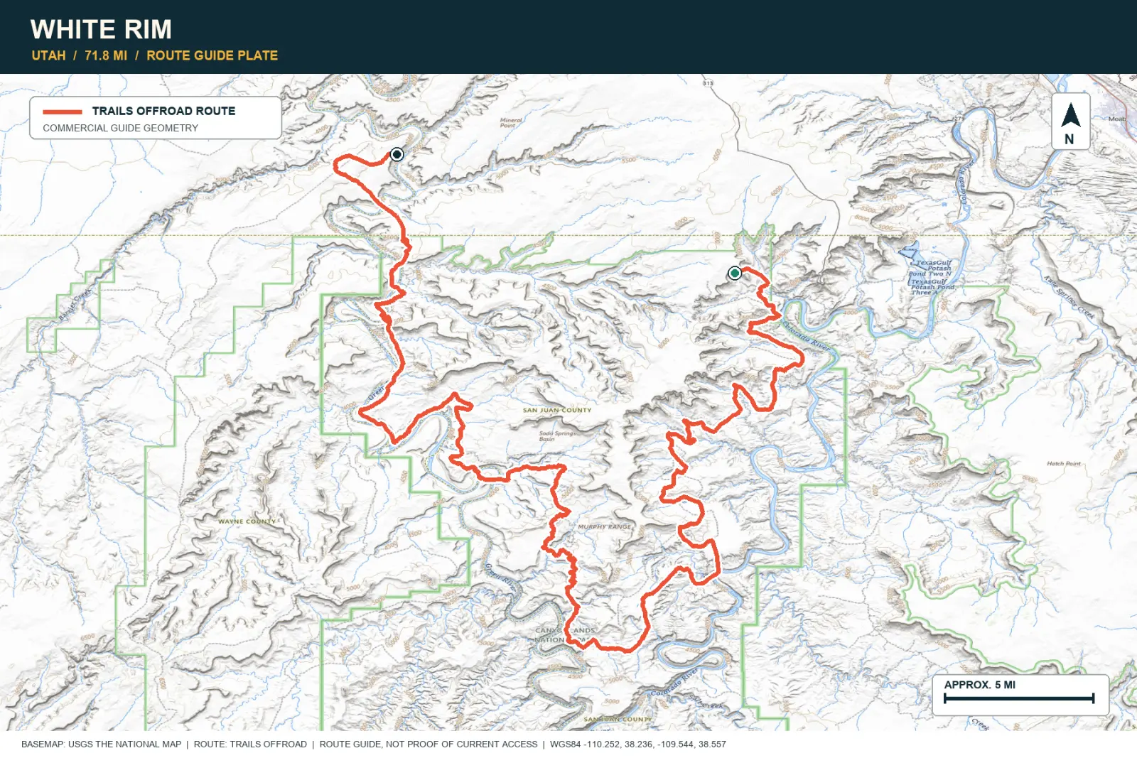
White Rim Road follows a sandstone bench below Island in the Sky. The Colorado and Green rivers cut deep canyons on each side. Plan several days to see the changing walls, hoodoos, and light.
SIGNATURE VIEWColorado and Green River canyons beneath Island in the Sky
TOPOGRAPHIC PROFILE
Elevation sampled from AWS Terrain Tiles along the published route. Small terrain and GPS differences are normal.

#03 / CALIFORNIA
Sierra granite and the road that named a Jeep
Source photo: Trails Offroad / Josh Noesser
WHY IT RANKS
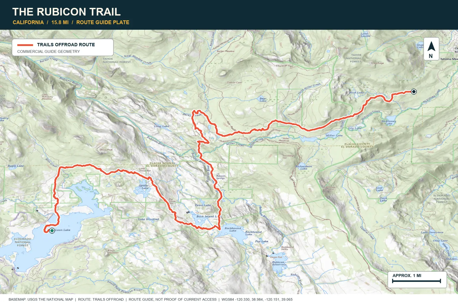
The Rubicon crosses polished Sierra granite between clear lakes and pine forest. Large rocks and repeated difficult sections require a capable vehicle. The road is also important to four-wheel-drive history.
SIGNATURE VIEWHigh Sierra slabs, forested basins, and crystal-clear water
TOPOGRAPHIC PROFILE
Elevation sampled from AWS Terrain Tiles along the published route. Small terrain and GPS differences are normal.
#04 / COLORADO
A 12,800-foot road through mining country
Source photo: Trails Offroad / Ariana Dufour
WHY IT RANKS
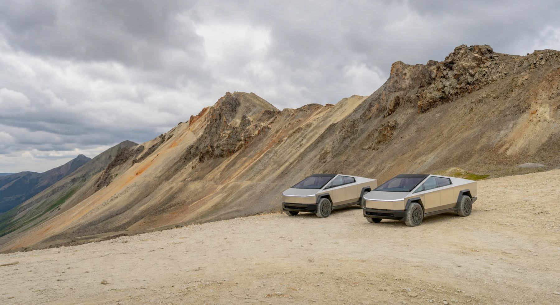
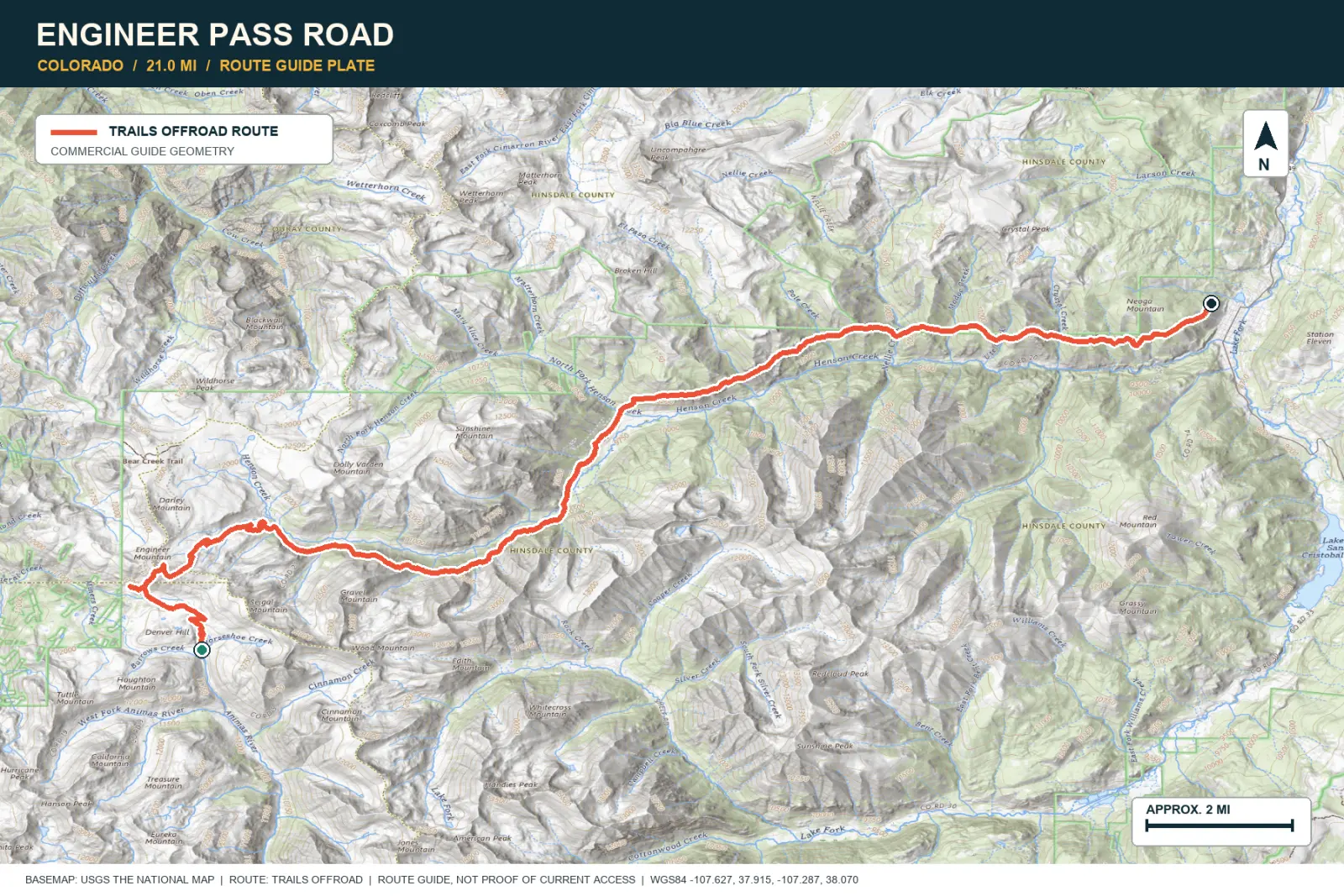
Engineer Pass climbs past mills, mine waste, and the buildings at Animas Forks. Open tundra surrounds the 12,800-foot pass. From the top, you can see Alpine Loop roads in several valleys.
SIGNATURE VIEWSan Juan summits, Animas Forks, and high mining country
TOPOGRAPHIC PROFILE
Elevation sampled from AWS Terrain Tiles along the published route. Small terrain and GPS differences are normal.
#05 / ALASKA
Braided rivers, gravel bars, and blue ice
Source photo: Trails Offroad / Kyle Todd
WHY IT RANKS
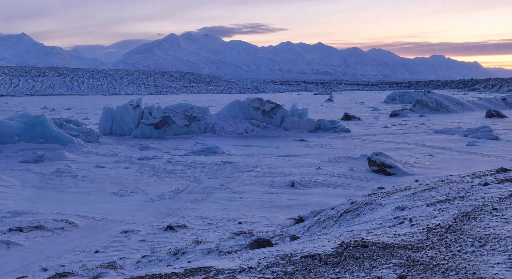
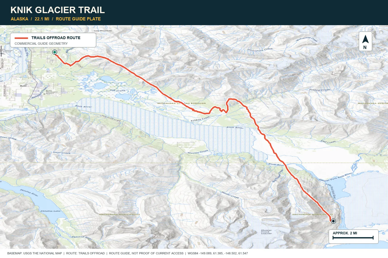
Knik Glacier Trail crosses gravel bars, braided water, and glacial deposits. The Chugach Mountains rise behind the glacier. Water levels and channels can change the route between visits.
SIGNATURE VIEWKnik Glacier across braided river flats and mountain walls
TOPOGRAPHIC PROFILE
Elevation sampled from AWS Terrain Tiles along the published route. Small terrain and GPS differences are normal.
#06 / COLORADO
Telluride to Ouray over the top
Source photo: Trails Offroad / Ryan Boudreau
WHY IT RANKS
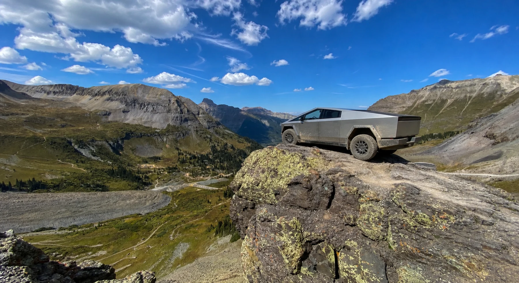
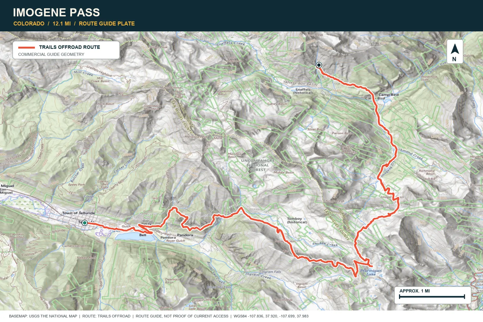
Imogene Pass connects Telluride and Ouray through the former Tomboy Mine. The road reaches a 13,216-foot pass. Waterfalls, mine ruins, and San Juan Mountain views appear along the complete crossing.
SIGNATURE VIEWTelluride and Ouray framed by the San Juan Mountains
TOPOGRAPHIC PROFILE
Elevation sampled from AWS Terrain Tiles along the published route. Small terrain and GPS differences are normal.
#07 / ARIZONA
The Grand Canyon, nearly straight down
Source photo: Trails Offroad / Wade May
WHY IT RANKS
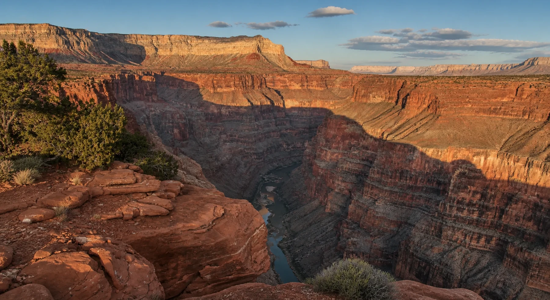
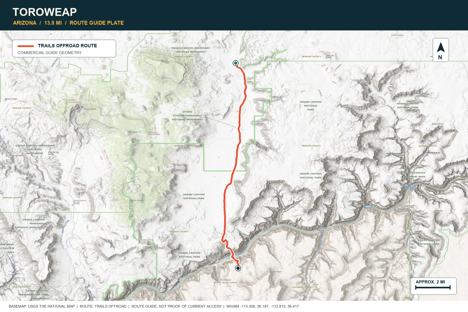
Toroweap ends at a rim about 3,000 feet above the Colorado River. The narrow canyon places the river almost directly below the viewpoint. A long dirt approach leads to this remote part of the Grand Canyon.
SIGNATURE VIEWA sheer 3,000-foot drop to the Colorado River
TOPOGRAPHIC PROFILE
Elevation sampled from AWS Terrain Tiles along the published route. Small terrain and GPS differences are normal.
#08 / UTAH
A wagon route that ran into solid rock
Source photo: Trails Offroad / TJ Bosworth
WHY IT RANKS
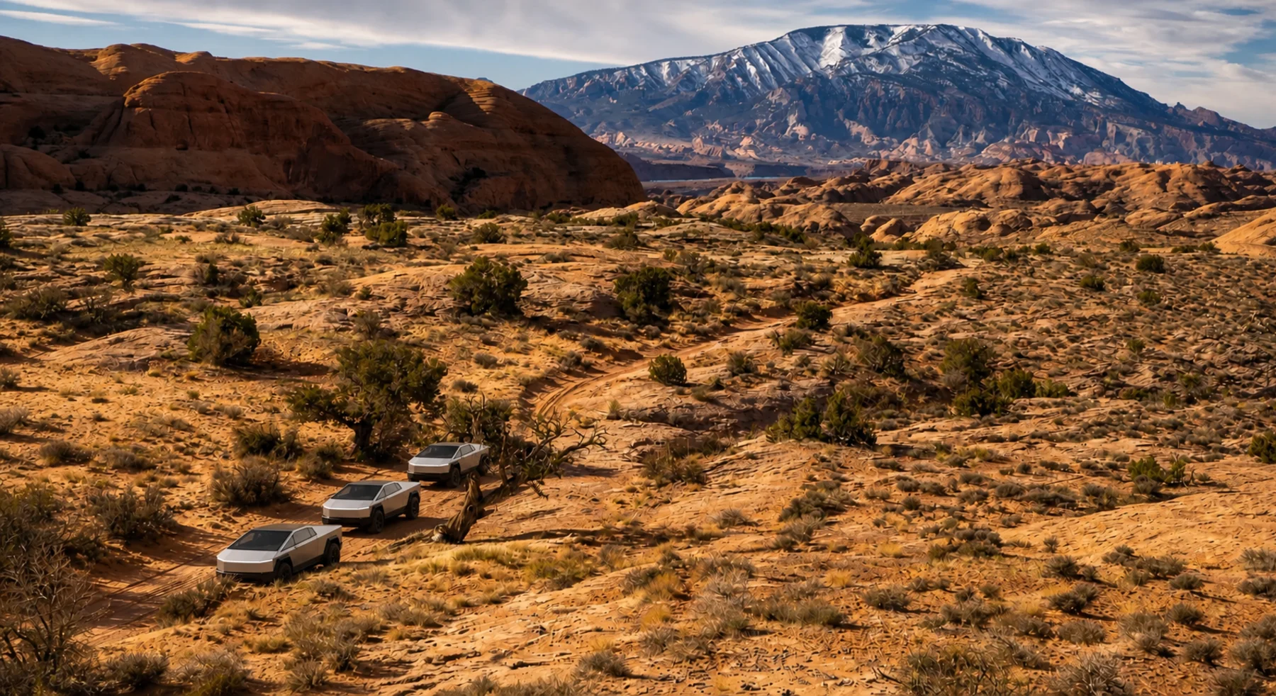
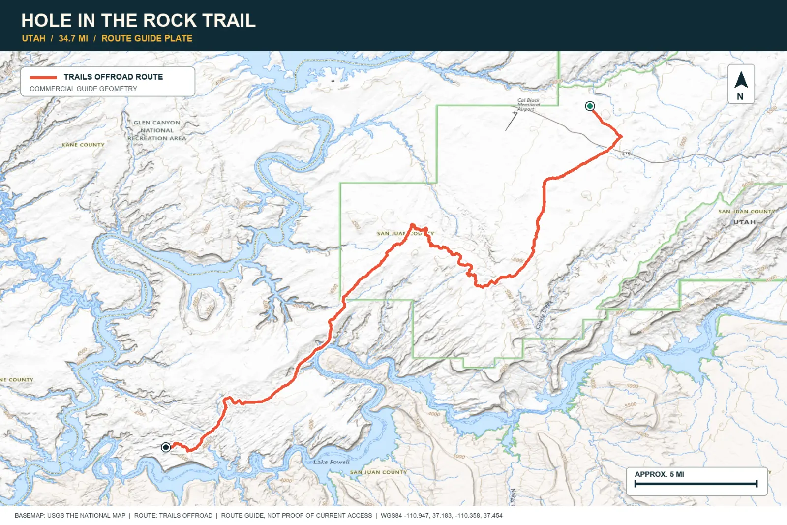
Hole in the Rock follows an 1879 wagon route through the Escalante area. Drivers cross ledges, deep cuts, and long sections of sandstone. The road ends near Lake Powell.
SIGNATURE VIEWSlickrock domes and the deeply incised edge of Lake Powell
TOPOGRAPHIC PROFILE
Elevation sampled from AWS Terrain Tiles along the published route. Small terrain and GPS differences are normal.
#09 / CALIFORNIA
Rock gardens between quiet Sierra lakes
Source photo: Trails Offroad / Josh Noesser
WHY IT RANKS
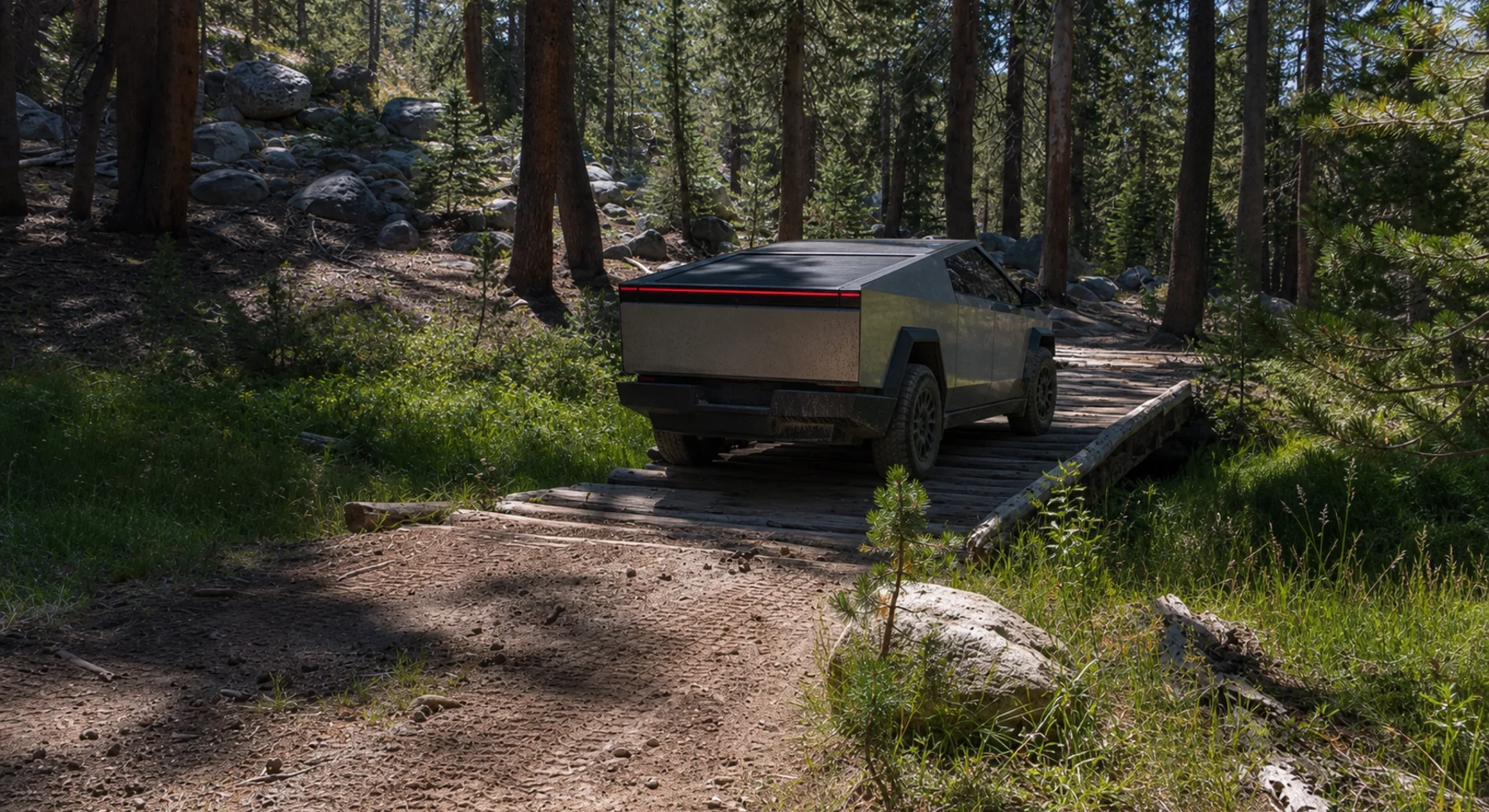
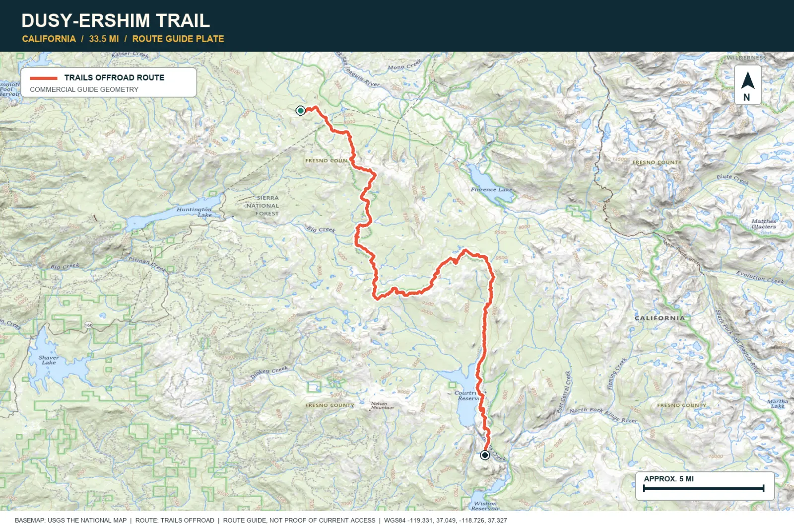
Dusy-Ershim has difficult rock sections across several days of travel. Granite basins, forest, lakes, and remote camps separate the obstacles. The route requires vehicle durability and careful planning.
SIGNATURE VIEWGranite basins, high lakes, and forest beneath 10,000-foot ridges
TOPOGRAPHIC PROFILE
Elevation sampled from AWS Terrain Tiles along the published route. Small terrain and GPS differences are normal.
#10 / UTAH
A hard turn into the Needles
Source photo: Trails Offroad / John
WHY IT RANKS
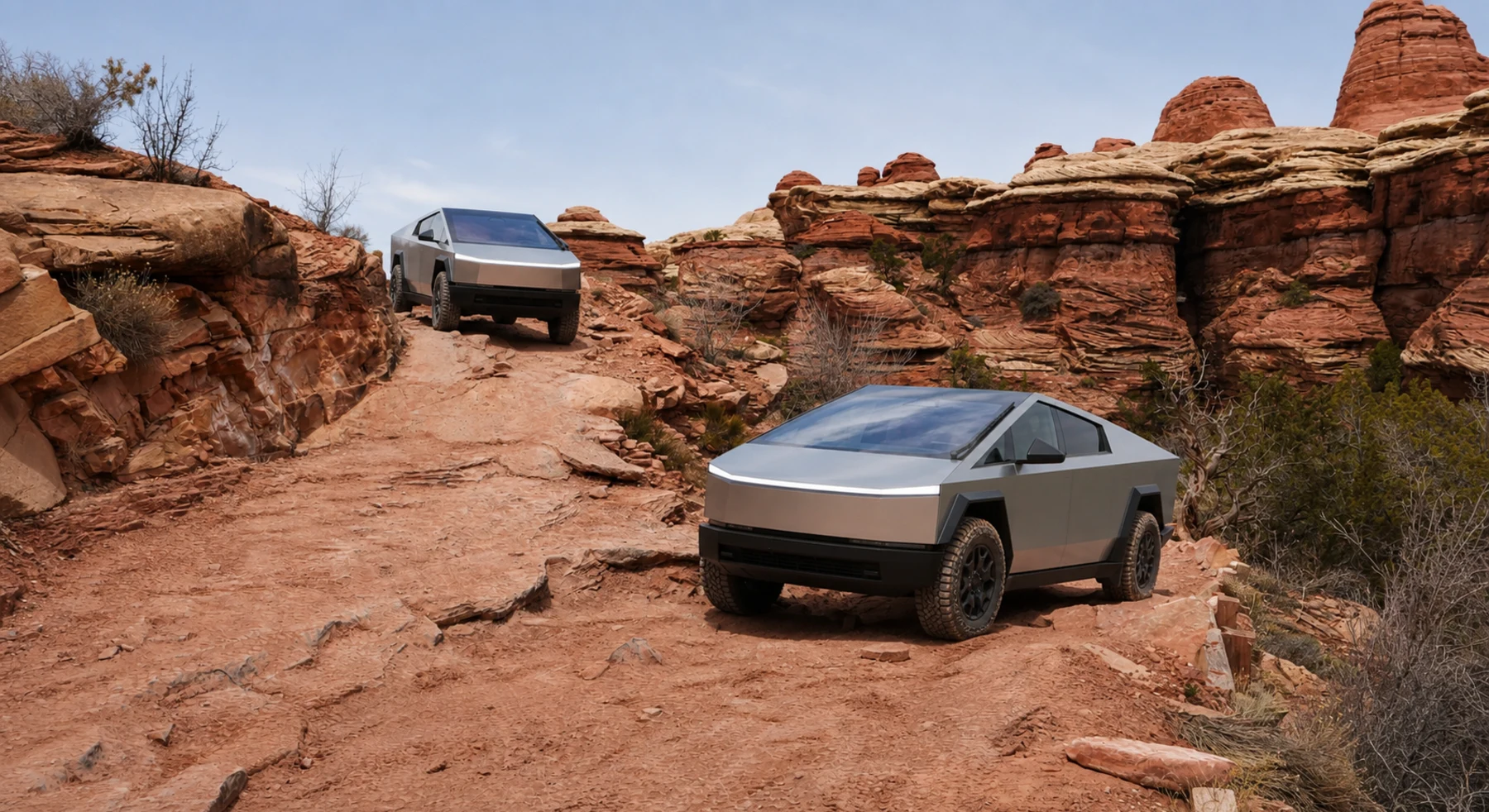
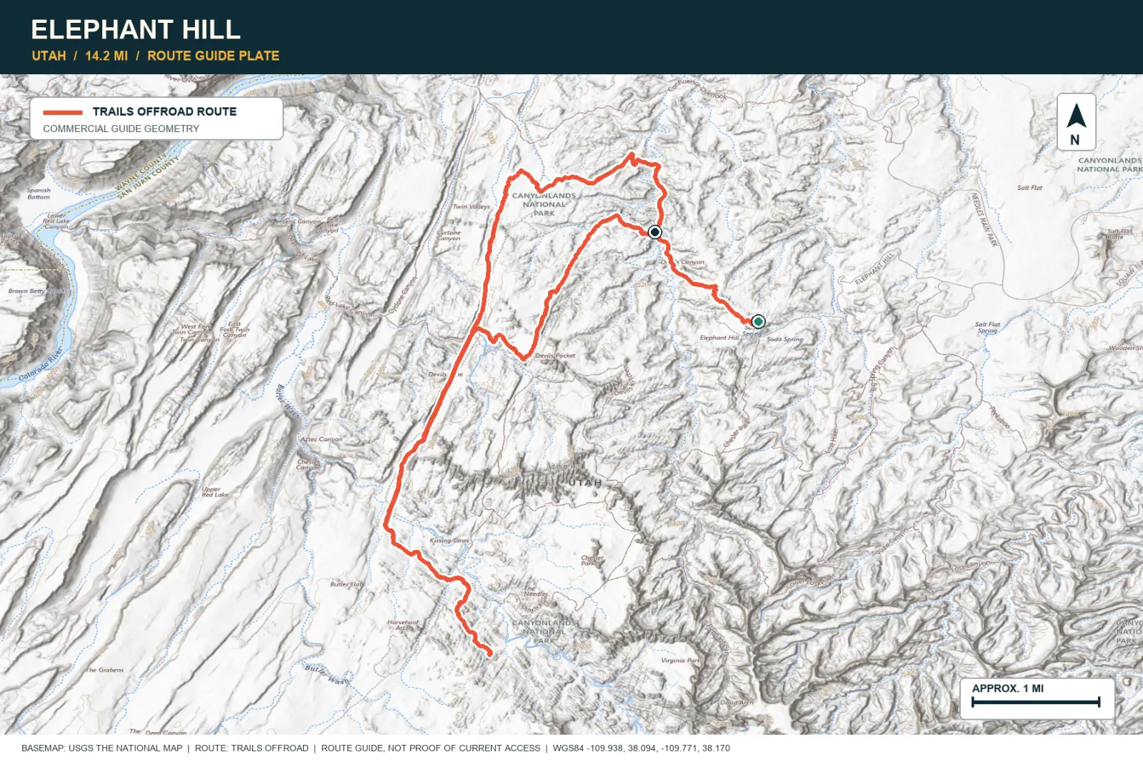
Elephant Hill drops from the mesa into red-and-white sandstone spires. Tight switchbacks and rocky steps define the entrance. Beyond them, the Needles close around the road and change shape at each bend.
SIGNATURE VIEWThousands of sandstone spires, slots, and distant mesas
TOPOGRAPHIC PROFILE
Elevation sampled from AWS Terrain Tiles along the published route. Small terrain and GPS differences are normal.
#11 / WYOMING
Twenty-eight switchbacks in two steep miles
Source photo: Trails Offroad / Todd
WHY IT RANKS
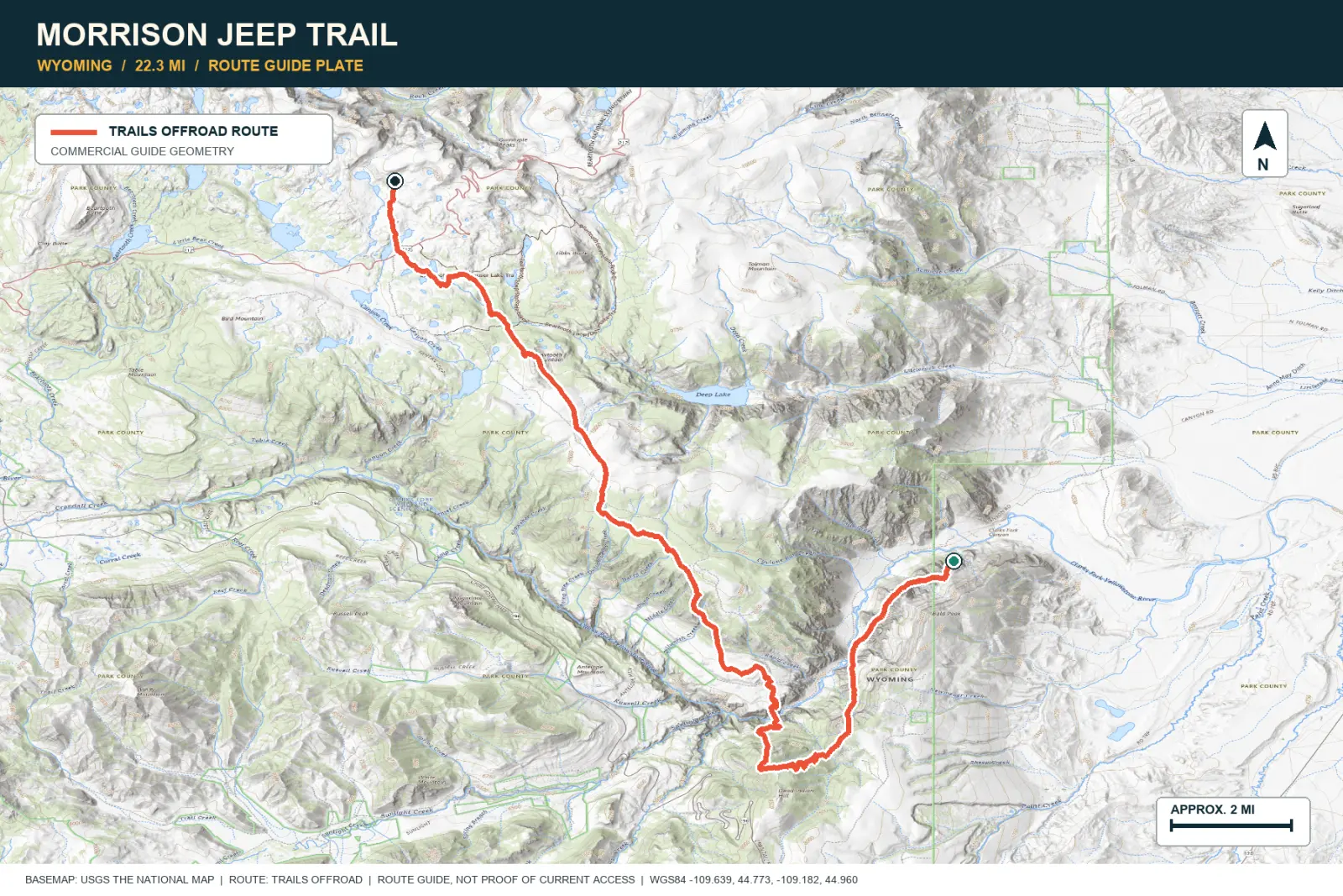
Morrison Jeep Trail climbs about 2,000 feet from the Clarks Fork canyon to the Beartooth Plateau. Twenty-eight switchbacks fit into two steep miles. The view changes from a river gorge to open alpine land.
SIGNATURE VIEWClarks Fork Canyon and the Beartooth Plateau
TOPOGRAPHIC PROFILE
Elevation sampled from AWS Terrain Tiles along the published route. Small terrain and GPS differences are normal.
#12 / CALIFORNIA
A desert crossing assembled from water and history
Source photo: Trails Offroad / Todd
WHY IT RANKS
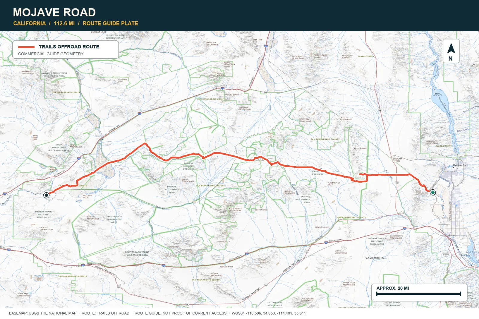
The Mojave Road crosses several desert basins in two or three days. The route passes springs, forts, lava fields, Joshua trees, dry lakes, and dunes. People used this travel corridor long before recreational driving began.
SIGNATURE VIEWJoshua tree woodland, lava fields, dunes, and empty basins
TOPOGRAPHIC PROFILE
Elevation sampled from AWS Terrain Tiles along the published route. Small terrain and GPS differences are normal.
#13 / COLORADO
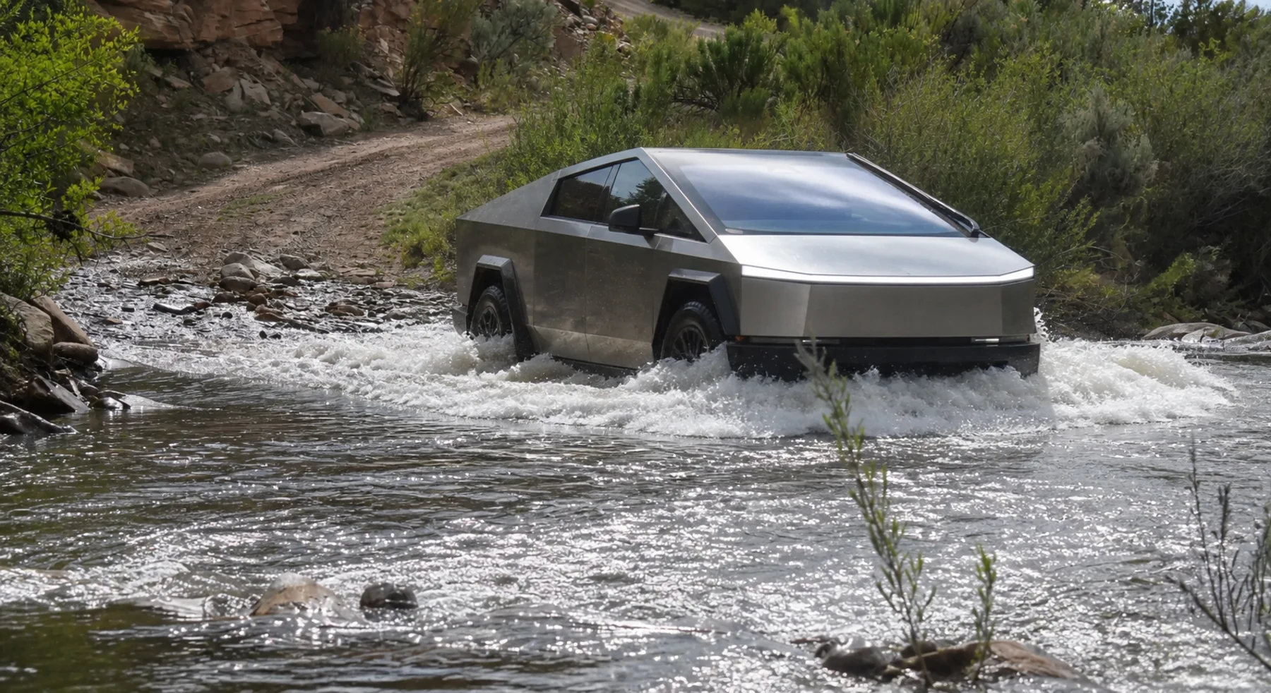
Aspen, uranium country, then Moab
Source photo: Trails Offroad / Tim Palmer
WHY IT RANKS
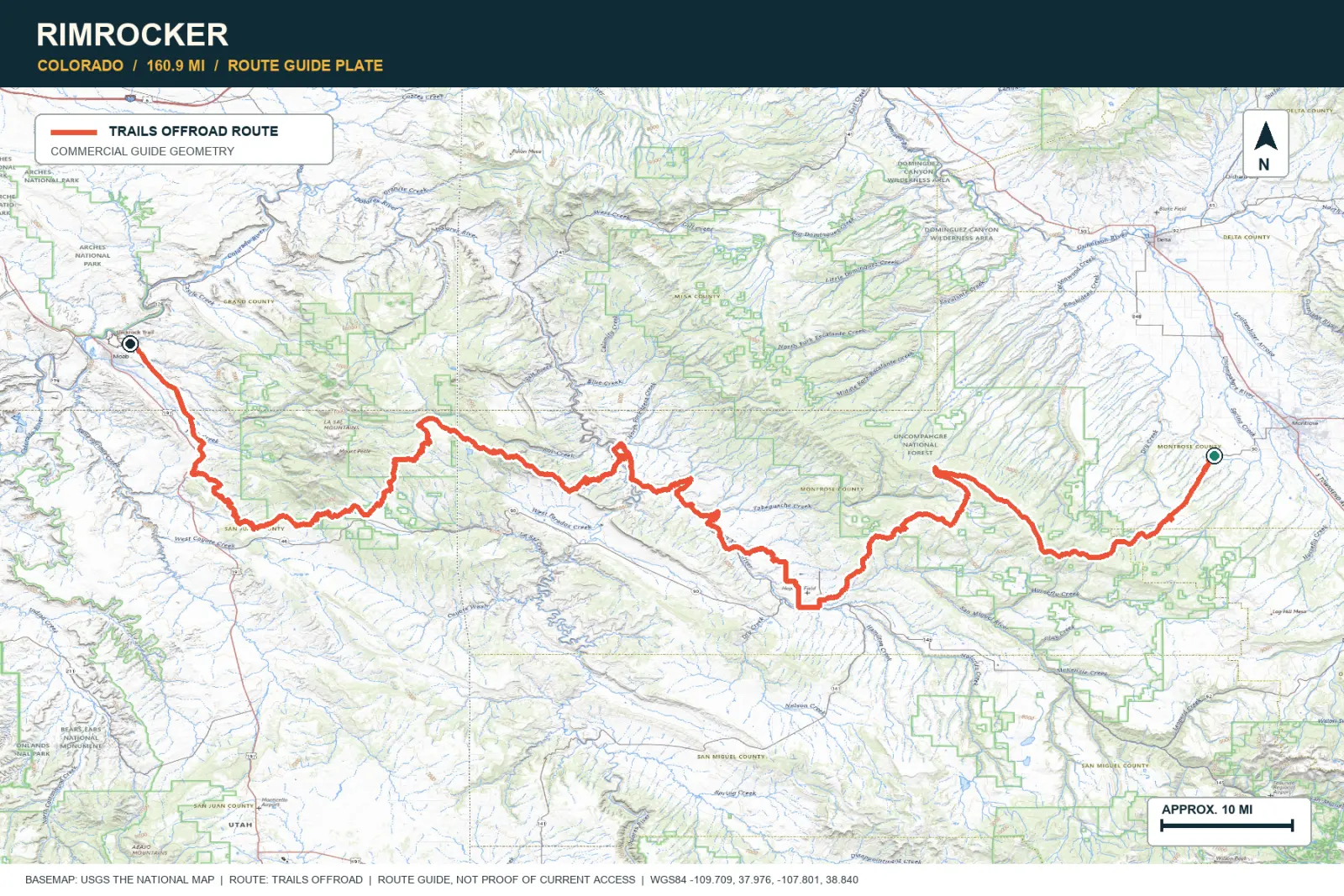
Rimrocker Trail runs for about 160 miles from Colorado to Moab. Forest and mining areas change into the La Sal Mountains and Utah sandstone. The long route shows each change in the landscape.
SIGNATURE VIEWAspen country, La Sal peaks, and red-rock shelf roads
TOPOGRAPHIC PROFILE
Elevation sampled from AWS Terrain Tiles along the published route. Small terrain and GPS differences are normal.
#14 / COLORADO
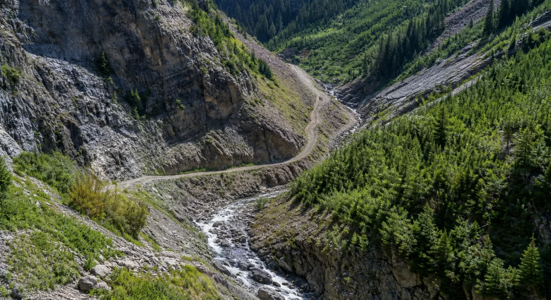
A narrow shelf above the Crystal River
Source photo: Trails Offroad / Ryan Boudreau
WHY IT RANKS
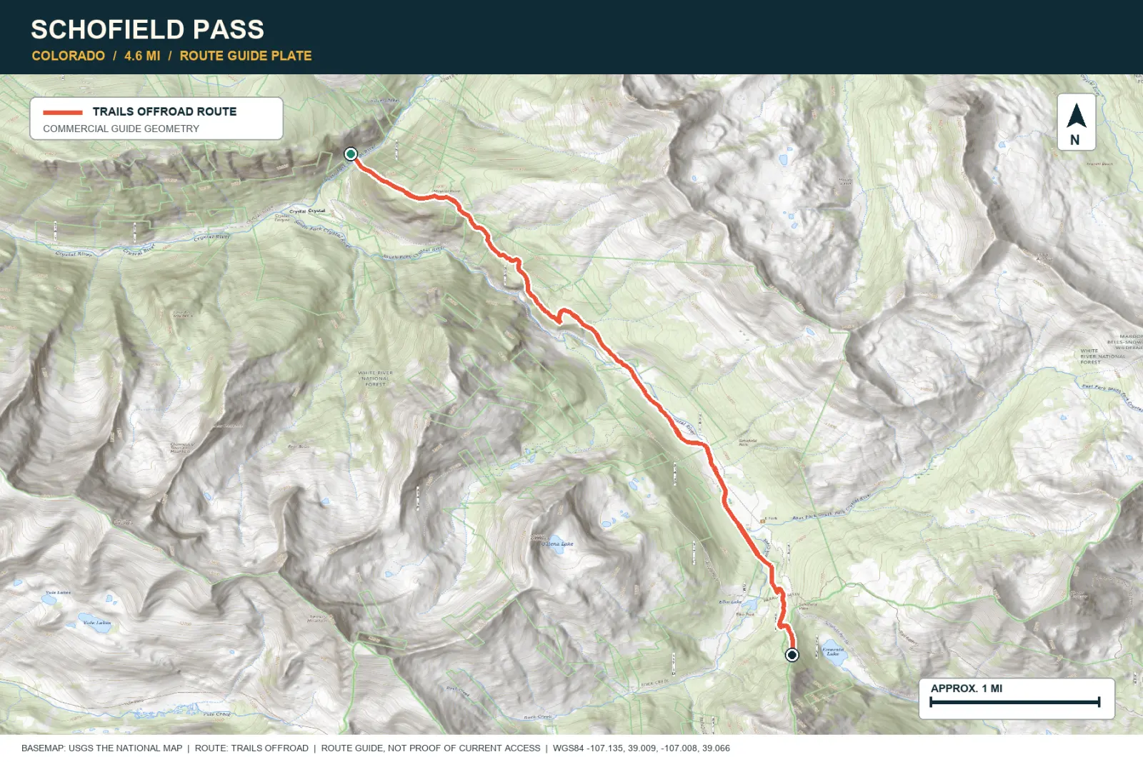
Schofield Pass follows a narrow shelf above the Crystal River near Devil's Punchbowl. Waterfalls and the Elk Mountains surround the road. Severe exposure requires careful judgment.
SIGNATURE VIEWCrystal River gorge, Devil's Punchbowl, and Elk Mountain peaks
TOPOGRAPHIC PROFILE
Elevation sampled from AWS Terrain Tiles along the published route. Small terrain and GPS differences are normal.
#15 / UTAH
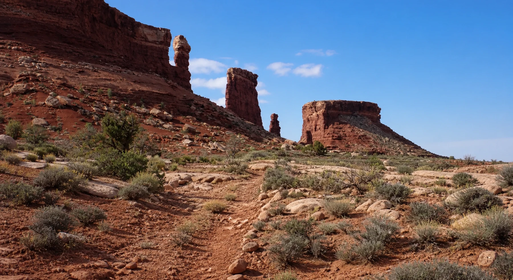
The switchback entrance to the Maze
Source photo: Trails Offroad / Bobby Nelson
WHY IT RANKS
Flint Trail descends about 800 feet below the Orange Cliffs. Water, fuel, and easy exits become scarce after the switchbacks. The road provides access to several days of travel in the Maze.
SIGNATURE VIEWOrange Cliffs, natural arches, and the Flint switchbacks
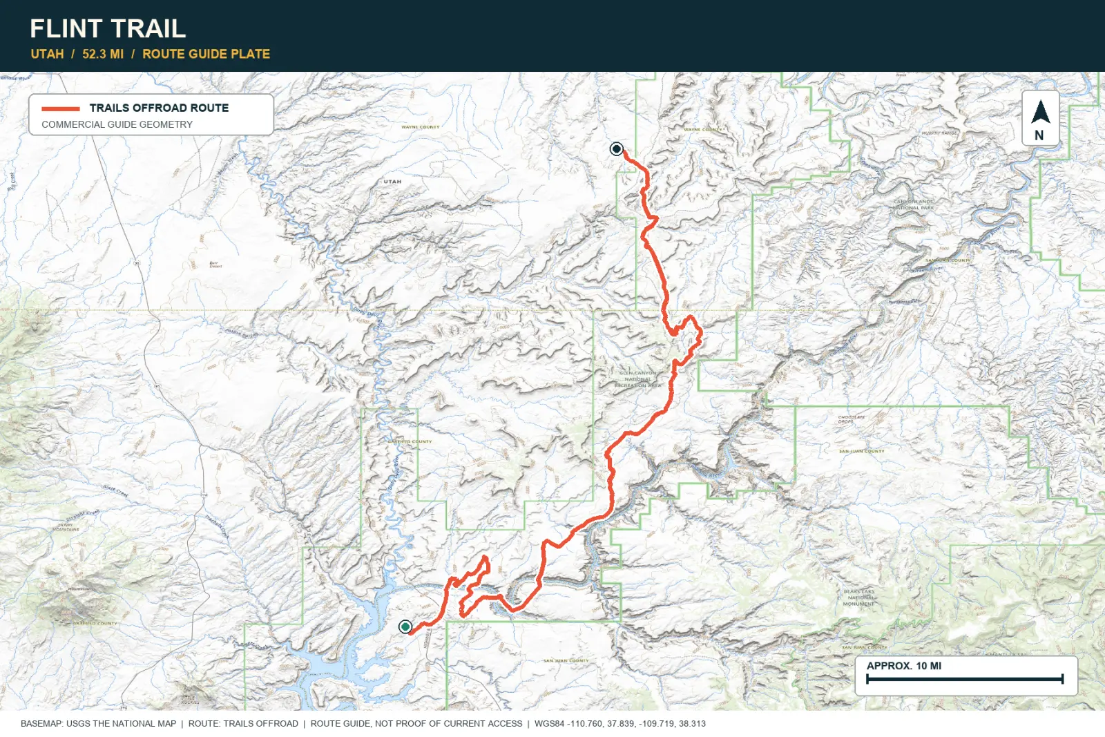
TOPOGRAPHIC PROFILE
Elevation sampled from AWS Terrain Tiles along the published route. Small terrain and GPS differences are normal.
#16 / ALASKA
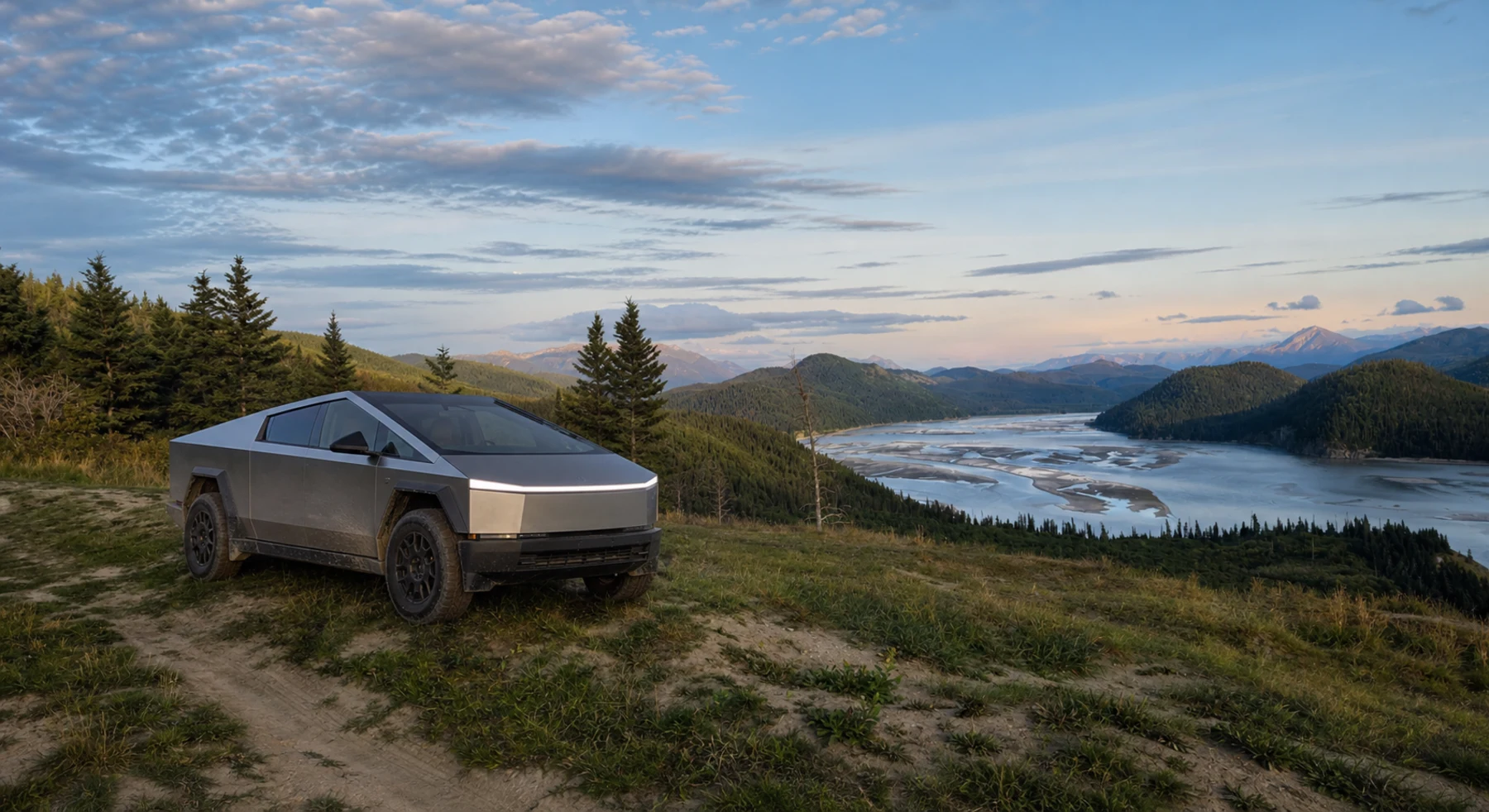
Sixty gravel miles on an old railway grade
Source photo: Trails Offroad / Kyle Todd
WHY IT RANKS
McCarthy Road follows the former Copper River and Northwestern Railway into Wrangell-St. Elias. The route passes forest, river canyons, old trestles, and the Kuskulana bridge. Glacial mountains remain visible along the drive.
SIGNATURE VIEWWrangell peaks, deep river canyons, and the Kuskulana bridge
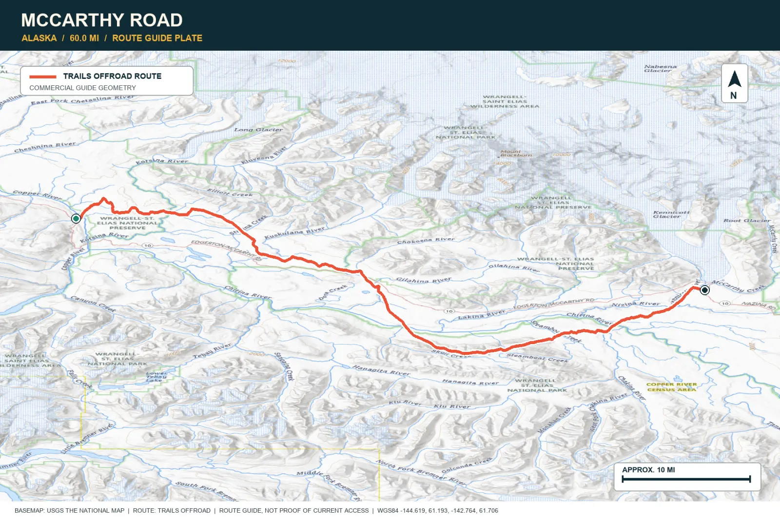
TOPOGRAPHIC PROFILE
Elevation sampled from AWS Terrain Tiles along the published route. Small terrain and GPS differences are normal.
#17 / UTAH
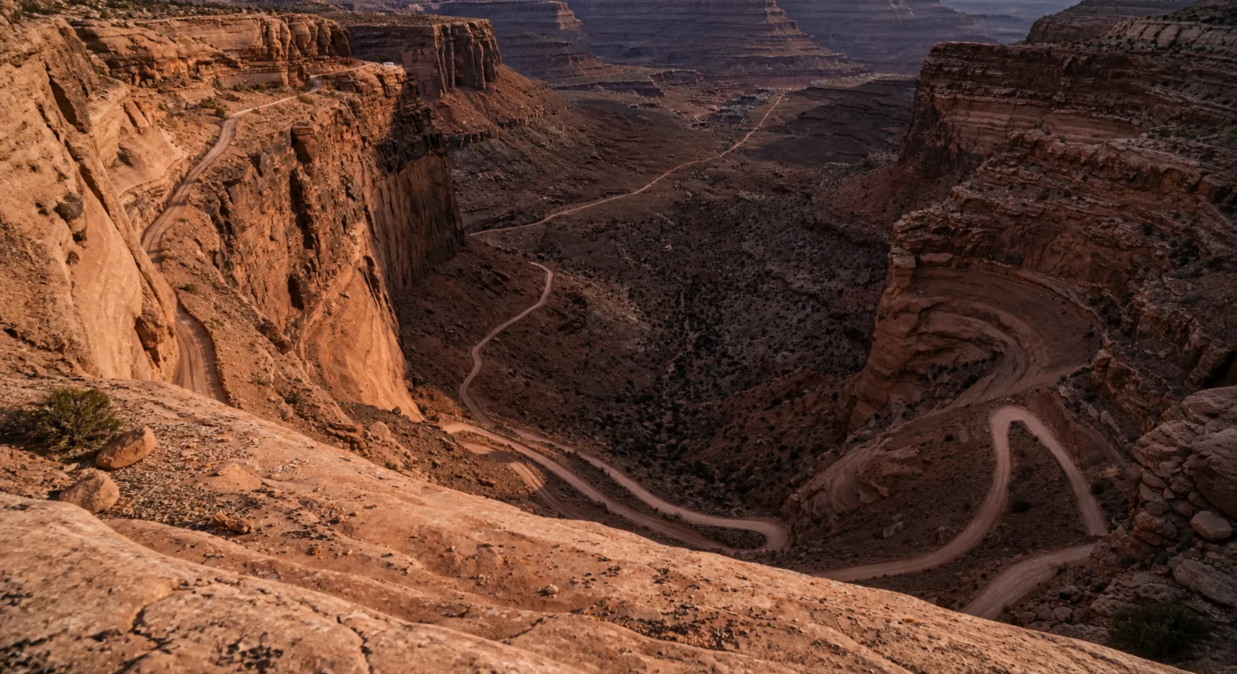
A staircase cut through the canyon wall
Source photo: Trails Offroad / Todd
WHY IT RANKS
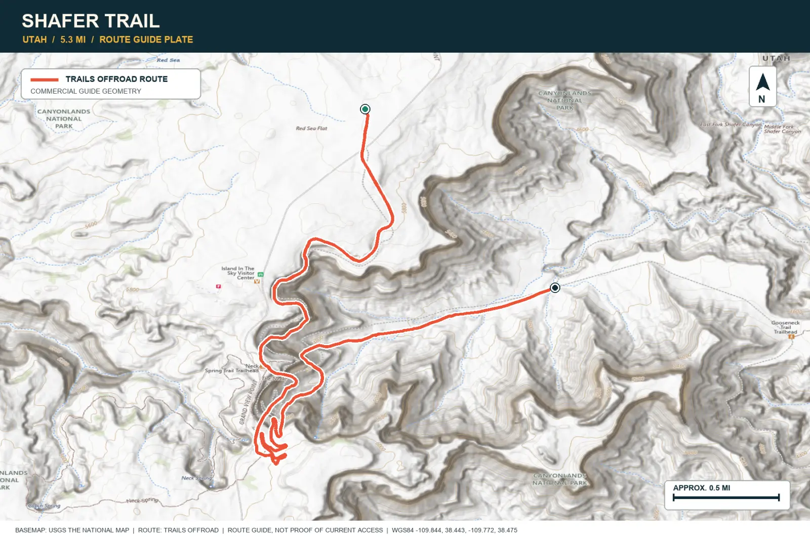
Shafer Trail descends from Island in the Sky to the river bench below. Its switchbacks cross several visible rock layers. The road gives a clear view of Canyonlands geology.
SIGNATURE VIEWA vertical descent beneath Island in the Sky
TOPOGRAPHIC PROFILE
Elevation sampled from AWS Terrain Tiles along the published route. Small terrain and GPS differences are normal.
#18 / IDAHO
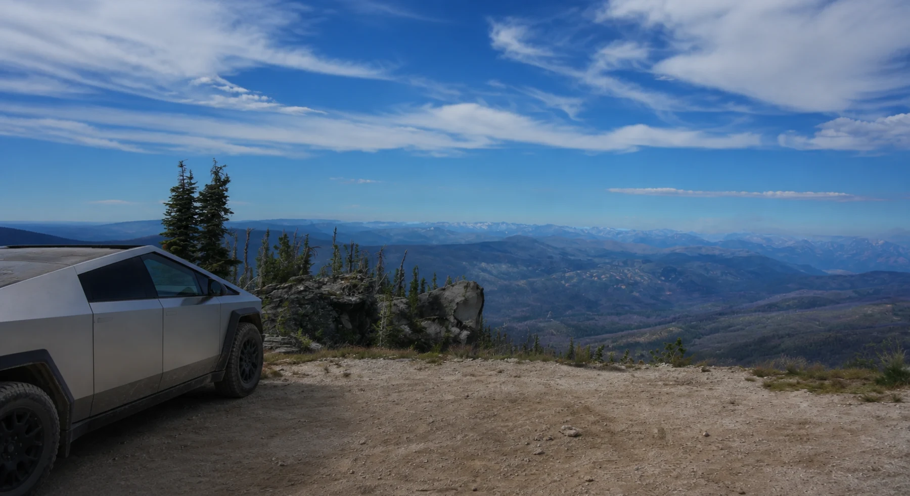
One road between two vast wilderness areas
Source photo: Trails Offroad / Dennis Clark
WHY IT RANKS
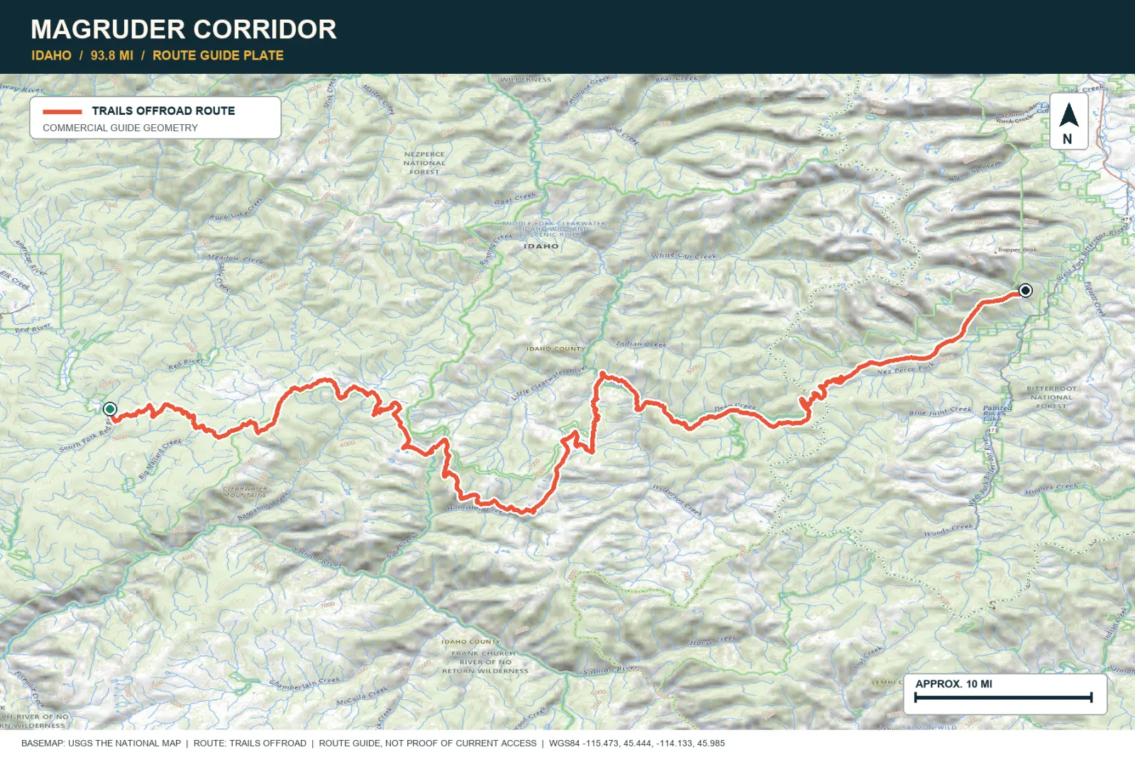
Magruder Corridor runs for almost 100 miles without services. It passes between the Selway-Bitterroot and Frank Church wilderness areas. Forest, fire areas, and high ridges surround the only road through this large region.
SIGNATURE VIEWBitterroot ridges, burn mosaics, and immense forest horizons
TOPOGRAPHIC PROFILE
Elevation sampled from AWS Terrain Tiles along the published route. Small terrain and GPS differences are normal.
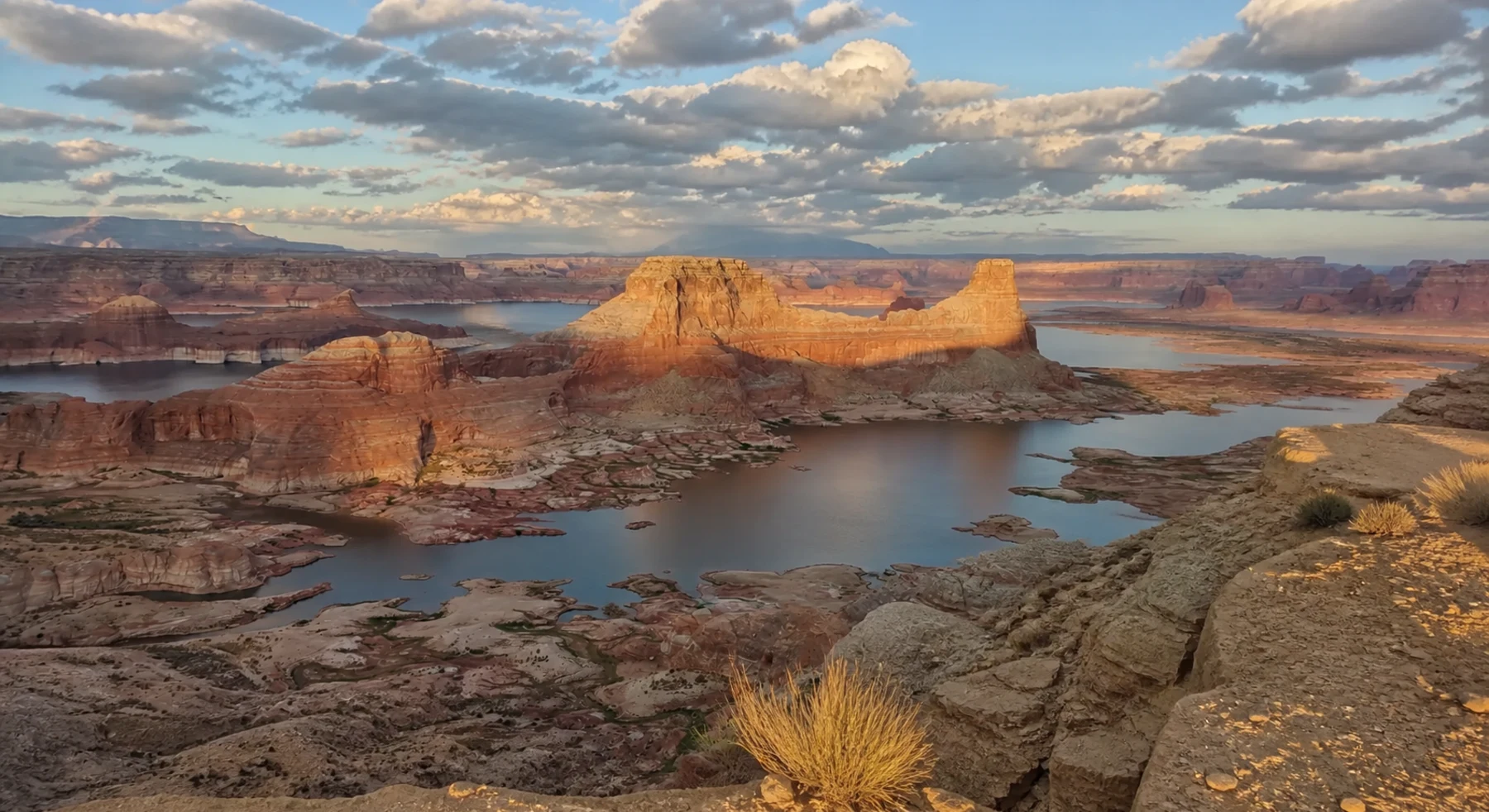
#19 / UTAH
A sandstone camp above Lake Powell
Source photo: Trails Offroad / John
WHY IT RANKS
Alstrom Point overlooks Lake Powell and Gunsight Butte. A long desert road leads to the sandstone camp and viewpoint. Low evening light makes the rock layers and flooded canyons easier to see.
SIGNATURE VIEWGunsight Butte and blue water folded into sandstone
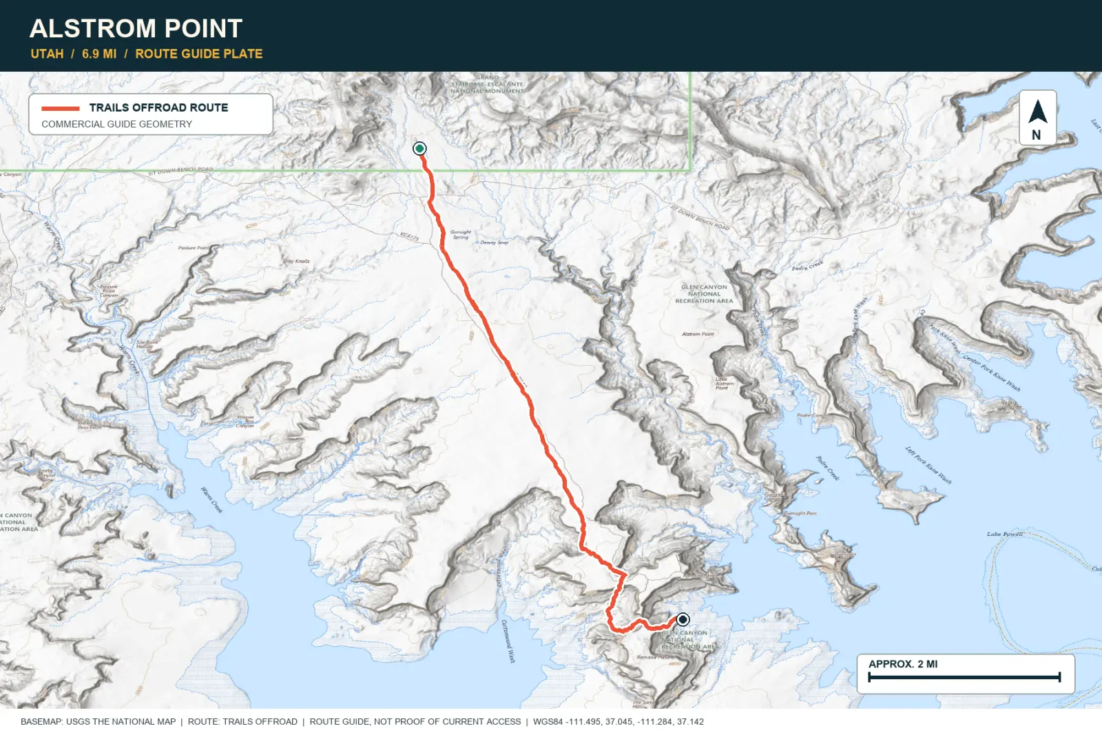
TOPOGRAPHIC PROFILE
Elevation sampled from AWS Terrain Tiles along the published route. Small terrain and GPS differences are normal.
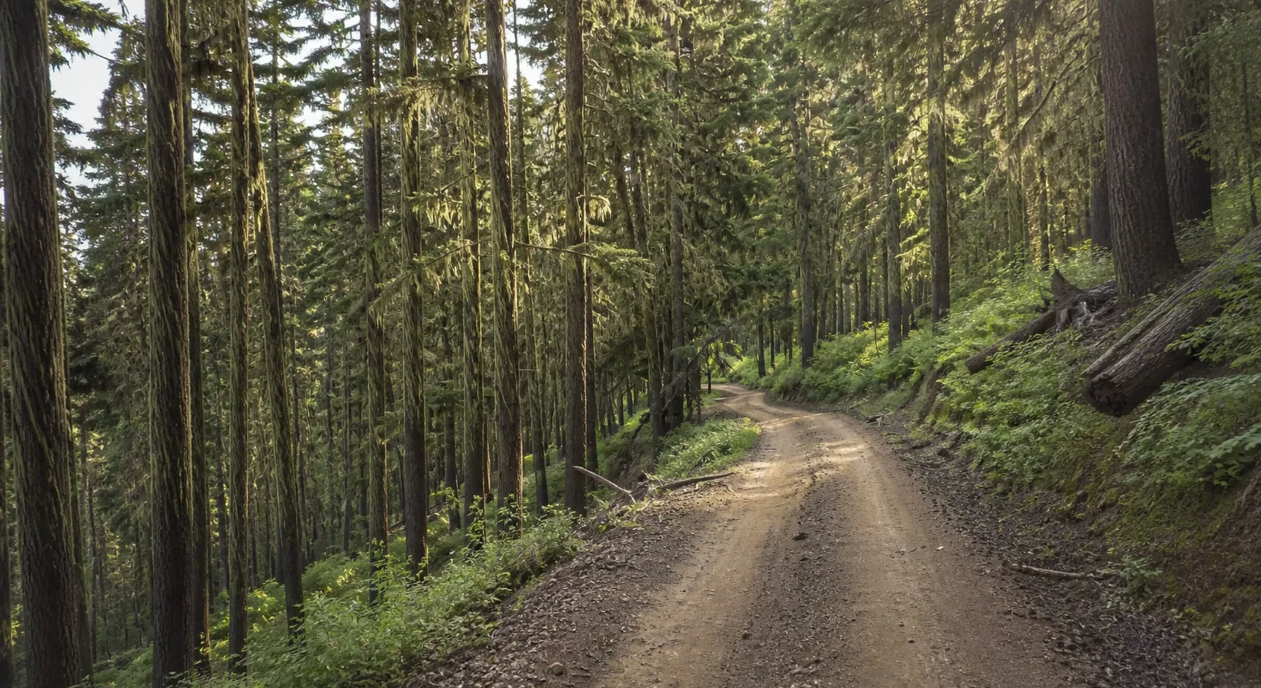
#20 / IDAHO
A rough ridge with a long human history
Source photo: Trails Offroad / Rose Meirs
WHY IT RANKS
Lolo Motorway follows a forested ridge above the Lochsa River. The route is important to the Nez Perce and to the Lewis and Clark expedition. It is long and has few services.
SIGNATURE VIEWLochsa country, endless conifers, and distant Bitterroot peaks
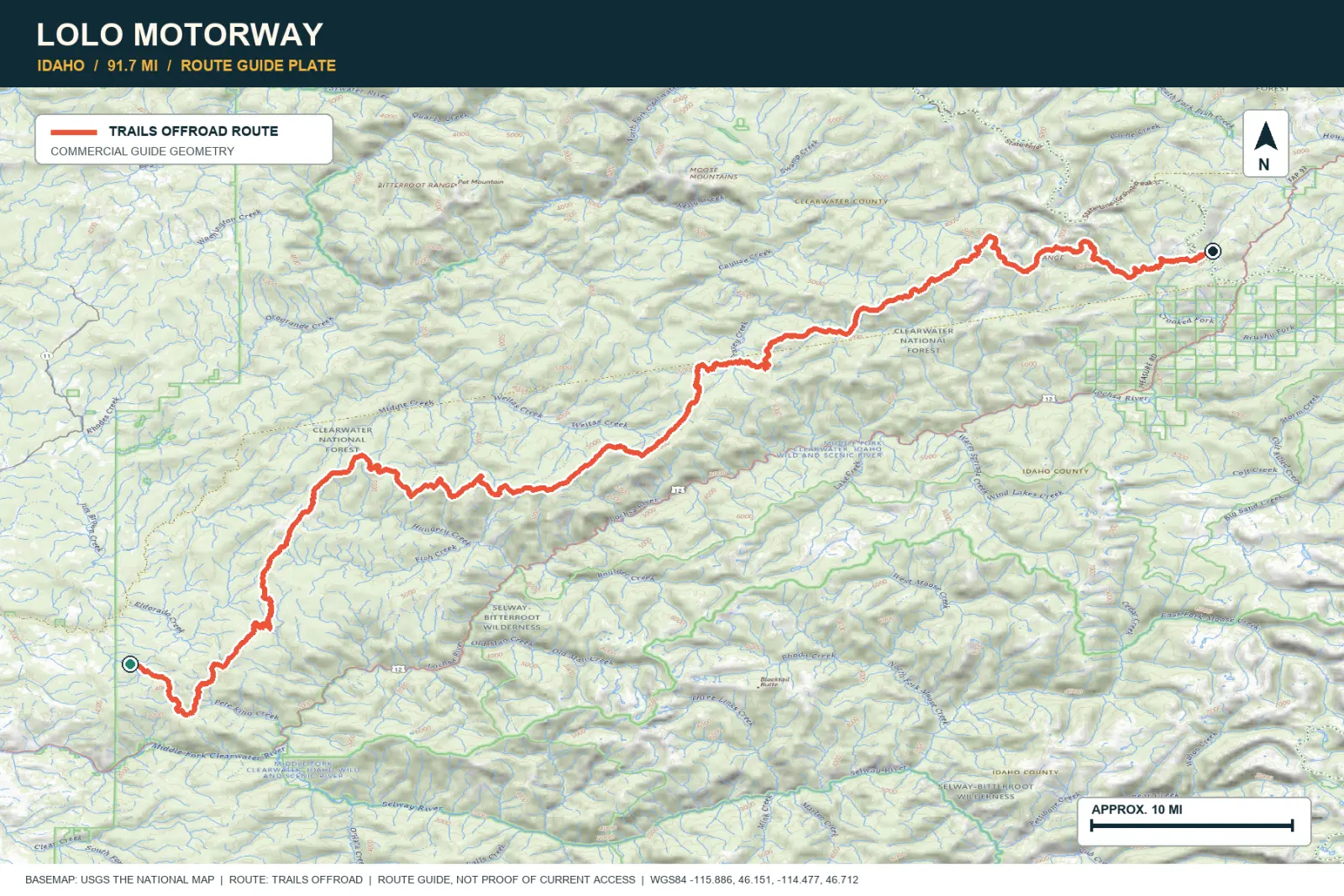
TOPOGRAPHIC PROFILE
Elevation sampled from AWS Terrain Tiles along the published route. Small terrain and GPS differences are normal.
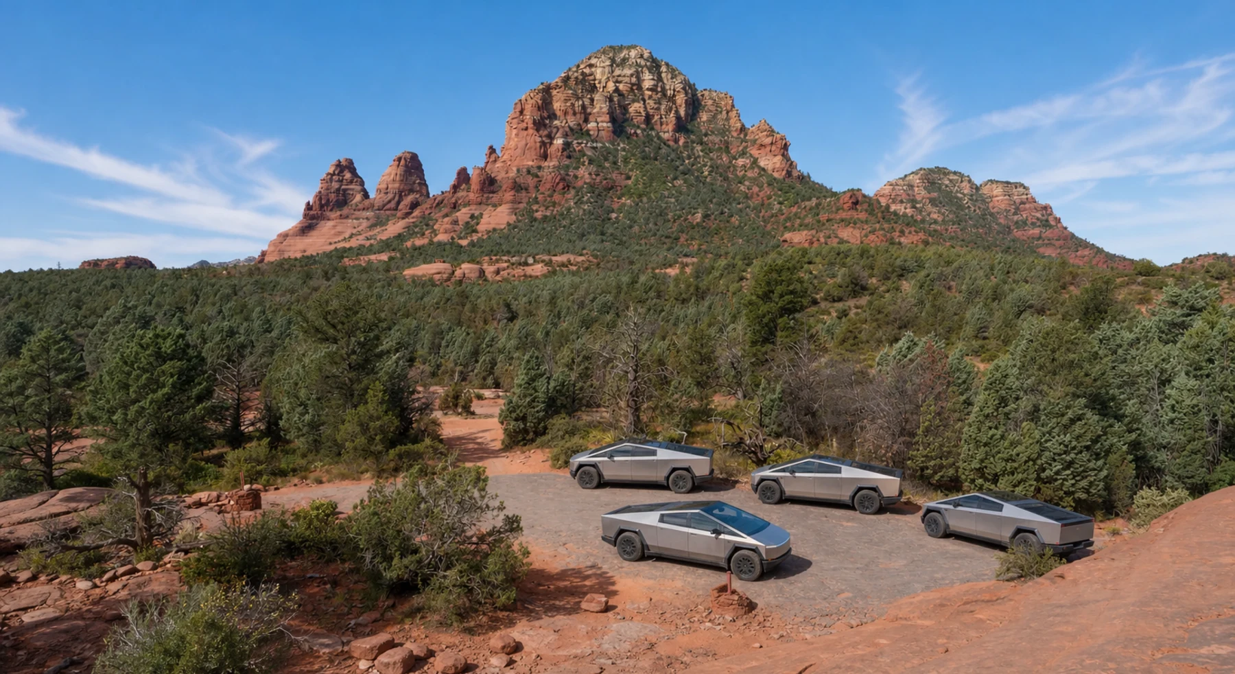
#21 / ARIZONA
Three red-rock miles with a lot going on
Source photo: Trails Offroad / Todd
WHY IT RANKS
Broken Arrow fits into a half-day trip near Sedona. The route passes sandstone fins, Submarine Rock, steep slickrock, and views of the Mogollon Rim. Heavy tour traffic can affect the drive.
SIGNATURE VIEWSubmarine Rock, Twin Buttes, and sunrise on the Mogollon Rim
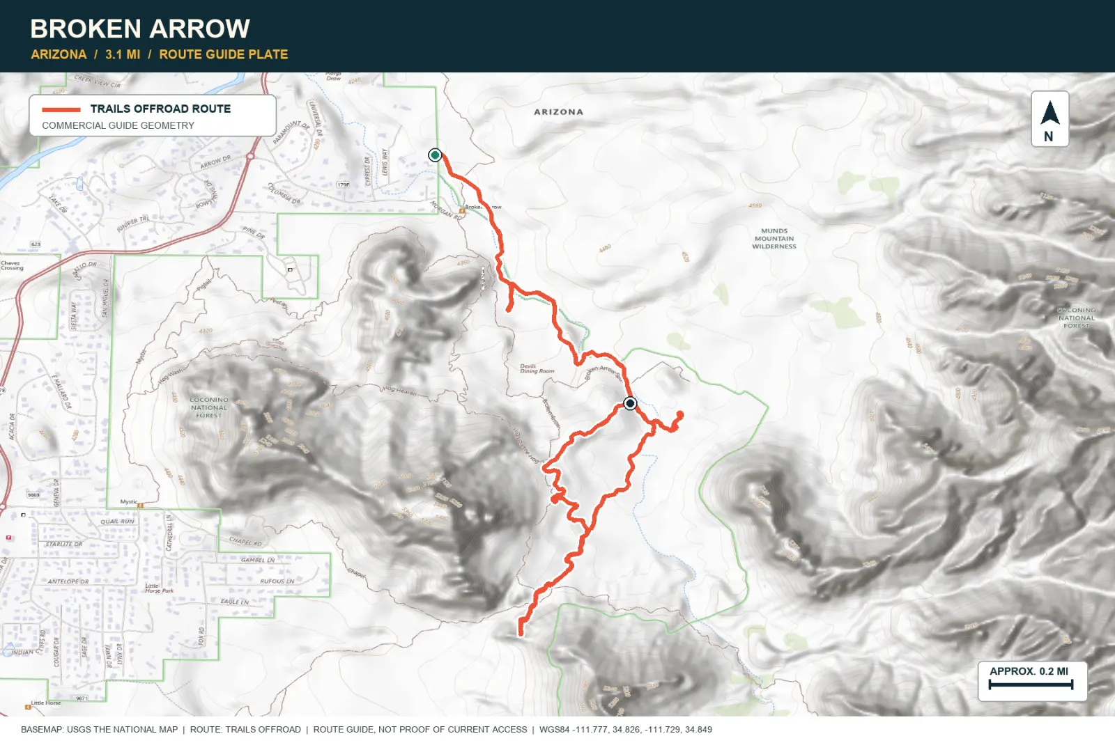
TOPOGRAPHIC PROFILE
Elevation sampled from AWS Terrain Tiles along the published route. Small terrain and GPS differences are normal.
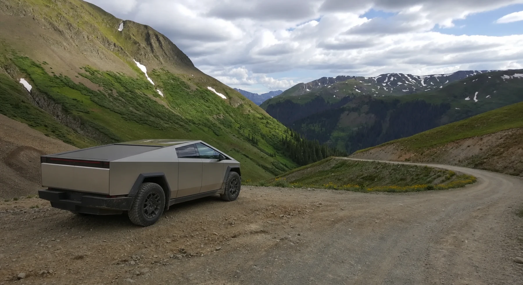
#22 / COLORADO
The gentler pass with the bigger basin
Source photo: Trails Offroad / JD Marshall
WHY IT RANKS
Cinnamon Pass climbs past old mining sites to 12,640 feet. American Basin and the San Juan Mountains surround the route. The exposure is lower than on Black Bear Pass.
SIGNATURE VIEWAmerican Basin and the serrated San Juan skyline
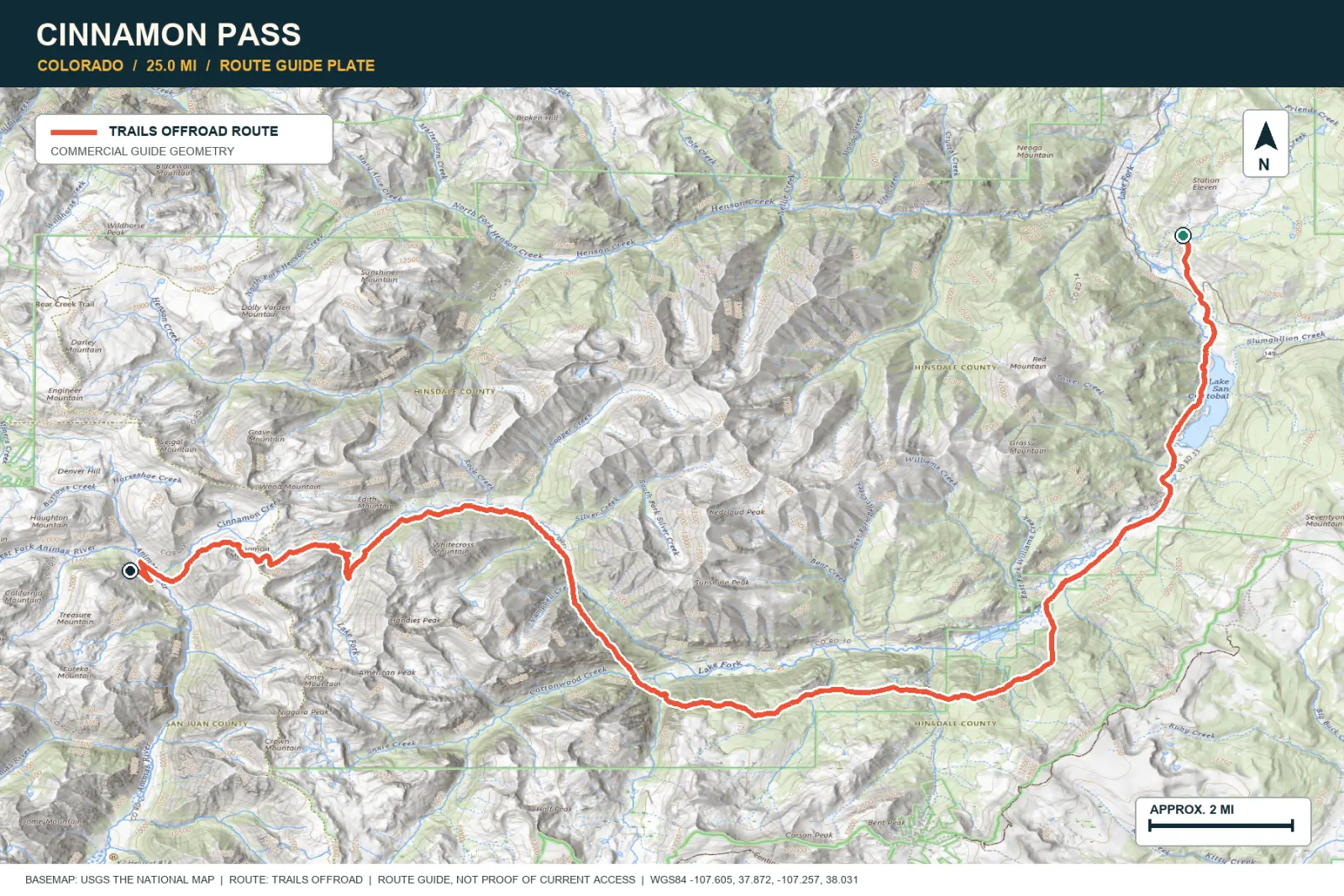
TOPOGRAPHIC PROFILE
Elevation sampled from AWS Terrain Tiles along the published route. Small terrain and GPS differences are normal.
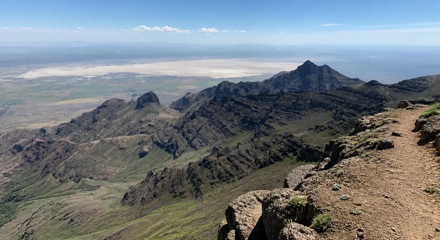
#23 / OREGON
Glacial gorges above the Alvord Desert
Source photo: Trails Offroad / Rose Meirs
WHY IT RANKS
Steens Mountain Loop climbs almost one vertical mile above the basin. Viewpoints look into Kiger Gorge and across the Alvord Desert. The complete loop shows both alpine landforms and open desert.
SIGNATURE VIEWGlacial gorges dropping toward the Alvord Desert
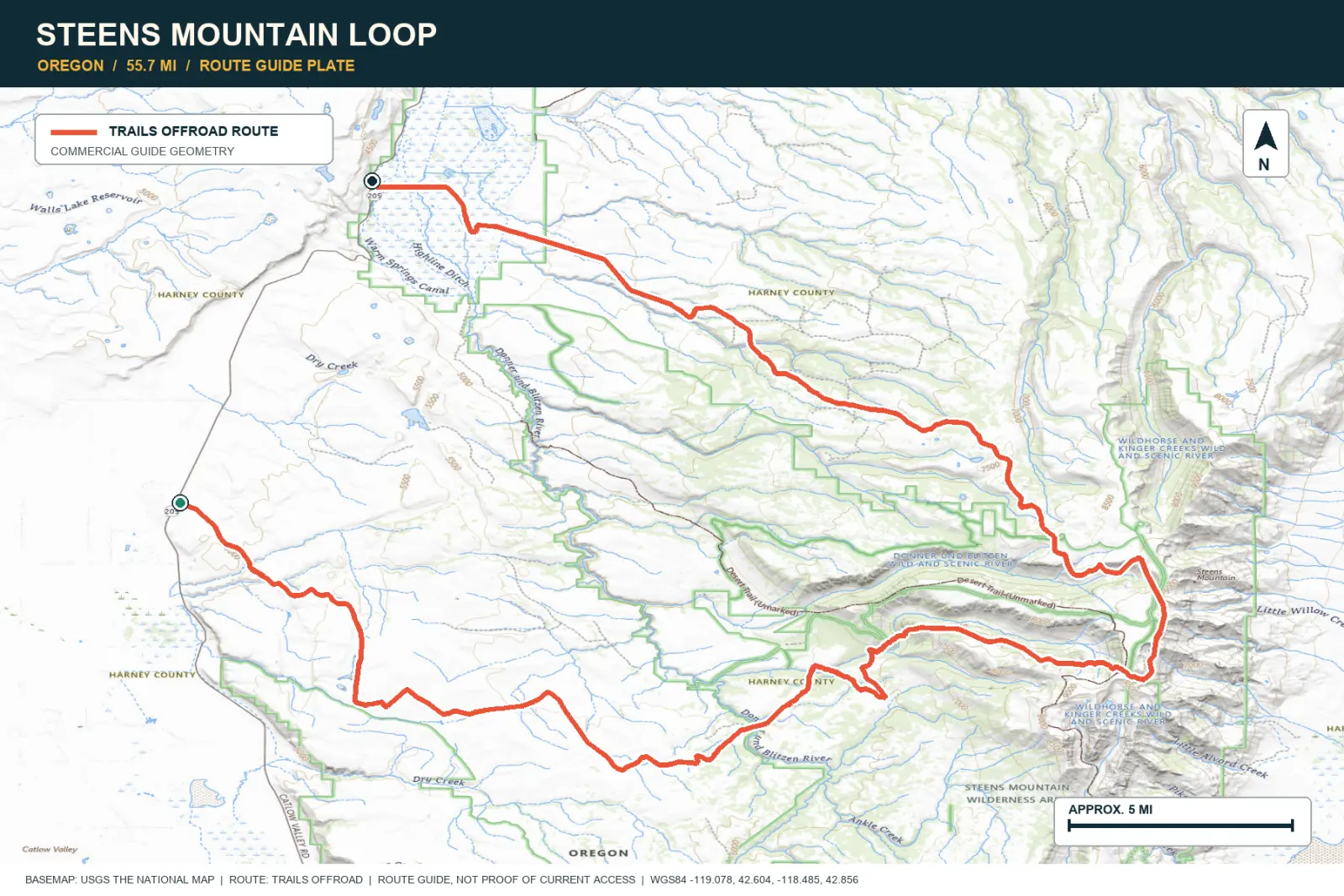
TOPOGRAPHIC PROFILE
Elevation sampled from AWS Terrain Tiles along the published route. Small terrain and GPS differences are normal.
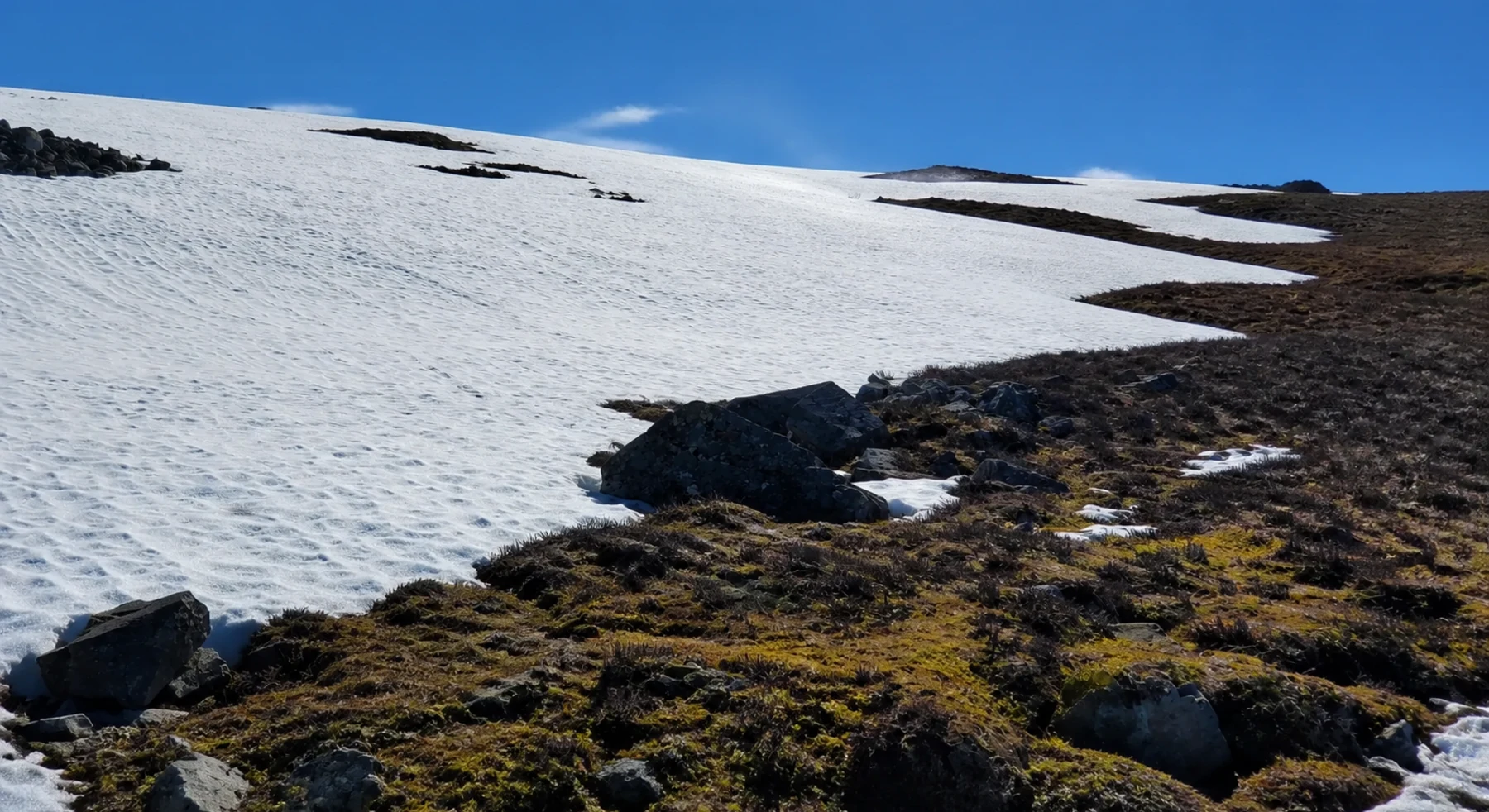
#24 / ALASKA
One hundred thirty-five gravel miles across Alaska
Source photo: Trails Offroad / Kyle Todd
WHY IT RANKS
The Denali Highway crosses 135 miles of Alaska on gravel. Tundra, braided rivers, lakes, and the Alaska Range remain visible for much of the route. Wildlife and weather can change quickly.
SIGNATURE VIEWGlaciers, tundra, braided rivers, and distant Denali
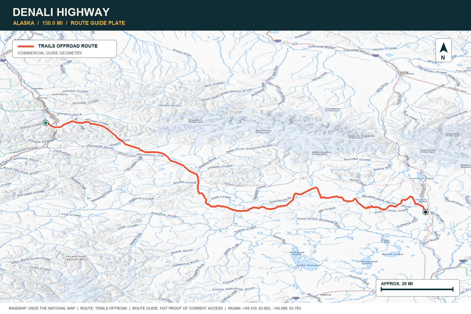
TOPOGRAPHIC PROFILE
Elevation sampled from AWS Terrain Tiles along the published route. Small terrain and GPS differences are normal.
#25 / NEVADA
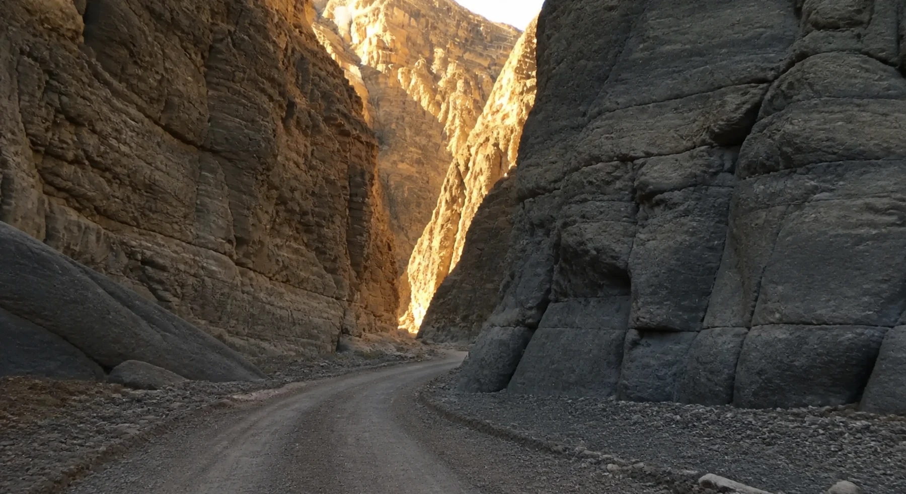
Open desert that tightens into a stone hallway
Source photo: Trails Offroad / Marc Nitz
WHY IT RANKS
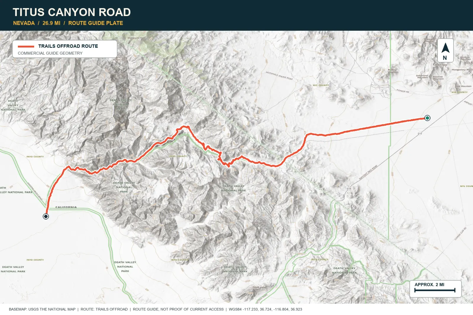
Titus Canyon begins in open desert and crosses Red Pass and old mining areas. Limestone walls then narrow around the road. The final section is a one-way passage with room for one vehicle.
SIGNATURE VIEWRed Pass, ghost-town country, and the slot-like Narrows
TOPOGRAPHIC PROFILE
Elevation sampled from AWS Terrain Tiles along the published route. Small terrain and GPS differences are normal.
#26 / CALIFORNIA
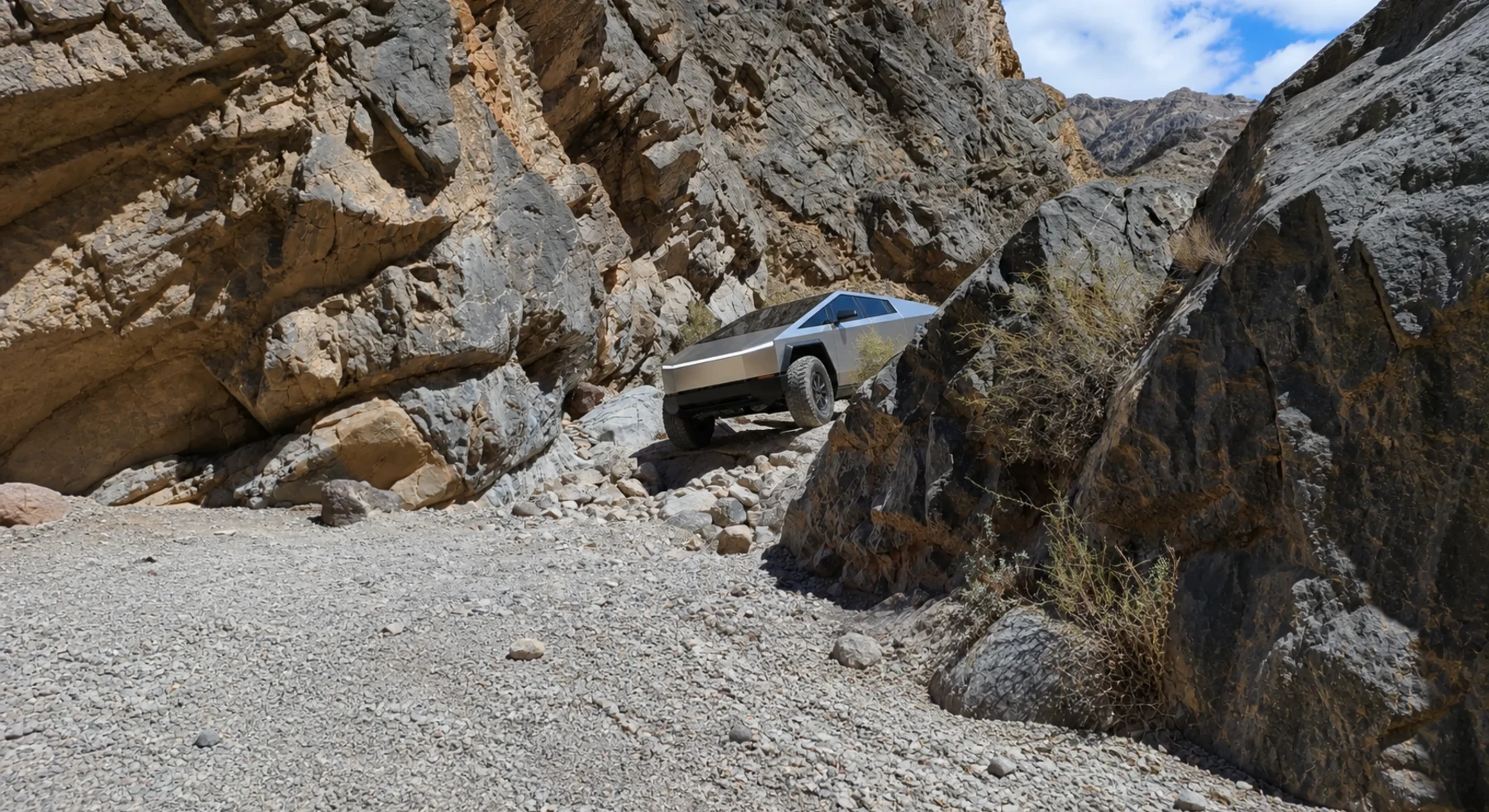
The difficult link between hot springs and dunes
Source photo: Trails Offroad / Josh Noesser
WHY IT RANKS
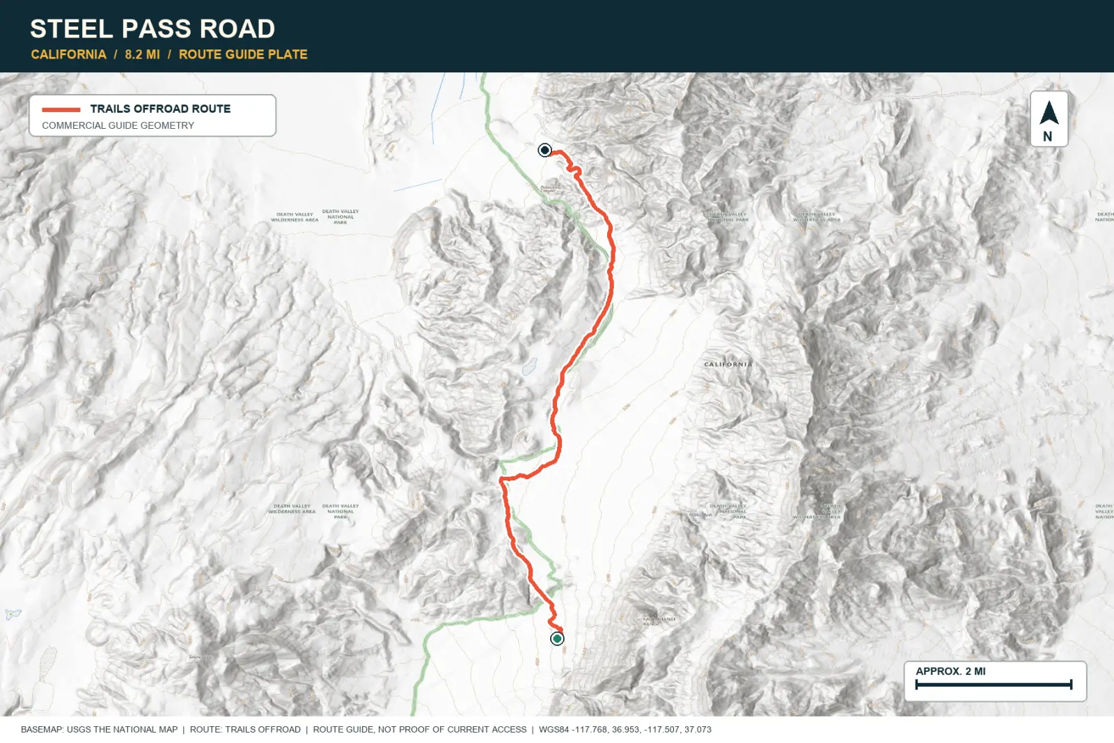
Steel Pass connects Saline Valley and Eureka Dunes through Dedeckera Canyon. A short group of rock steps controls the crossing. Large desert basins surround the technical section.
SIGNATURE VIEWEureka Dunes, Saline Valley, and Dedeckera Canyon
TOPOGRAPHIC PROFILE
Elevation sampled from AWS Terrain Tiles along the published route. Small terrain and GPS differences are normal.
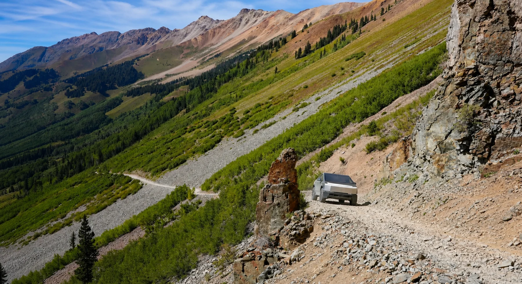
#27 / COLORADO
A pale road through dark San Juan peaks
Source photo: Trails Offroad / JD Marshall
WHY IT RANKS
Ophir Pass is a short crossing through the San Juan Mountains. The road crosses loose, pale rock below steep ridges and then descends into forest. It provides high mountain views in a compact trip.
SIGNATURE VIEWUpper Ophir Valley and sharp ridges above a talus shelf
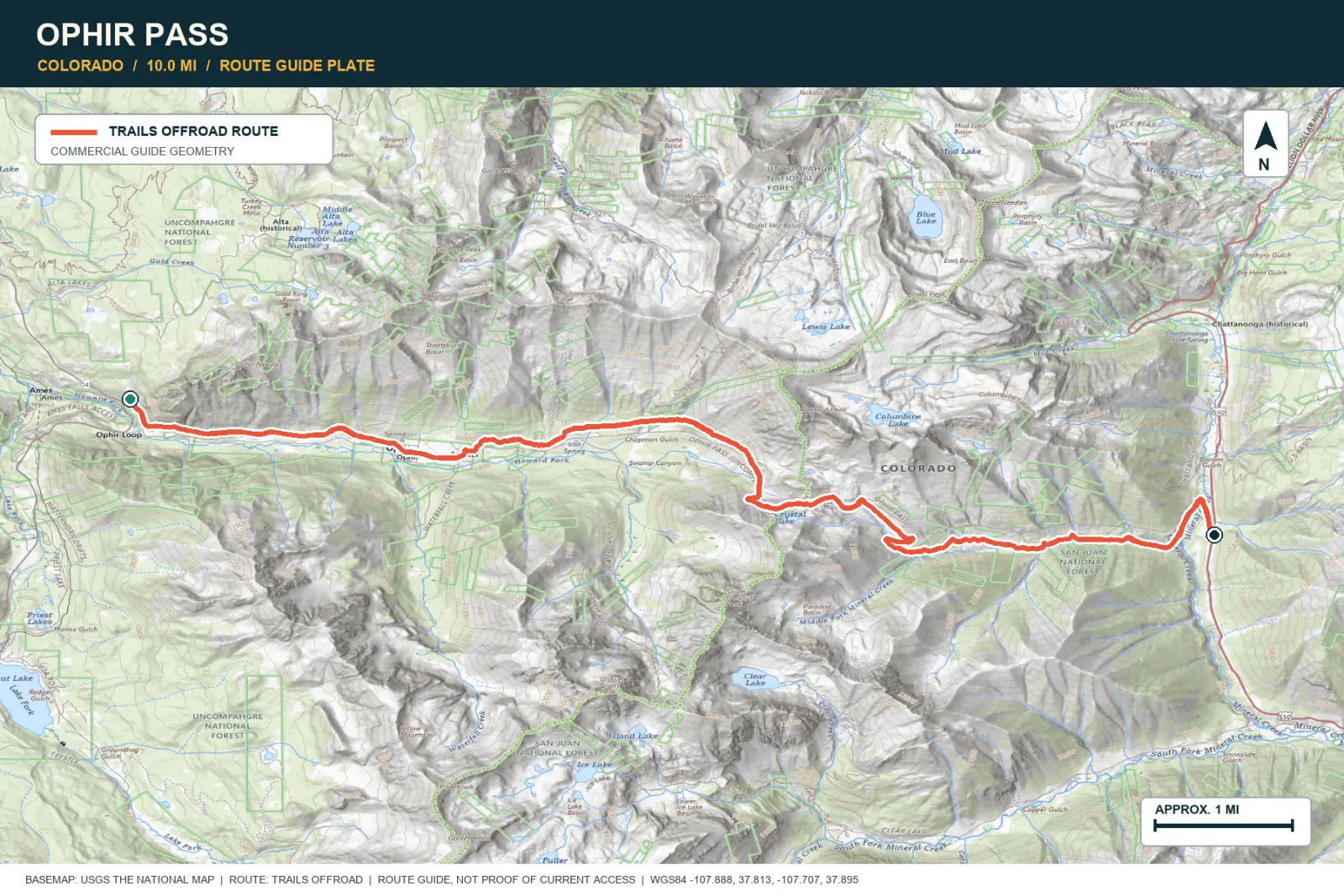
TOPOGRAPHIC PROFILE
Elevation sampled from AWS Terrain Tiles along the published route. Small terrain and GPS differences are normal.
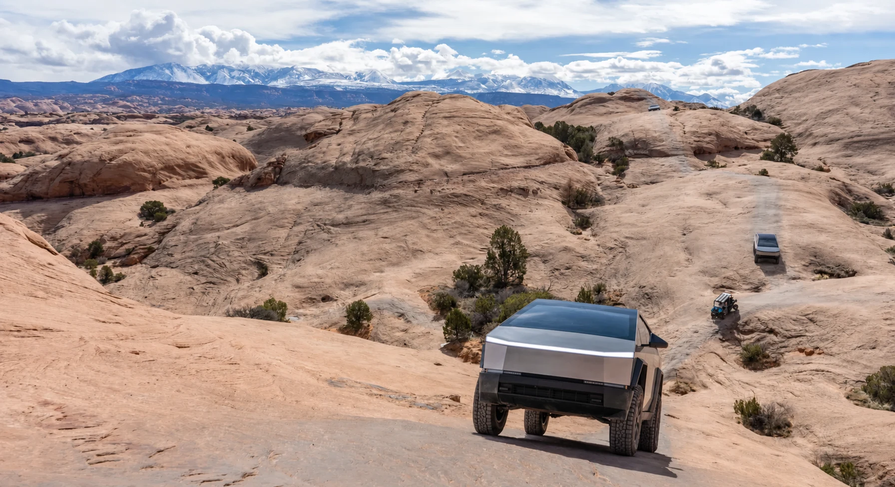
#28 / UTAH
Moab slickrock with the tire marks still visible
Source photo: Trails Offroad / Ryan Boudreau
WHY IT RANKS
Hell's Revenge crosses steep sandstone fins near Moab. The La Sal Mountains remain visible above the red rock. Optional obstacles can be extreme, but the main route shows how rubber tires grip sandstone.
SIGNATURE VIEWLa Sal Mountains beyond a field of sculpted slickrock
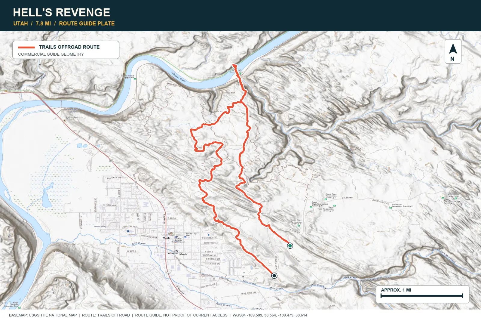
TOPOGRAPHIC PROFILE
Elevation sampled from AWS Terrain Tiles along the published route. Small terrain and GPS differences are normal.
#29 / MONTANA
A Montana road that stays above the trees
Source photo: Trails Offroad / Cory Wooldridge
WHY IT RANKS
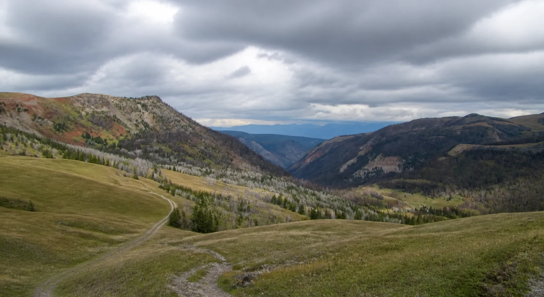
Gravelly Range Road stays above the trees across open Montana grassland. Wildlife, weather, and distant mountains remain visible for many miles. The route provides a long view of the high plateau.
SIGNATURE VIEWWildflower meadows and ranges in every direction
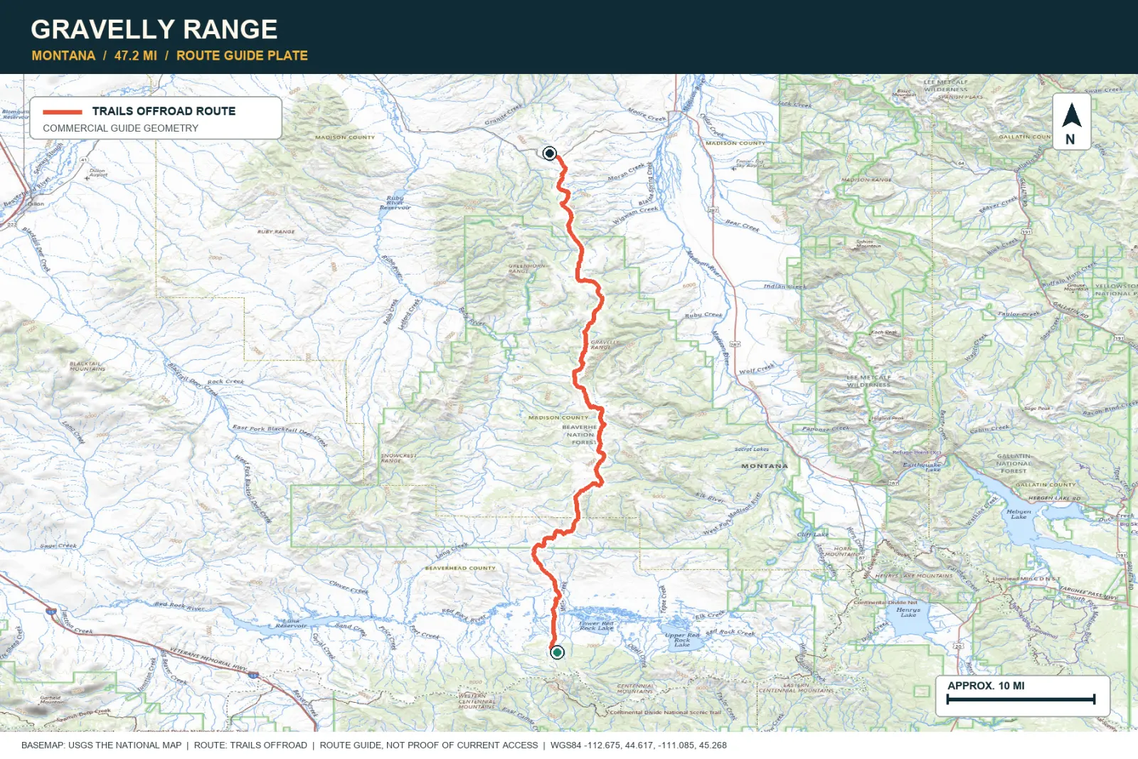
TOPOGRAPHIC PROFILE
Elevation sampled from AWS Terrain Tiles along the published route. Small terrain and GPS differences are normal.
#30 / ARIZONA
Sedona's red rock from the rough old rim road
Source photo: Trails Offroad / Wade May
WHY IT RANKS
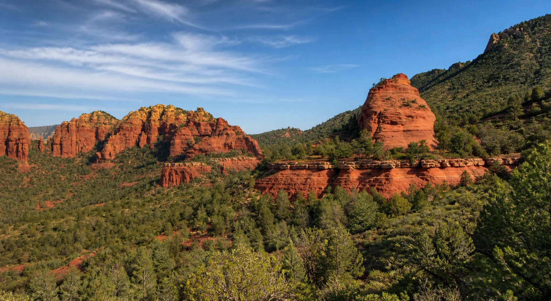
Schnebly Hill Road climbs from Sedona to the ponderosa forest on the Mogollon Rim. The surface is rough and rocky. Several viewpoints show the red-rock basin from increasing elevations.
SIGNATURE VIEWRed Rock Country dropping from the Mogollon escarpment
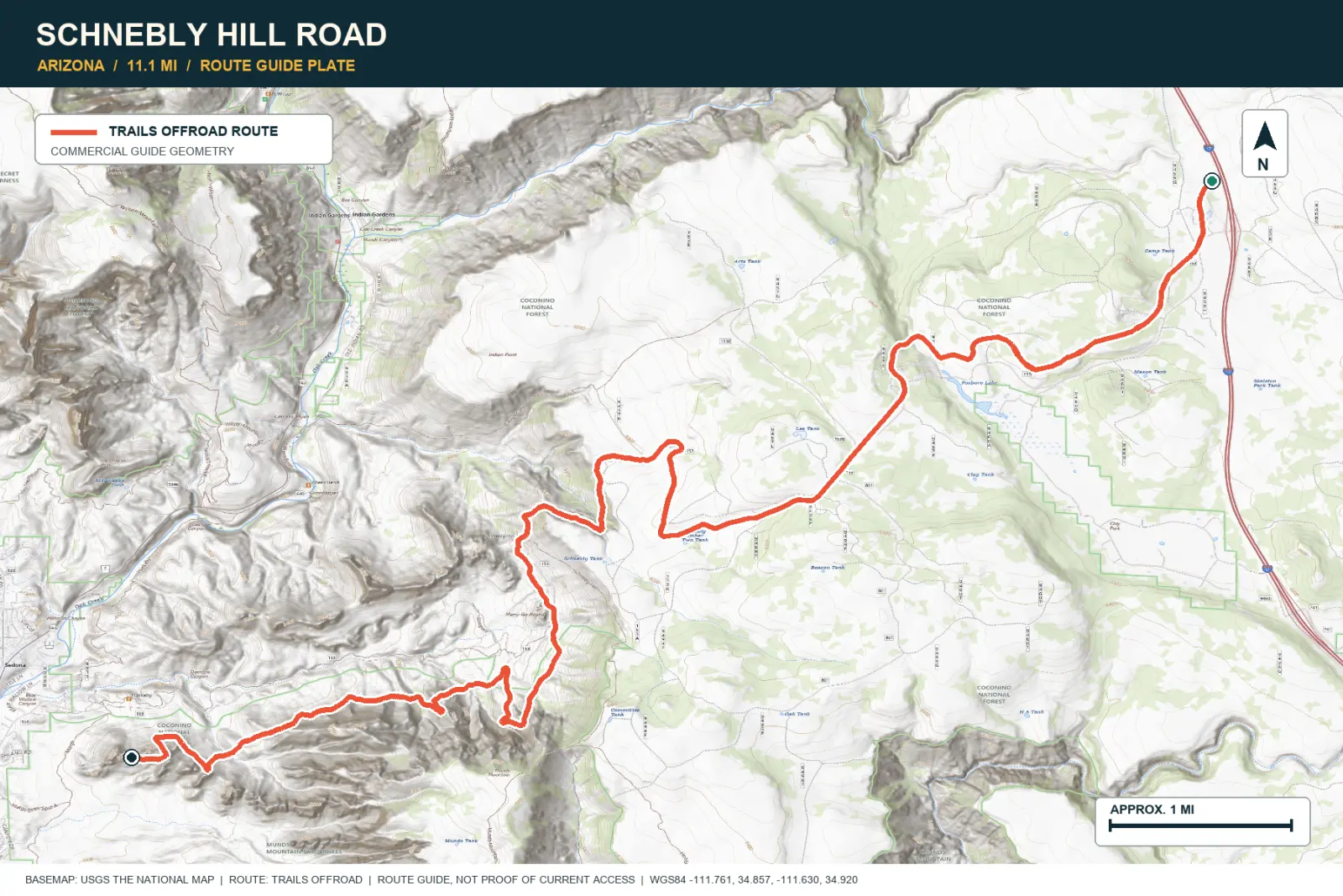
TOPOGRAPHIC PROFILE
Elevation sampled from AWS Terrain Tiles along the published route. Small terrain and GPS differences are normal.
#31 / UTAH
The road ends where the Maze begins
Source photo: Trails Offroad / TJ Bosworth
WHY IT RANKS
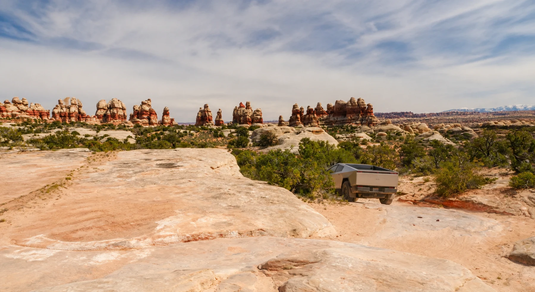
The Doll House has tall sandstone towers in the remote Maze district of Canyonlands. The vehicle approach is long and difficult. Foot trails continue from the parking area into nearby canyons.
SIGNATURE VIEWEroded stone 'dolls' above the Colorado River country
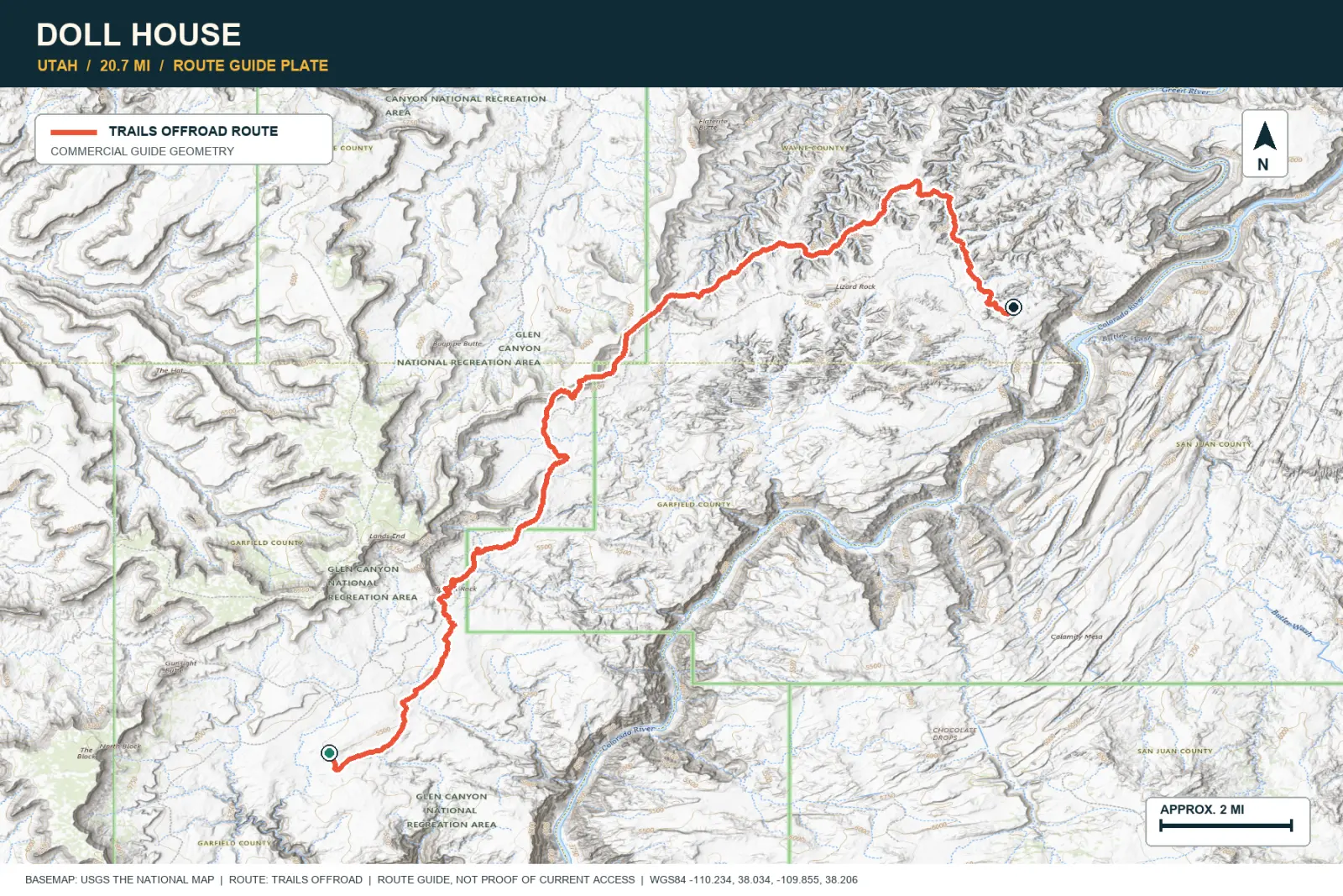
TOPOGRAPHIC PROFILE
Elevation sampled from AWS Terrain Tiles along the published route. Small terrain and GPS differences are normal.
#32 / CALIFORNIA
Five exposed miles above Racetrack Valley
Source photo: Trails Offroad / Josh Noesser
WHY IT RANKS
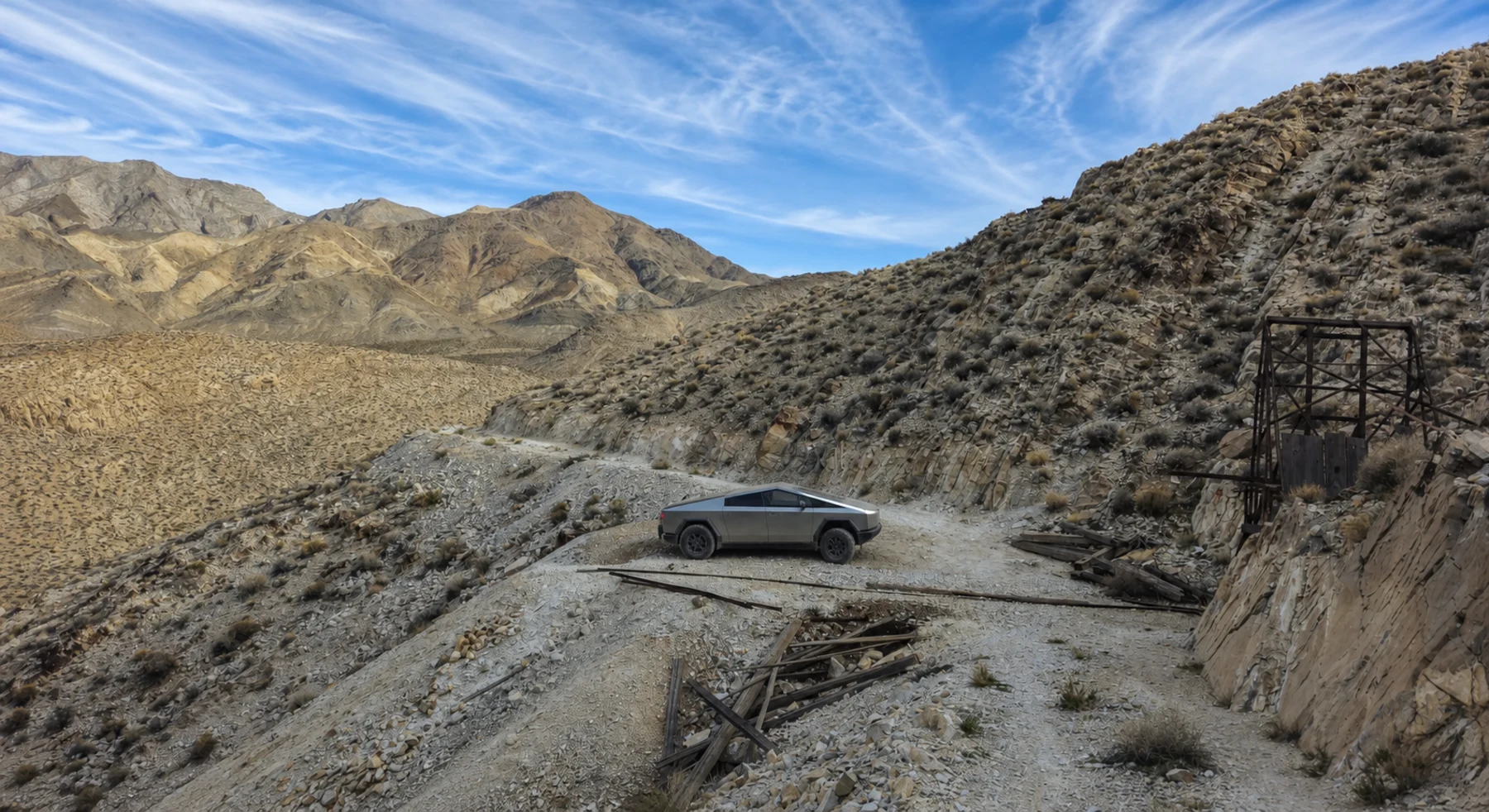
Lippincott Pass is a short, exposed shelf road between Racetrack and Saline valleys. The route has broad views and few safe edges. Plan it as part of a fully supplied Death Valley trip.
SIGNATURE VIEWDeath Valley, the Inyo Mountains, and empty mining country
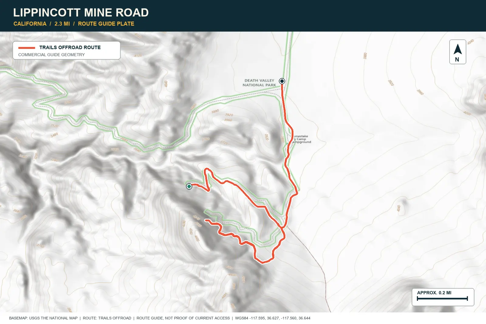
TOPOGRAPHIC PROFILE
Elevation sampled from AWS Terrain Tiles along the published route. Small terrain and GPS differences are normal.
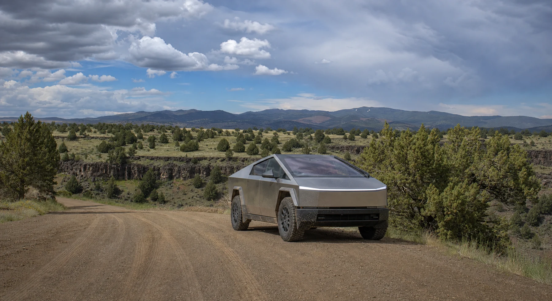
#33 / IDAHO
One hundred miles of Owyhee high desert
Source photo: Trails Offroad / Rose Meirs
WHY IT RANKS
The Owyhee Uplands Byway crosses about 100 miles of volcanic tableland, canyon rims, and ranch land. Services are scarce. The route provides a full day in open sagebrush country.
SIGNATURE VIEWOwyhee canyon rims across a vast sagebrush plateau
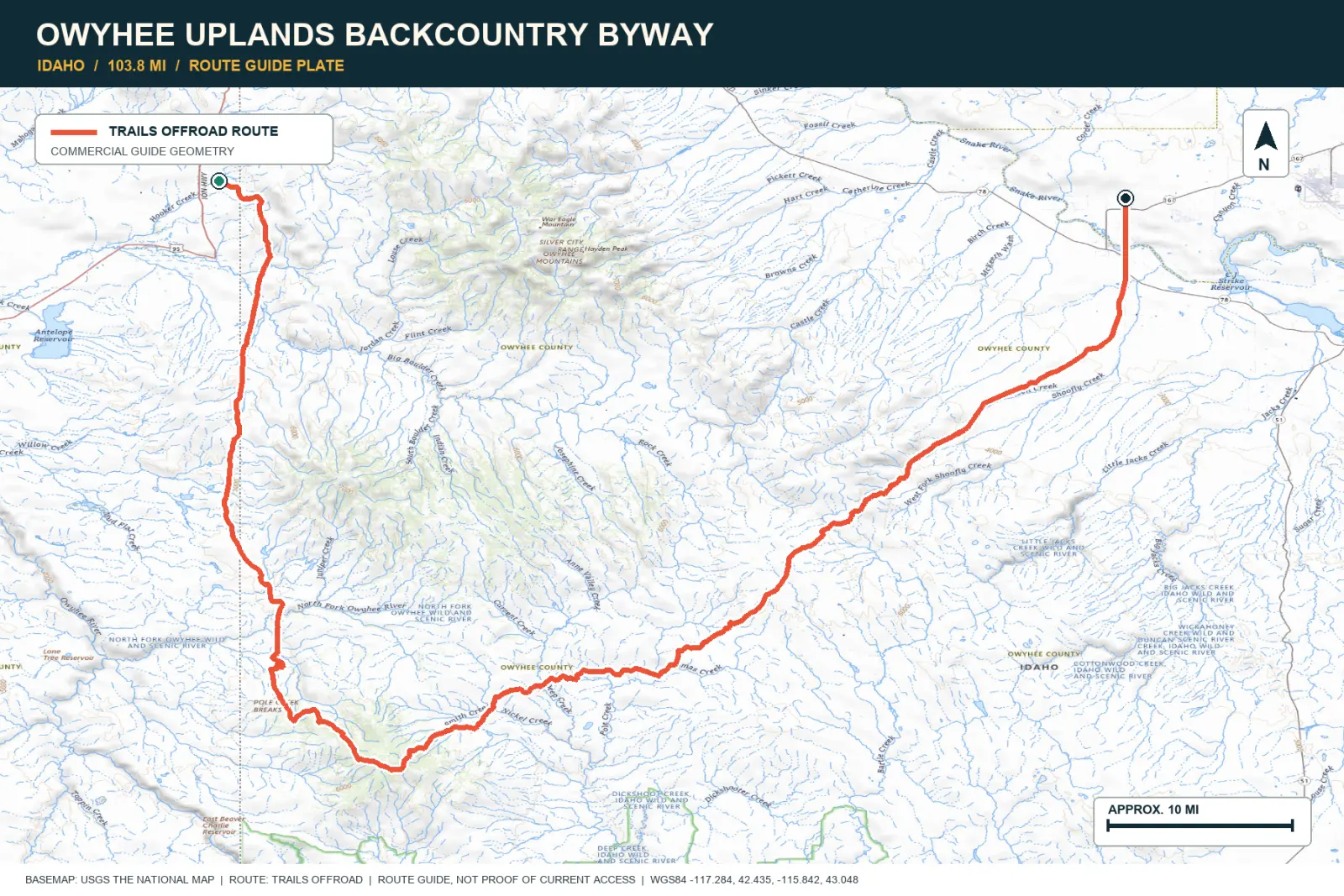
TOPOGRAPHIC PROFILE
Elevation sampled from AWS Terrain Tiles along the published route. Small terrain and GPS differences are normal.
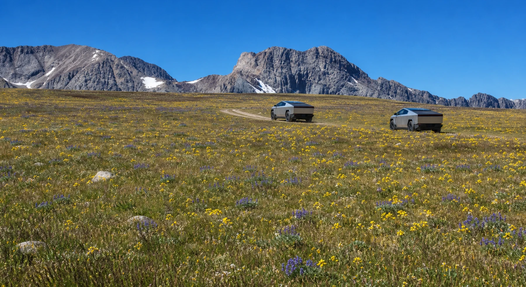
#34 / IDAHO
An Idaho meadow at 10,417 feet
Source photo: Trails Offroad / Rose Meirs
WHY IT RANKS
Railroad Ridge climbs to a broad meadow at 10,417 feet. The summit shows the Sawtooths, Lost River Range, and Frank Church area. Few Idaho roads reach a viewpoint at this elevation.
SIGNATURE VIEWSawtooths, Frank Church wilderness, and the Lost River Range
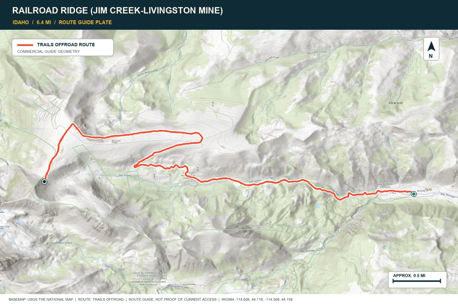
TOPOGRAPHIC PROFILE
Elevation sampled from AWS Terrain Tiles along the published route. Small terrain and GPS differences are normal.
#35 / MONTANA
Two-track to the edge of Bighorn Canyon
Source photo: OnX Offroad
WHY IT RANKS
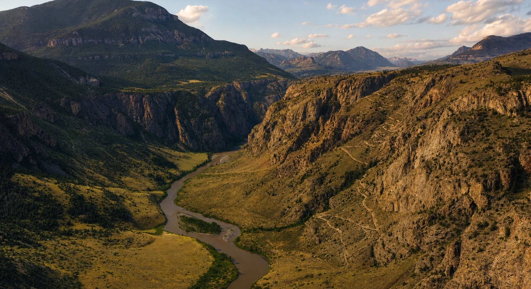
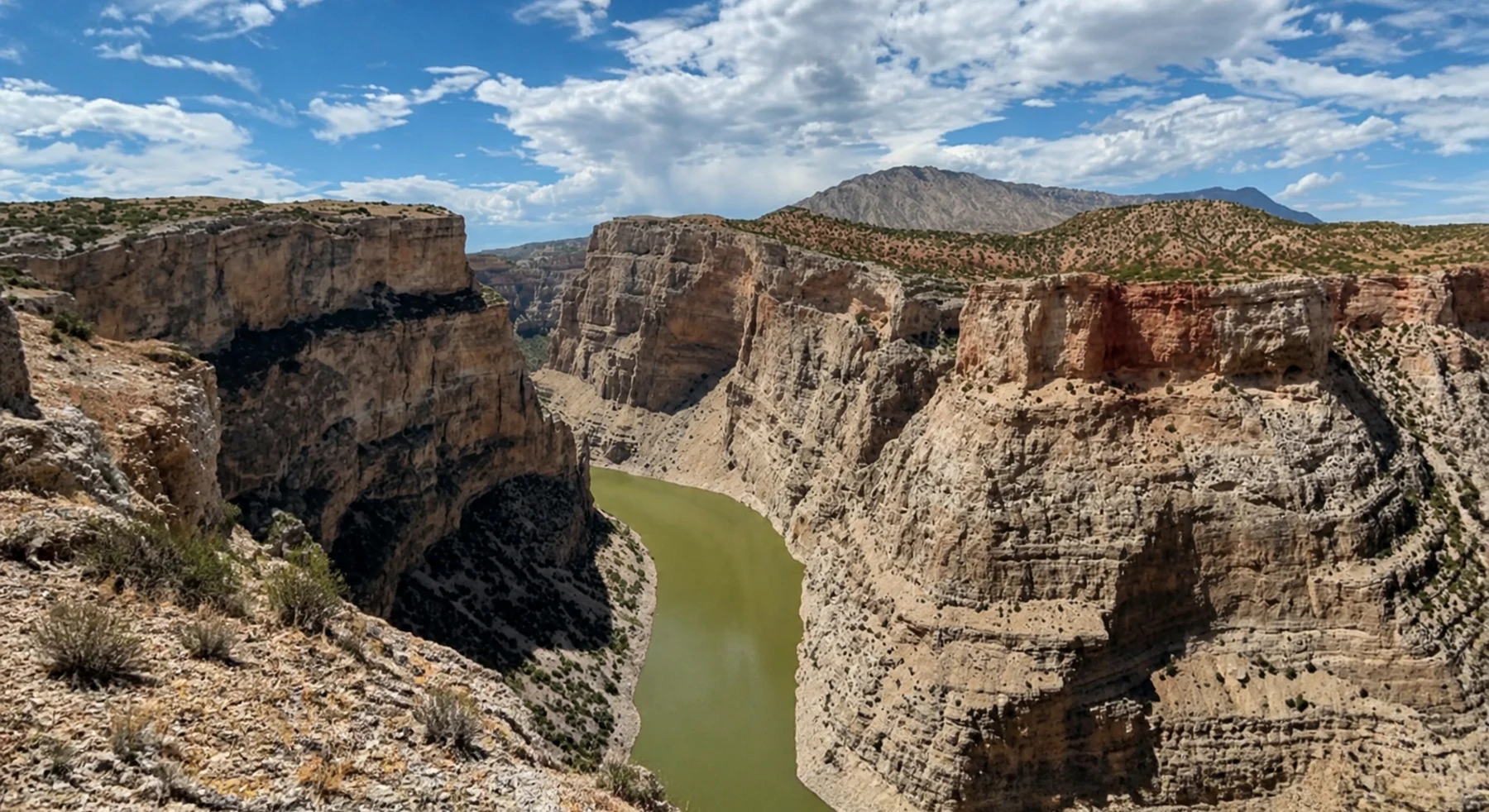
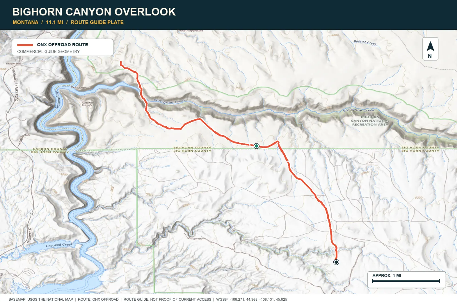
The road crosses open high country to the rim of Bighorn Canyon. Pale limestone walls drop to the river below. The final overlook appears after a gradual two-track approach.
SIGNATURE VIEWThe Bighorn River cutting through pale limestone walls
TOPOGRAPHIC PROFILE
Elevation sampled from AWS Terrain Tiles along the published route. Small terrain and GPS differences are normal.
#36 / CALIFORNIA
Forest and granite below a working lookout
Source photo: Trails Offroad / GM
WHY IT RANKS
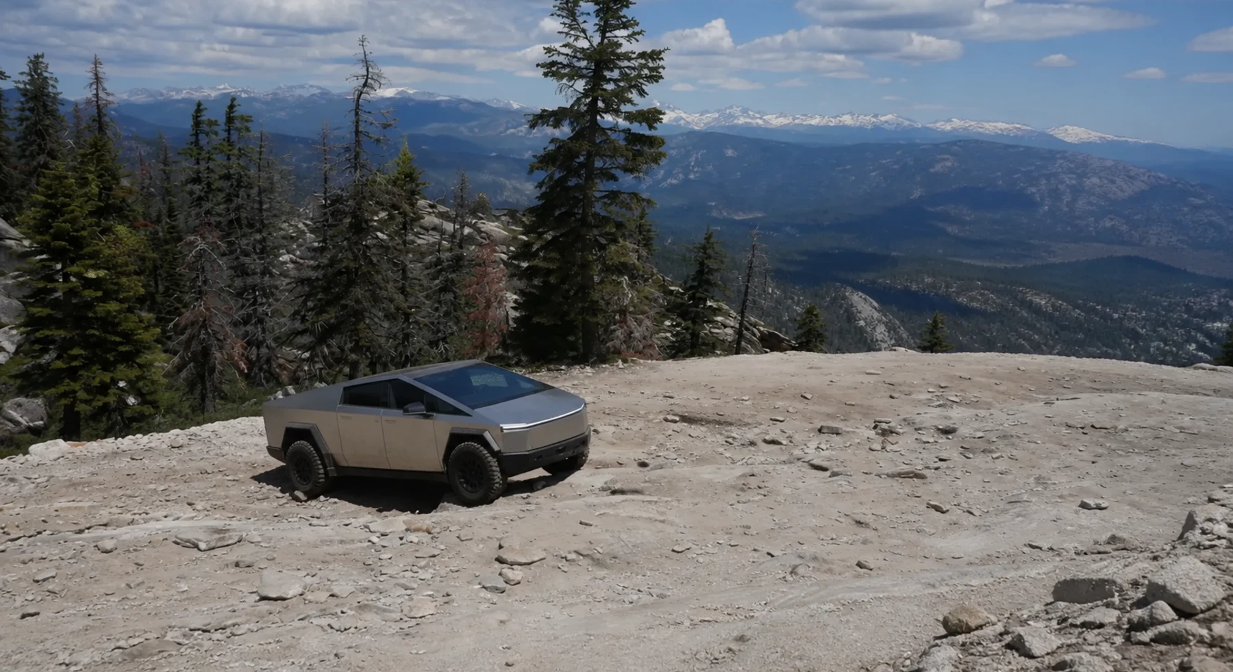
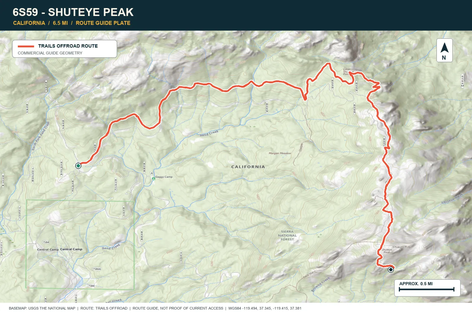
Shuteye Peak climbs through Sierra forest to open granite and a fire lookout. On a clear day, the summit shows Yosemite, Bass Lake, Kaiser Pass, the Sierra crest, and the Central Valley.
SIGNATURE VIEWYosemite wilderness, Kaiser Pass, Bass Lake, and the Central Valley
TOPOGRAPHIC PROFILE
Elevation sampled from AWS Terrain Tiles along the published route. Small terrain and GPS differences are normal.
#37 / WASHINGTON
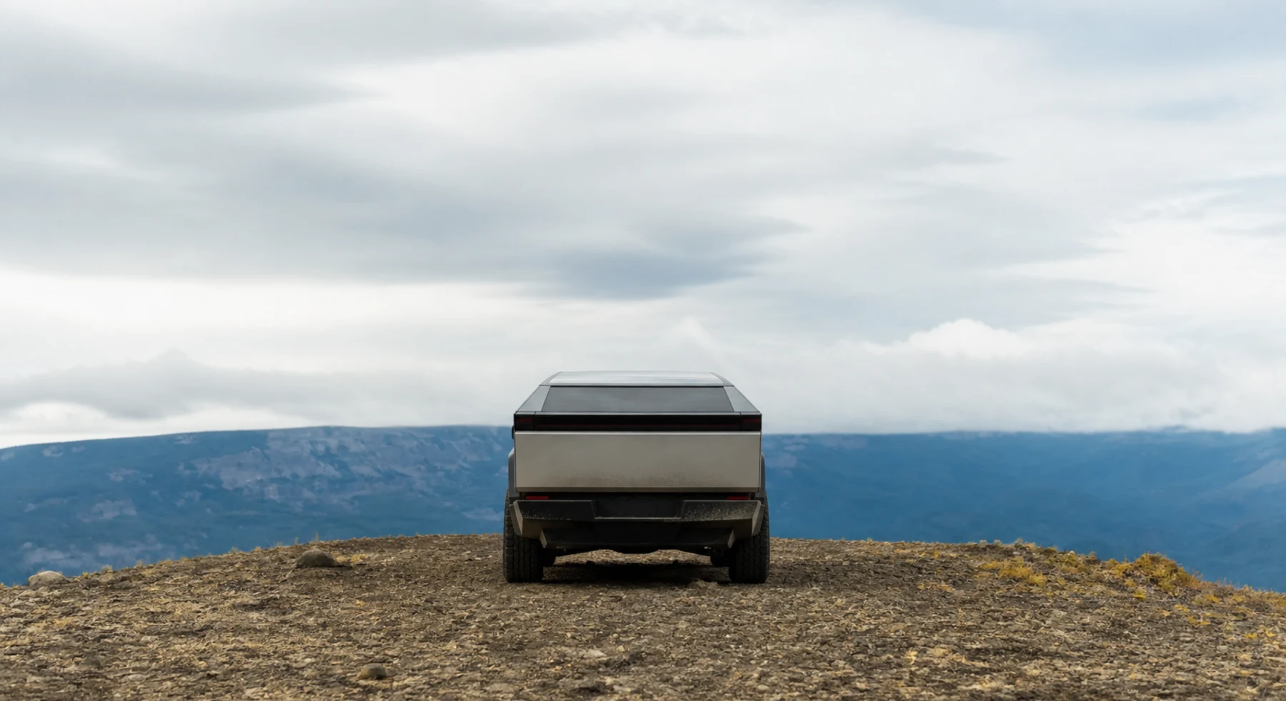
A dusty ridge above Rimrock Lake
Source photo: Trails Offroad / Jasmine & Jon Hughes
WHY IT RANKS
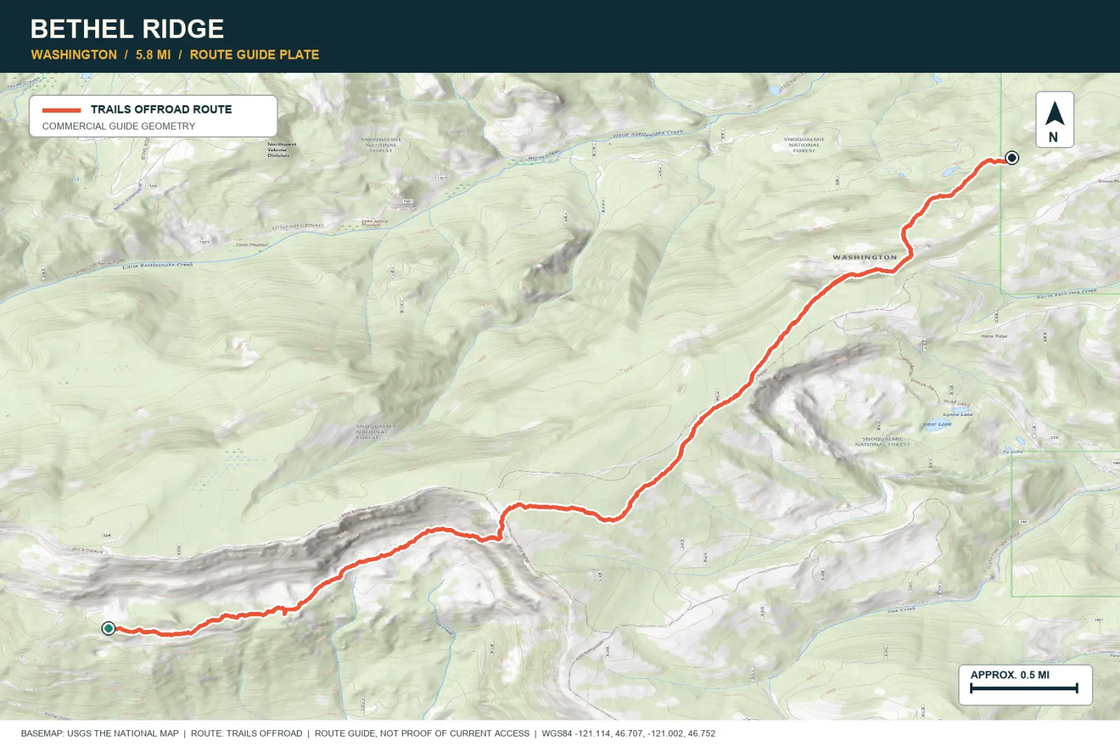
Bethel Ridge alternates between forest and open viewpoints. Rimrock Lake lies below the road, and Mount Adams is visible on clear days. Evening light can improve the western view.
SIGNATURE VIEWMount Adams, Rimrock Lake, and the eastern Cascades
TOPOGRAPHIC PROFILE
Elevation sampled from AWS Terrain Tiles along the published route. Small terrain and GPS differences are normal.
#38 / WASHINGTON
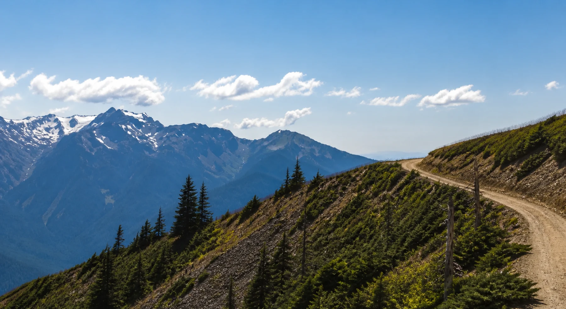
The narrow road beyond Hurricane Ridge
Source photo: Trails Offroad / Jasmine & Jon Hughes
WHY IT RANKS
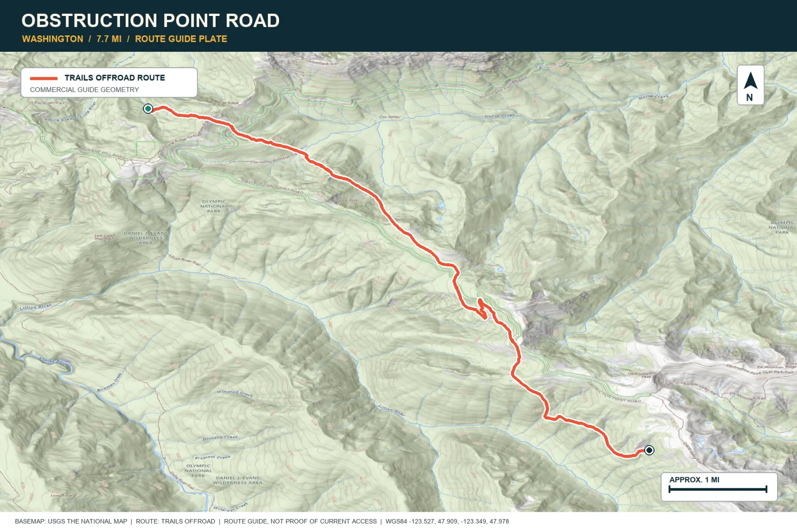
Obstruction Point Road continues beyond Hurricane Ridge on a narrow seasonal route. Subalpine meadows, Olympic peaks, forest, and distant ridges surround the road. The route is an out-and-back.
SIGNATURE VIEWMount Olympus and layered ridges above subalpine meadows
TOPOGRAPHIC PROFILE
Elevation sampled from AWS Terrain Tiles along the published route. Small terrain and GPS differences are normal.
#39 / TEXAS
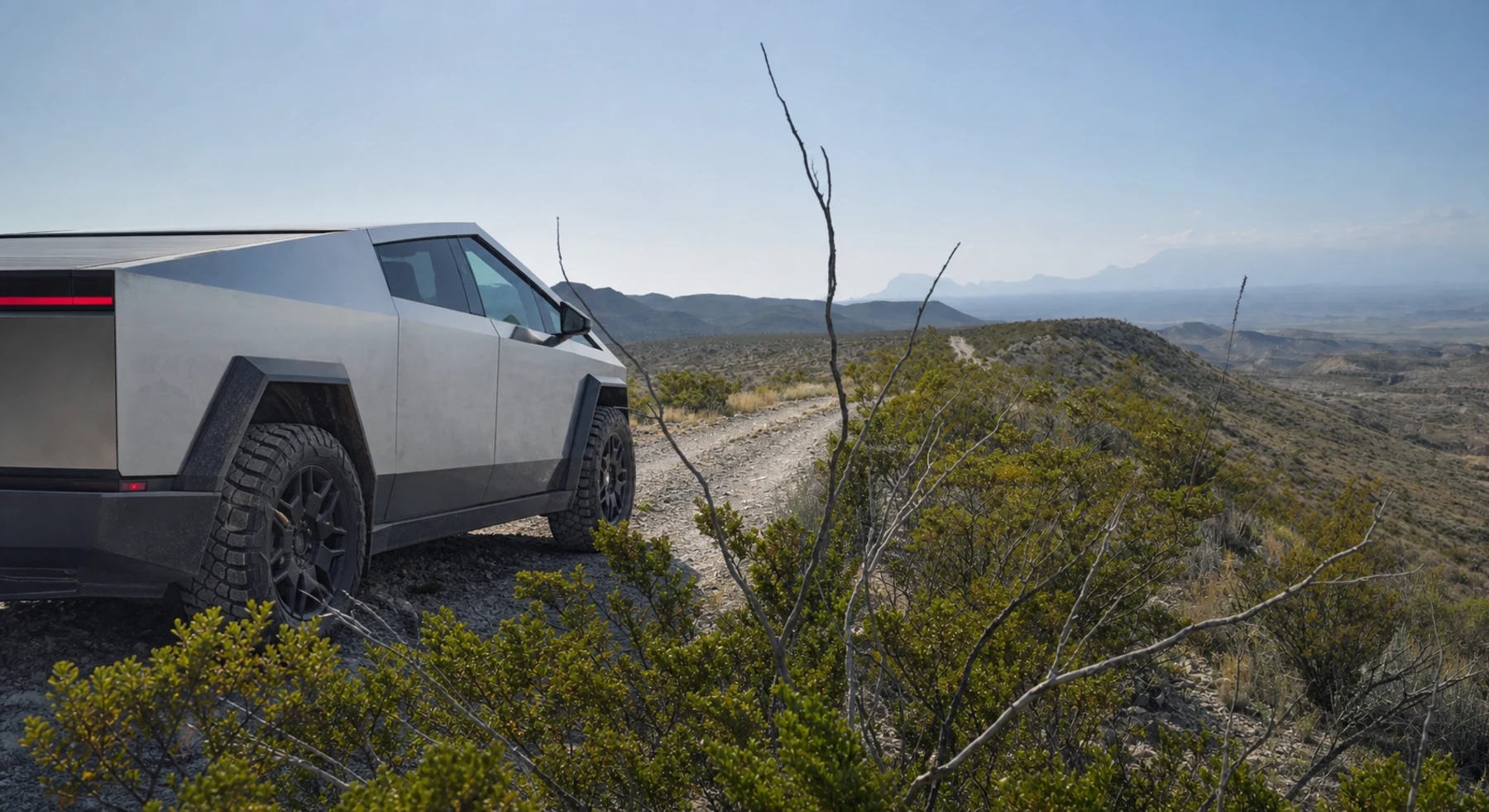
Twenty-seven miles through Big Bend geology
Source photo: Trails Offroad / John-Paul Clark
WHY IT RANKS
Old Ore Road crosses ridges and broad desert channels in Big Bend. The Chisos Mountains remain visible along much of the route. A short walk from the road leads to the folded limestone at Ernst Tinaja.
SIGNATURE VIEWChisos Mountains across the Tornillo Creek drainage
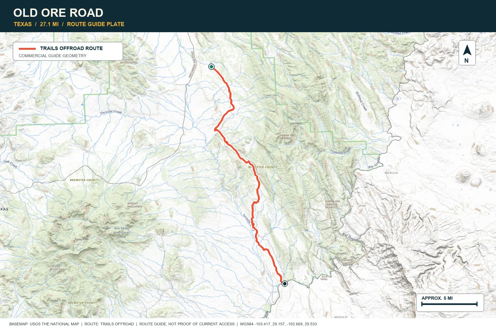
TOPOGRAPHIC PROFILE
Elevation sampled from AWS Terrain Tiles along the published route. Small terrain and GPS differences are normal.
#40 / TEXAS
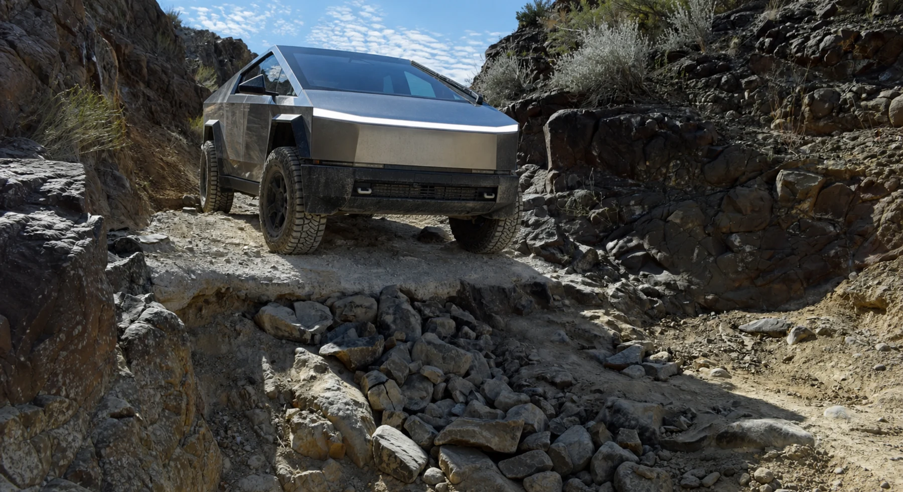
Big Bend's remote road with one famous step
Source photo: Trails Offroad / John-Paul Clark
WHY IT RANKS
Black Gap is the difficult section of a larger Big Bend backcountry loop. The route includes a rock ledge, rough washes, and long distances from pavement. Carry enough vehicle and energy reserve for the complete trip.
SIGNATURE VIEWChihuahuan Desert horizons under the Chisos Mountains
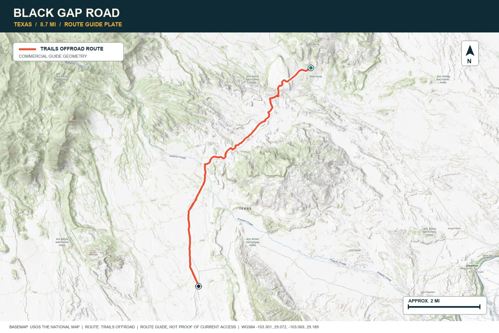
TOPOGRAPHIC PROFILE
Elevation sampled from AWS Terrain Tiles along the published route. Small terrain and GPS differences are normal.
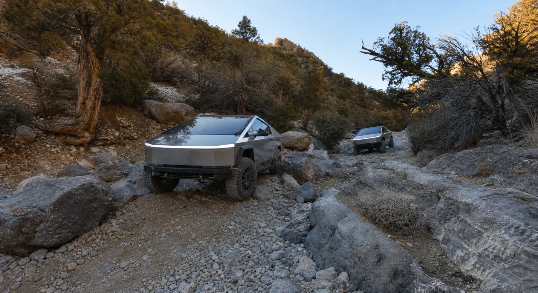
#41 / NEVADA
A rock wash on the far side of Las Vegas
Source photo: Trails Offroad / James and Mimi Nicholson
WHY IT RANKS
Rocky Gap crosses a rough limestone wash in the Spring Mountains. The route climbs from Joshua trees toward evergreen forest. A difficult central rock section has no easy bypass.
SIGNATURE VIEWLimestone ridges, Joshua country, and Las Vegas far beyond
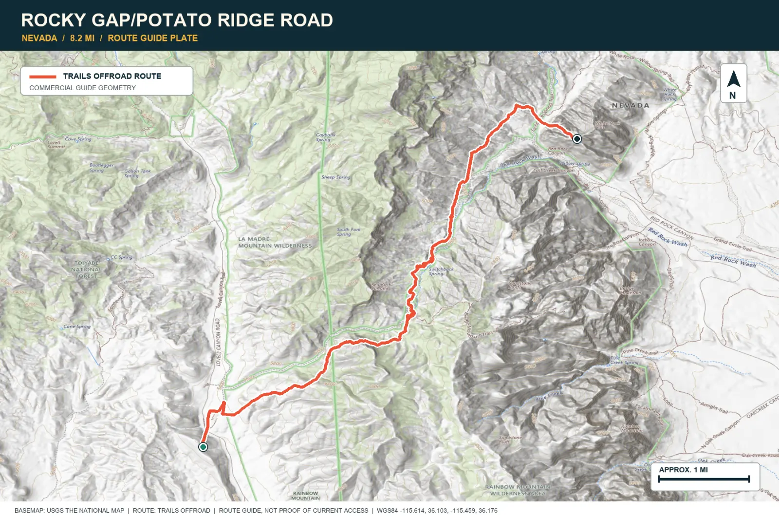
TOPOGRAPHIC PROFILE
Elevation sampled from AWS Terrain Tiles along the published route. Small terrain and GPS differences are normal.
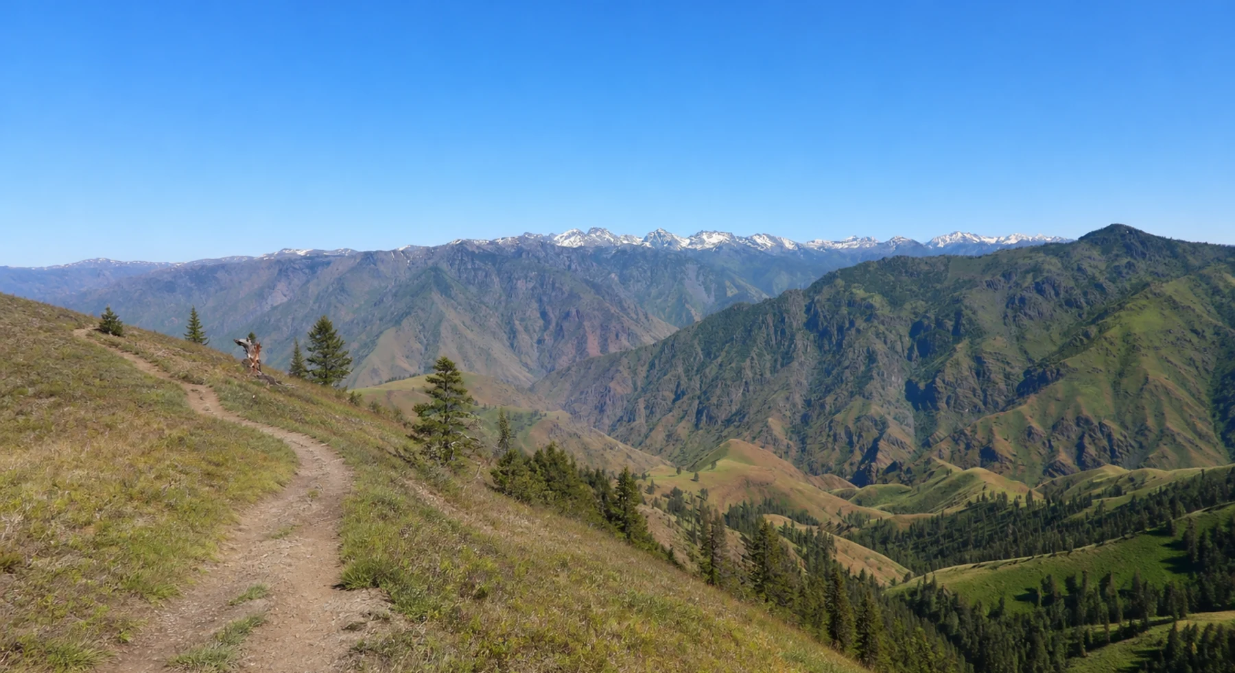
#42 / OREGON
An 82-foot lookout above Hells Canyon
Source photo: Trails Offroad / Rose Meirs
WHY IT RANKS
Hat Point Road climbs through forest to a fire tower above the Snake River. The Seven Devils rise across Hells Canyon. The 82-foot tower provides a clear view of the canyon's large elevation change.
SIGNATURE VIEWHells Canyon, the Snake River, and Idaho's Seven Devils
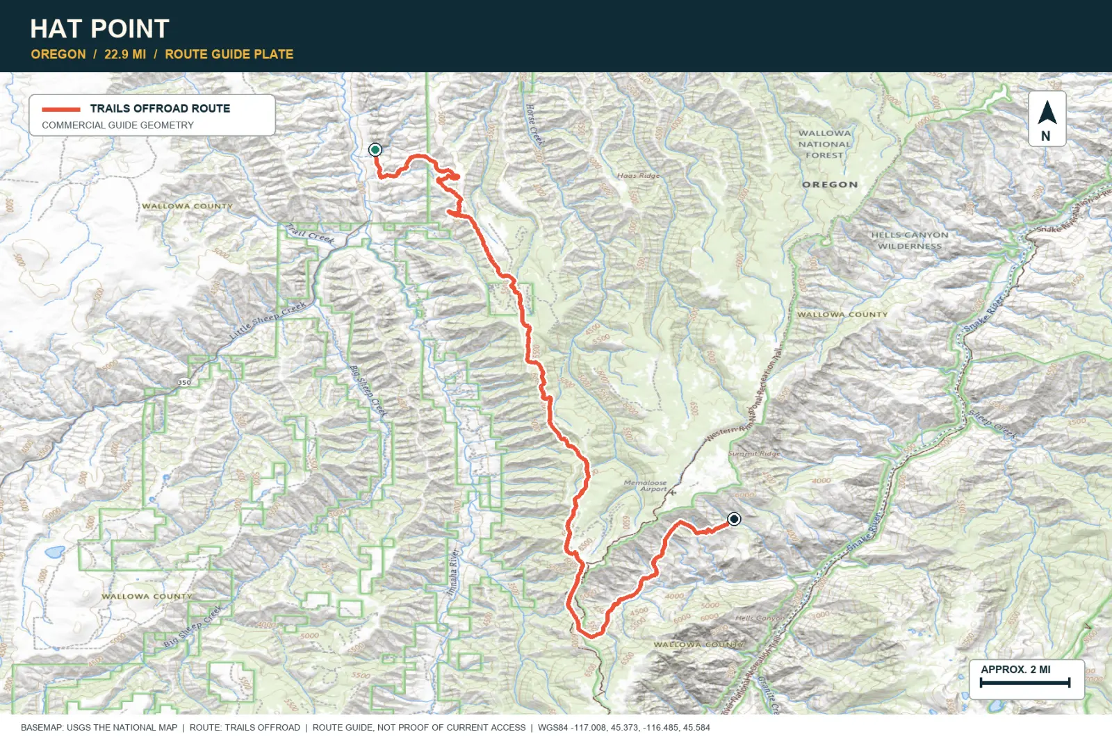
TOPOGRAPHIC PROFILE
Elevation sampled from AWS Terrain Tiles along the published route. Small terrain and GPS differences are normal.
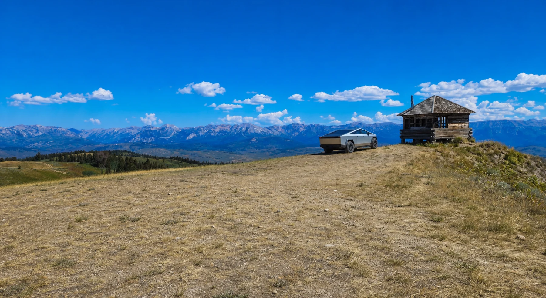
#43 / WYOMING
A short road to a Wyoming fire lookout
Source photo: Trails Offroad / Ryan Boudreau
WHY IT RANKS
Monument Ridge reaches a fire lookout above Jackson Hole on a short route. The summit shows the Gros Ventre, Wyoming Range, and distant Teton Range. The trip does not require a full day.
SIGNATURE VIEWThe Gros Ventre, Wyoming Range, and distant Tetons
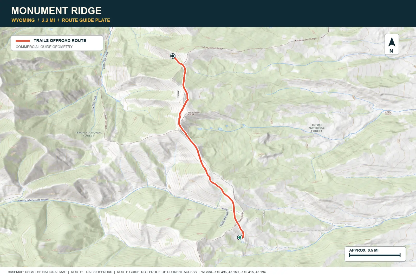
TOPOGRAPHIC PROFILE
Elevation sampled from AWS Terrain Tiles along the published route. Small terrain and GPS differences are normal.
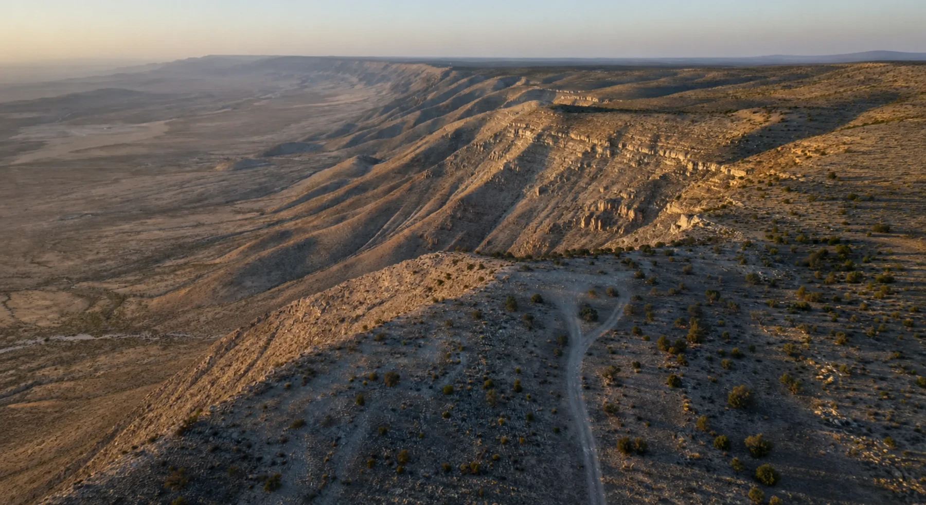
#44 / NEW MEXICO
Pinyon shade and long Dog Canyon views
Source photo: Trails Offroad / Tony Faiola
WHY IT RANKS
Guadalupe Rim follows the western side of the range. Pinyon-juniper forest opens to views across Dog Canyon and the southern New Mexico desert. Campsites lie along the moderate road.
SIGNATURE VIEWGuadalupe escarpments and southern New Mexico desert
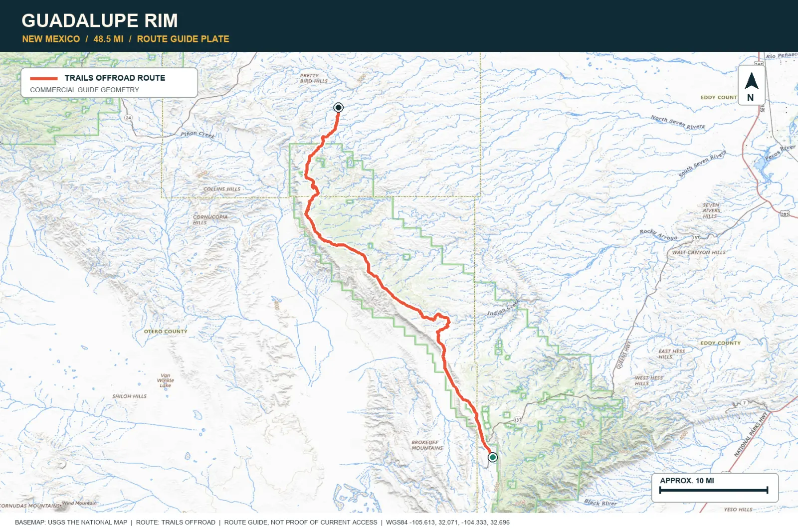
TOPOGRAPHIC PROFILE
Elevation sampled from AWS Terrain Tiles along the published route. Small terrain and GPS differences are normal.
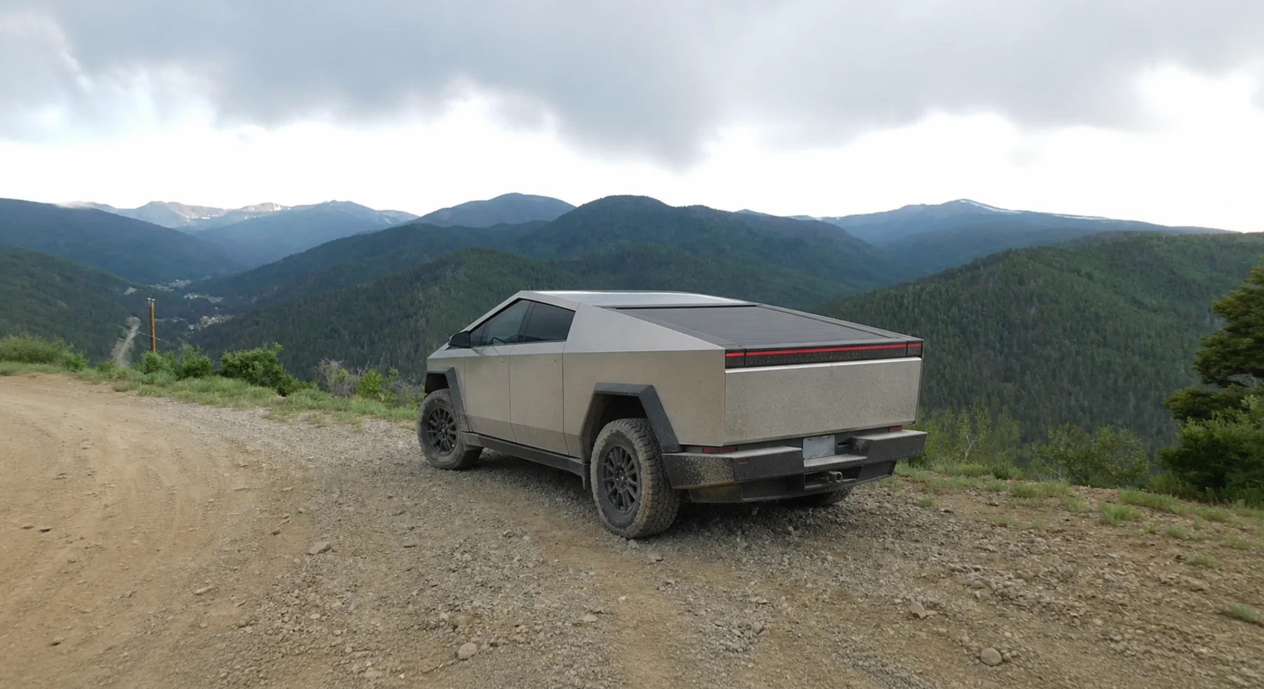
#45 / NEW MEXICO
The switchbacks Red River used before the highway
Source photo: Trails Offroad / Brett Brogdon
WHY IT RANKS
Old Red River Pass follows the former eastern road into town. Rough switchbacks climb through forest to a view above Red River. New Mexico's highest mountains are visible from the summit.
SIGNATURE VIEWWheeler Peak wilderness and the town far below
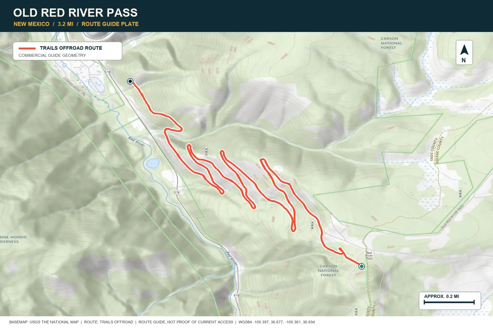
TOPOGRAPHIC PROFILE
Elevation sampled from AWS Terrain Tiles along the published route. Small terrain and GPS differences are normal.
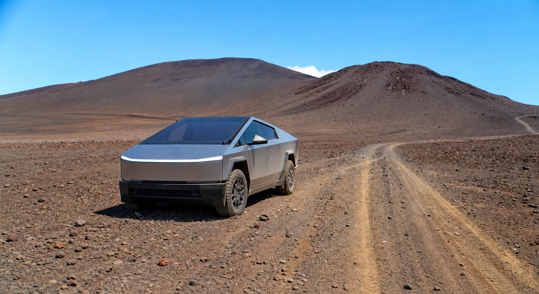
#46 / HAWAII
Red cinder above a sea of cloud
Source photo: Trails Offroad / Patrick McKay
WHY IT RANKS
Skyline Road climbs above the trees into the alpine desert on Mauna Kea. The route passes red cinder cones and native silversword plants. Clouds can form below the road.
SIGNATURE VIEWMauna Kea cinder cones over a sea of cloud
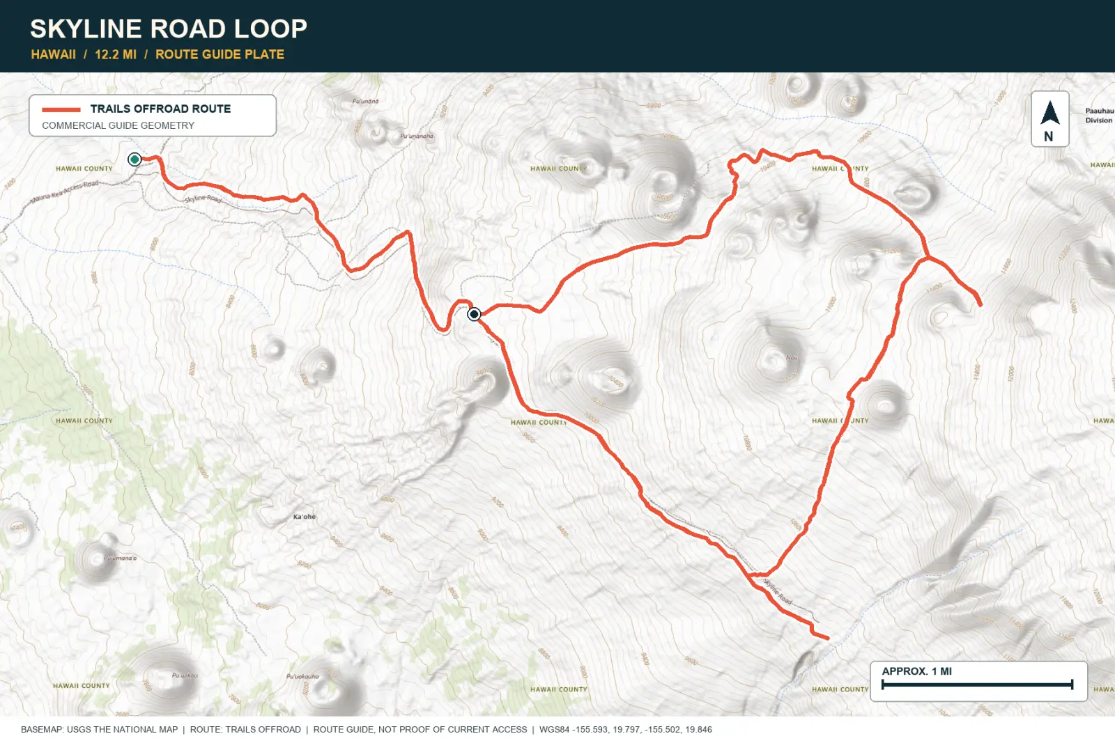
TOPOGRAPHIC PROFILE
Elevation sampled from AWS Terrain Tiles along the published route. Small terrain and GPS differences are normal.
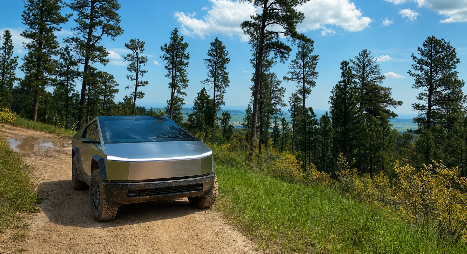
#47 / SOUTH DAKOTA
Ponderosa forest to a Black Hills summit
Source photo: Trails Offroad / Marcus Trusty
WHY IT RANKS
Spearfish Mountain climbs through ponderosa forest to an open summit. The top shows Crow Peak, Spearfish Valley, and distant Bear Butte. The route is short and moderate.
SIGNATURE VIEWSpearfish valley, Crow Peak, and Bear Butte
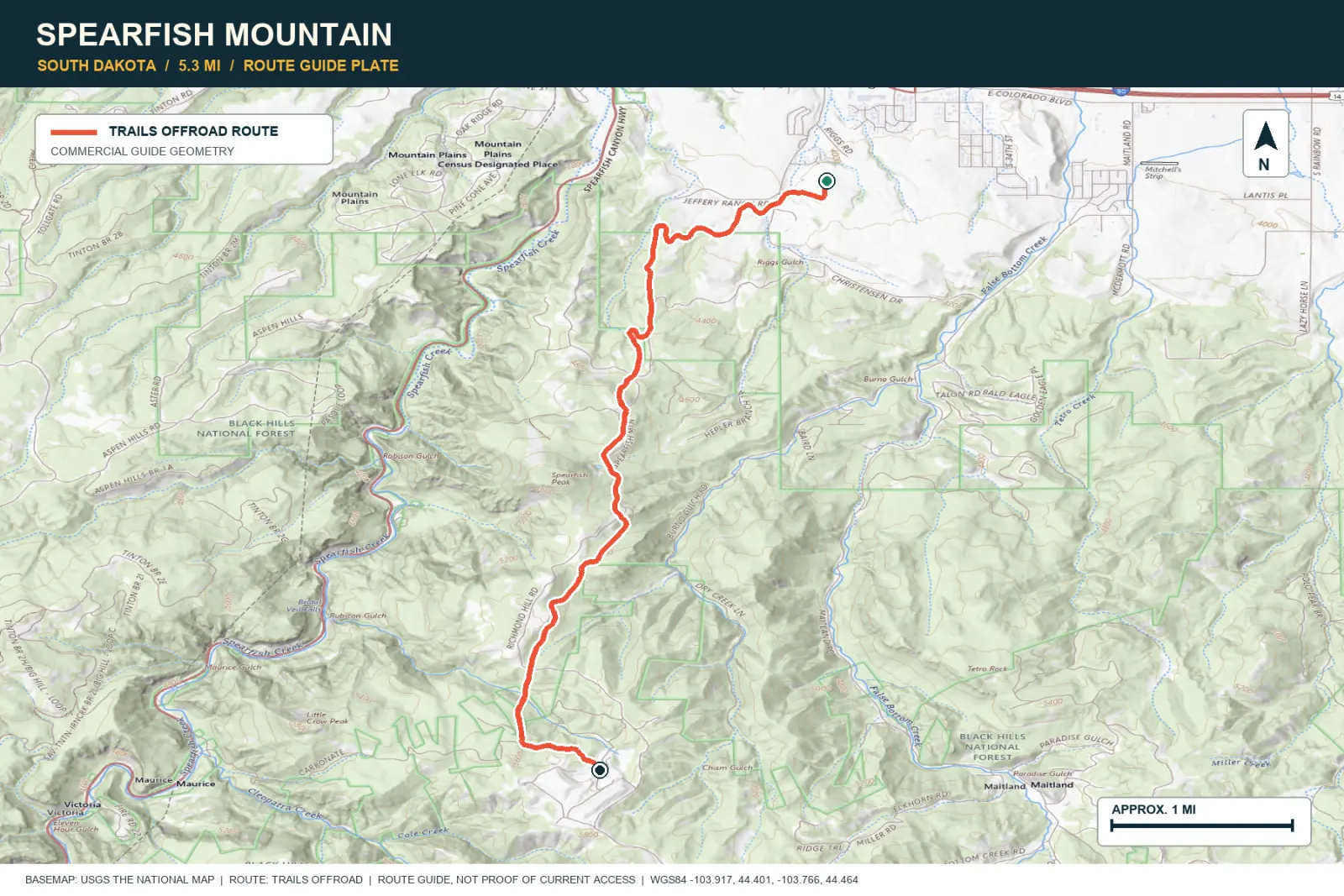
TOPOGRAPHIC PROFILE
Elevation sampled from AWS Terrain Tiles along the published route. Small terrain and GPS differences are normal.
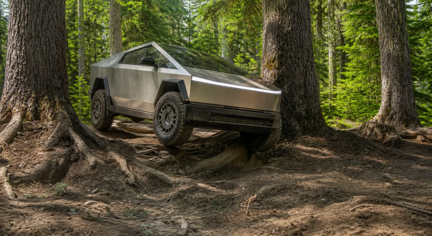
#48 / WASHINGTON
Roots, mud, and Mount Rainier
Source photo: Trails Offroad / Michael Graham
WHY IT RANKS
Naches Trail is a difficult forest route with roots and mud. Meadows and ridges later open toward Mount Rainier. Indigenous travelers and the Longmire wagon party used this corridor.
SIGNATURE VIEWMount Rainier from forest, meadow, and ridgeline
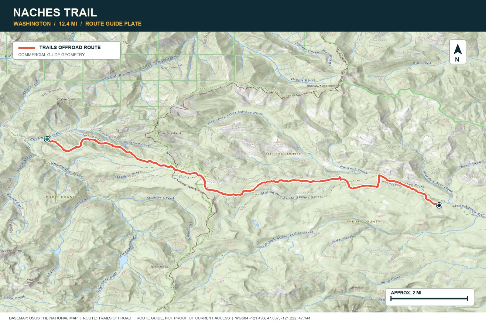
TOPOGRAPHIC PROFILE
Elevation sampled from AWS Terrain Tiles along the published route. Small terrain and GPS differences are normal.
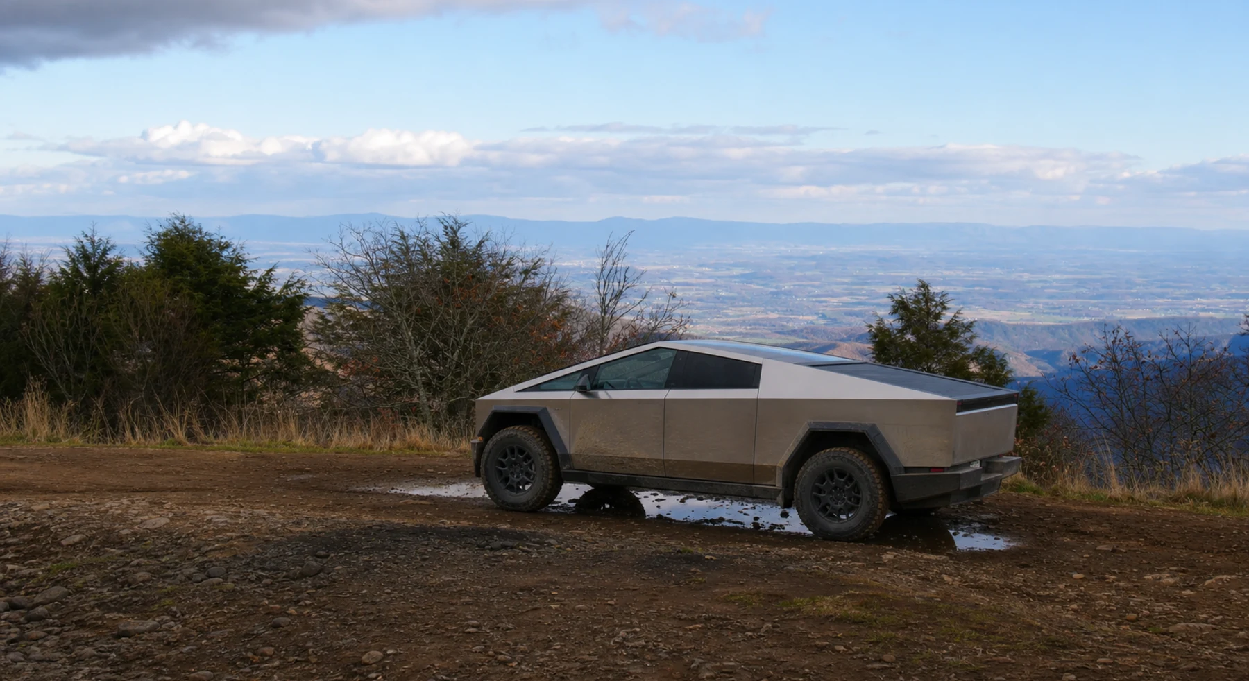
#49 / VIRGINIA
An Appalachian lookout at the end of a friendly ridge
Source photo: Trails Offroad / Todd
WHY IT RANKS
Flagpole Knob follows a moderate ridge road above the Shenandoah Valley. The summit shows several layers of the Blue Ridge. The route is suitable for drivers who do not want a difficult rock trail.
SIGNATURE VIEWBlue Ridge folds receding across Virginia
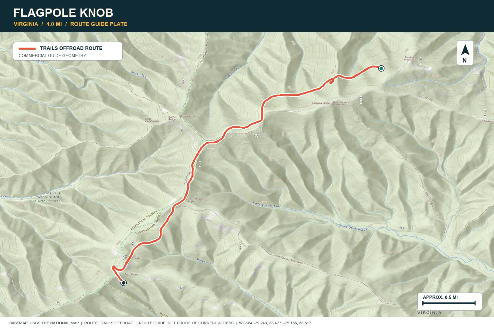
TOPOGRAPHIC PROFILE
Elevation sampled from AWS Terrain Tiles along the published route. Small terrain and GPS differences are normal.
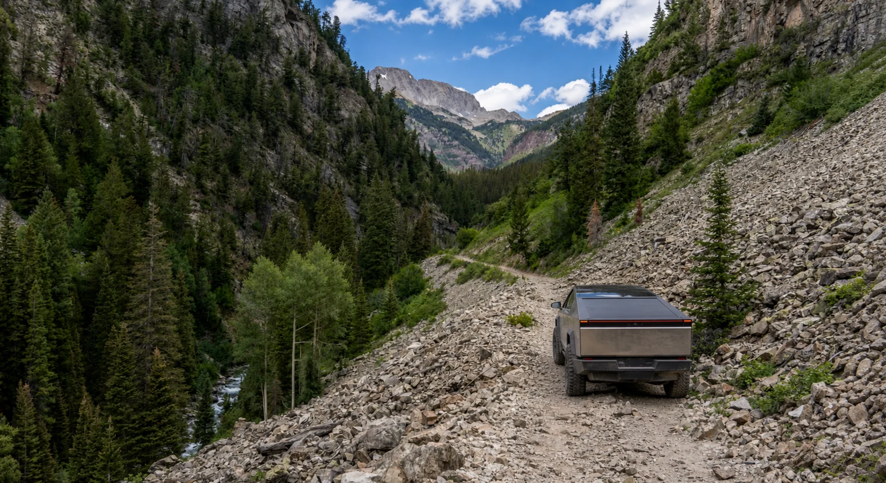
#50 / COLORADO
Wildflower meadows behind the Crystal Mill crowds
Source photo: Trails Offroad / Ryan Boudreau
WHY IT RANKS
Lead King Basin continues beyond Crystal Mill into meadows below the Elk Mountains. Wildflowers appear in summer, and the aspen changes color in fall. The best views extend beyond the well-known mill.
SIGNATURE VIEWElk Mountain peaks, alpine streams, and the Crystal valley
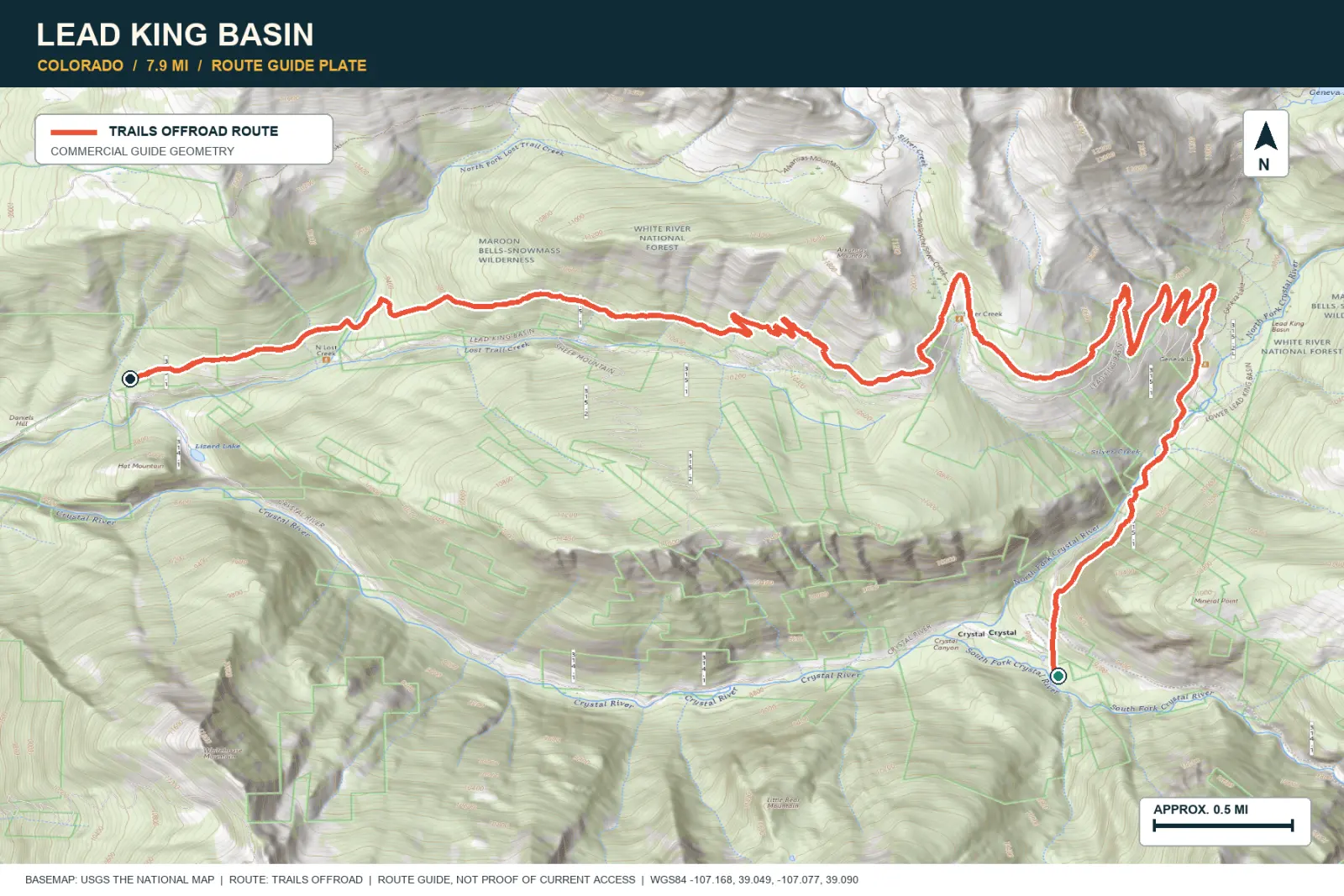
TOPOGRAPHIC PROFILE
Elevation sampled from AWS Terrain Tiles along the published route. Small terrain and GPS differences are normal.