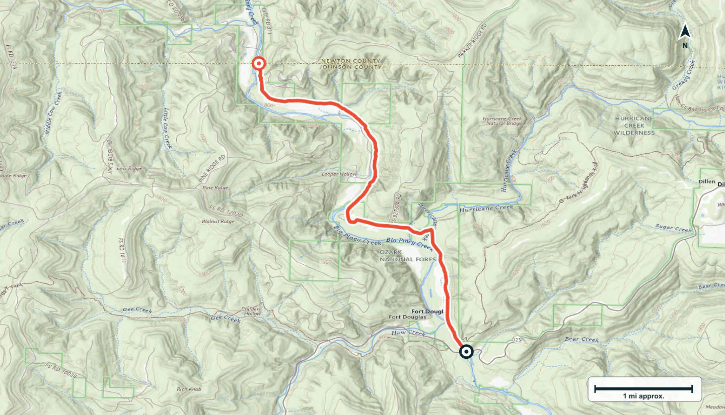

ADVENTURE ROUTE COLLECTION · ARKANSAS
Arkansas Ozarks: Water and Ridge Roads
Use eight routes in the Arkansas Ozarks. Start on easy forest roads. Add water, mud, rock, and steeper ridge travel in measured stages.
WHY IT FITS
Why this progression can fit your trip.
The routes form a compact forest collection. Each stage adds one main demand without requiring a long move to a new base.
ROUTE PROGRESSION
Add one skill at a time.
Drive only the stages that fit your vehicle, experience, weather, and current access. A later stage is not a required finish.
Black Berry Loop
- Route distance
- 2.2 mi
- Allow
- 1–2 hours
Start on a short forest loop. Use it to check maps, tires, and the effect of wet soil.
Access note: Source snapshot: Open. Check the live source before travel.
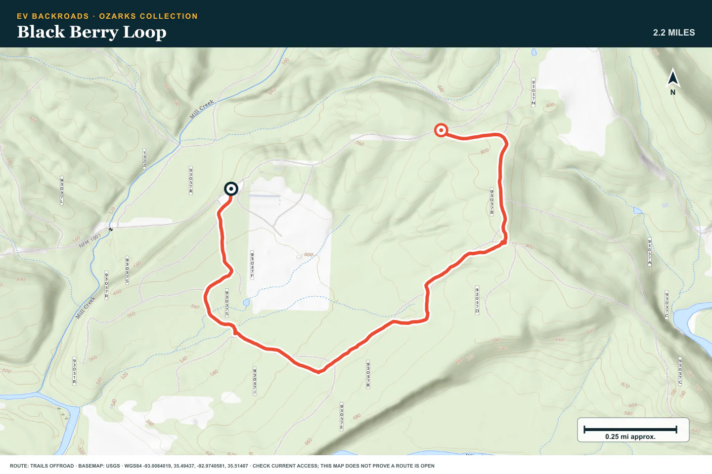
TOPOGRAPHIC PROFILE
Black Berry Loop, from start to finish
- Climb
- +305 ft
- Descent
- −166 ft
Elevation sampled from AWS Terrain Tiles along the published route. Small terrain and GPS differences are normal.
Lindsey Road
- Route distance
- 6.2 mi
- Allow
- 2–3 hours
Add a longer road with water nearby. Inspect every wet section before you drive it.
Access note: Source snapshot: Open. Check the live source before travel.
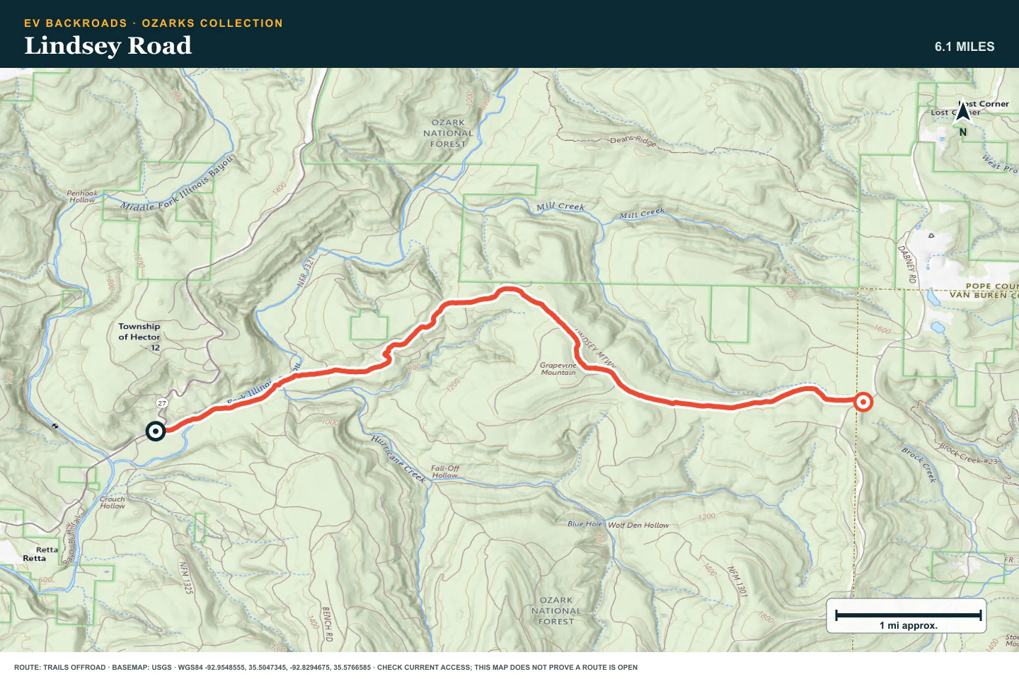
TOPOGRAPHIC PROFILE
Lindsey Road, from start to finish
- Climb
- +998 ft
- Descent
- −206 ft
Elevation sampled from AWS Terrain Tiles along the published route. Small terrain and GPS differences are normal.
Carwash Falls
- Route distance
- 5.5 mi
- Allow
- 2–3 hours
Use the waterfall route only when water is low and stable. Stay on the legal road surface.
Access note: Source snapshot: Open. Check the live source before travel.
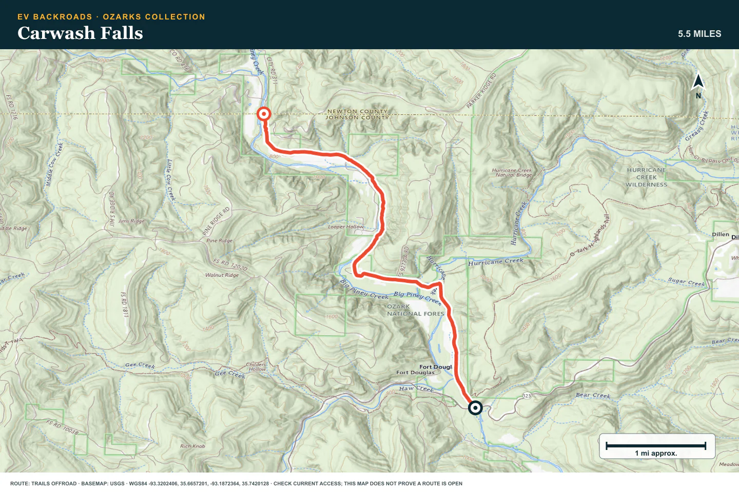
TOPOGRAPHIC PROFILE
Carwash Falls, from start to finish
- Climb
- +317 ft
- Descent
- −237 ft
Elevation sampled from AWS Terrain Tiles along the published route. Small terrain and GPS differences are normal.
Indian Creek Road
- Route distance
- 10.5 mi
- Allow
- Half day
Add rock and water on a longer forest route. Use low speed and walk uncertain crossings.
Access note: Source snapshot: Open. Check the live source before travel.
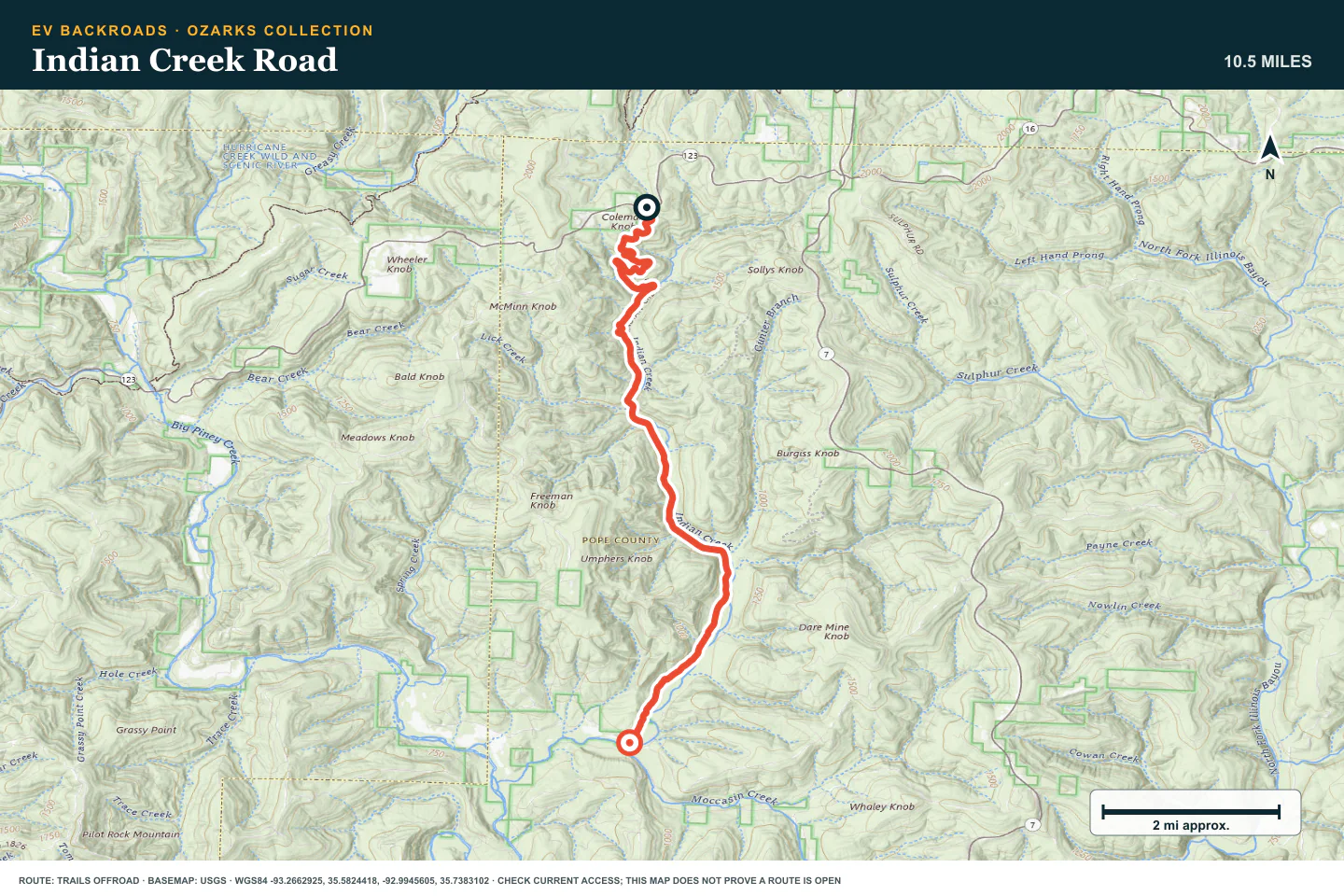
TOPOGRAPHIC PROFILE
Indian Creek Road, from start to finish
- Climb
- +138 ft
- Descent
- −1,300 ft
Elevation sampled from AWS Terrain Tiles along the published route. Small terrain and GPS differences are normal.
Barker
- Route distance
- 3.7 mi
- Allow
- 2–3 hours
Add mud and changing elevation. Turn around before traction needs speed or road damage.
Access note: Source snapshot: Open. Check the live source before travel.
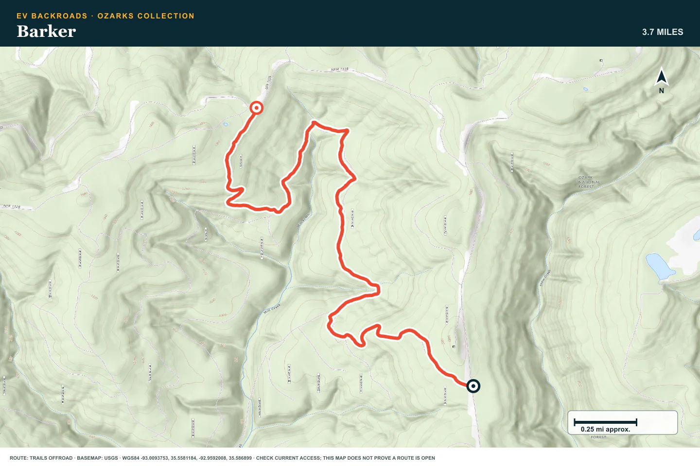
TOPOGRAPHIC PROFILE
Barker, from start to finish
- Climb
- +460 ft
- Descent
- −520 ft
Elevation sampled from AWS Terrain Tiles along the published route. Small terrain and GPS differences are normal.
Payne Ridge Road
- Route distance
- 4.3 mi
- Allow
- Half day
Use the ridge road to add distance and changing weather exposure. Check the return at the midpoint.
Access note: Source snapshot: Open. Check the live source before travel.
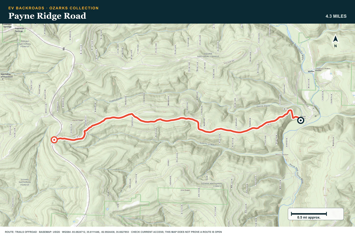
TOPOGRAPHIC PROFILE
Payne Ridge Road, from start to finish
- Climb
- +1,095 ft
- Descent
- −85 ft
Elevation sampled from AWS Terrain Tiles along the published route. Small terrain and GPS differences are normal.
Boyd Road
- Route distance
- 7 mi
- Allow
- Half day
Add rougher rock and water. Stop and inspect any section that hides the safe line.
Access note: Source snapshot: Open. Check the live source before travel.
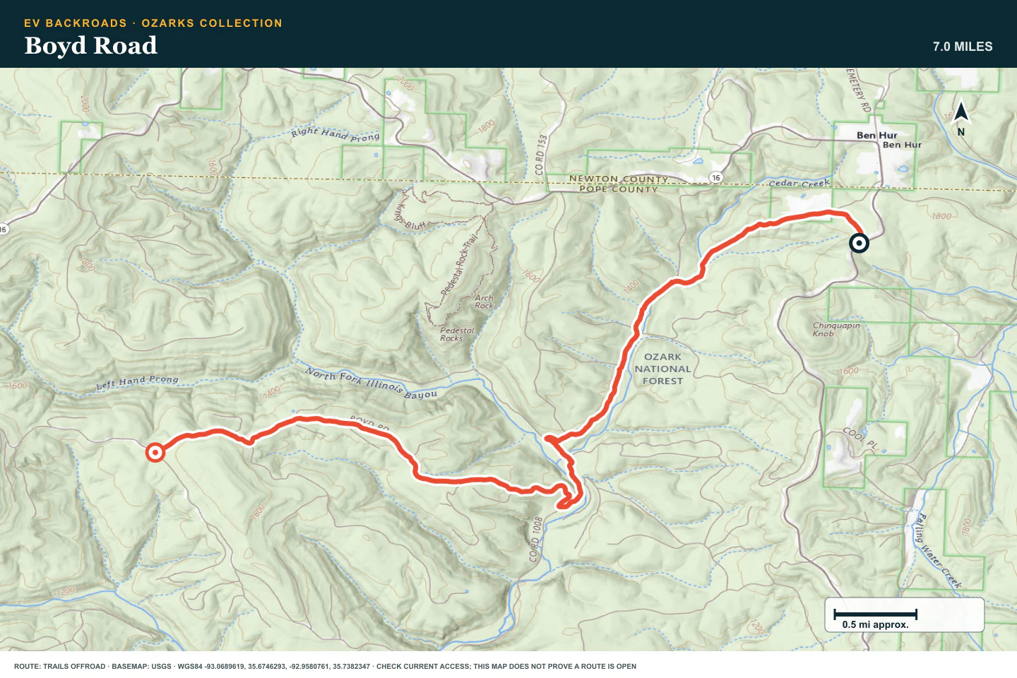
TOPOGRAPHIC PROFILE
Boyd Road, from start to finish
- Climb
- +795 ft
- Descent
- −743 ft
Elevation sampled from AWS Terrain Tiles along the published route. Small terrain and GPS differences are normal.
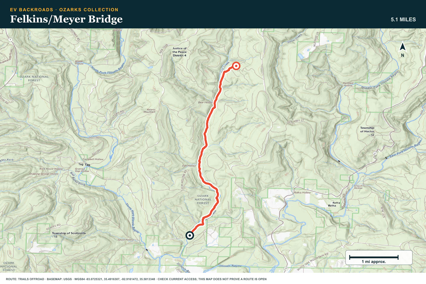
Felkins/Meyer Bridge
- Route distance
- 5.1 mi
- Allow
- Half day
Keep this rougher route as the final stage. Use it only with suitable clearance, tires, and current local information.
Access note: Source snapshot: Open. Check the live source before travel.
TOPOGRAPHIC PROFILE
Felkins/Meyer Bridge, from start to finish
- Climb
- +558 ft
- Descent
- −48 ft
Elevation sampled from AWS Terrain Tiles along the published route. Small terrain and GPS differences are normal.
ROUTE READINESS
Do seven checks before you leave pavement.
surface
Forest dirt, rock, mud, and water crossings
clearance
Extra clearance and durable all-terrain tires for later stages
remoteness
Recovery and cell service can be slow in narrow valleys
charging
Start each route with a verified return to charging
cell Coverage
Download the route before you enter the forest
weather
Do not enter after heavy rain or when water is rising
turnaround
Stop before unknown water, deep mud, or repeated wheelspin
BEFORE YOU GO
Make these decisions while you have a signal.
- Check forest access and recent rain
- Inspect tires and recovery points
- Set water, battery, and daylight limits
TURN AROUND WHEN
Follow the limits that you set.
- Water is moving or the bottom is not visible
- Mud is deeper than the tires can cross without damage
- The next obstacle exceeds the last controlled stage
CARRY
Prepare for common problems.
- Tire repair kit and compressor
- Traction boards, shovel, and recovery strap
- Offline maps, water, and dry clothing
OPEN THE LIVE MAP
Check the drive home.
See the route with open chargers and road-distance charging gaps. Planned stations do not change current coverage.