
ADVENTURE ROUTE COLLECTION · ALBERTA + BRITISH COLUMBIA, CANADA
Canadian Rockies: Valley Roads to Remote Lakes
Use eight routes across the Canadian Rockies. Start on established valley roads. Add longer lake roads and remote northern routes in separate stages.
WHY IT FITS
Why this progression can fit your trip.
The collection turns a regional road trip into measured trail days. Early stages stay closer to towns. Later stages require more time, charging work, and self-sufficiency.
ROUTE PROGRESSION
Add one skill at a time.
Drive only the stages that fit your vehicle, experience, weather, and current access. A later stage is not a required finish.
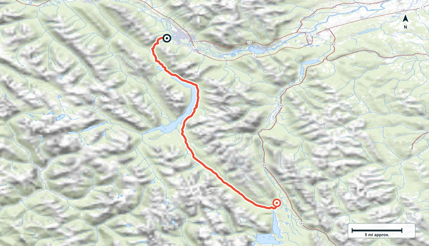
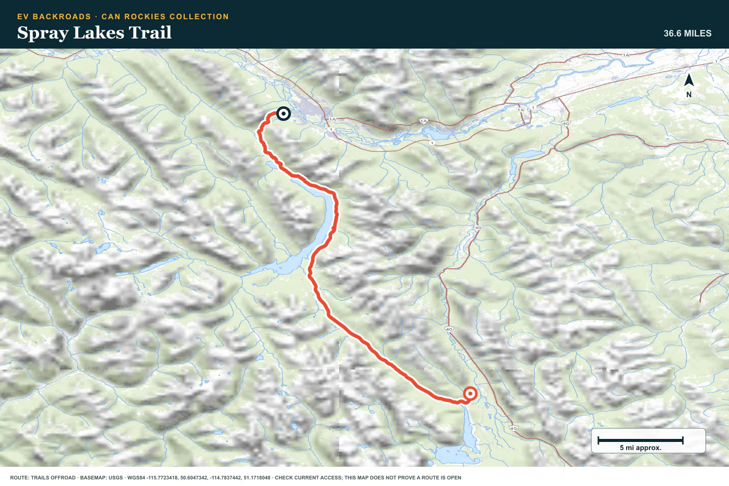
Spray Lakes Trail
- Route distance
- 36.7 mi
- Allow
- Half day
Start near Canmore on a long established gravel road. Use it to check mountain weather, tire pressure, and energy use.
Access note: Source snapshot: Open. Check the live source before travel.
TOPOGRAPHIC PROFILE
Spray Lakes Trail, from start to finish
- Climb
- +1,681 ft
- Descent
- −1,068 ft
Elevation sampled from AWS Terrain Tiles along the published route. Small terrain and GPS differences are normal.
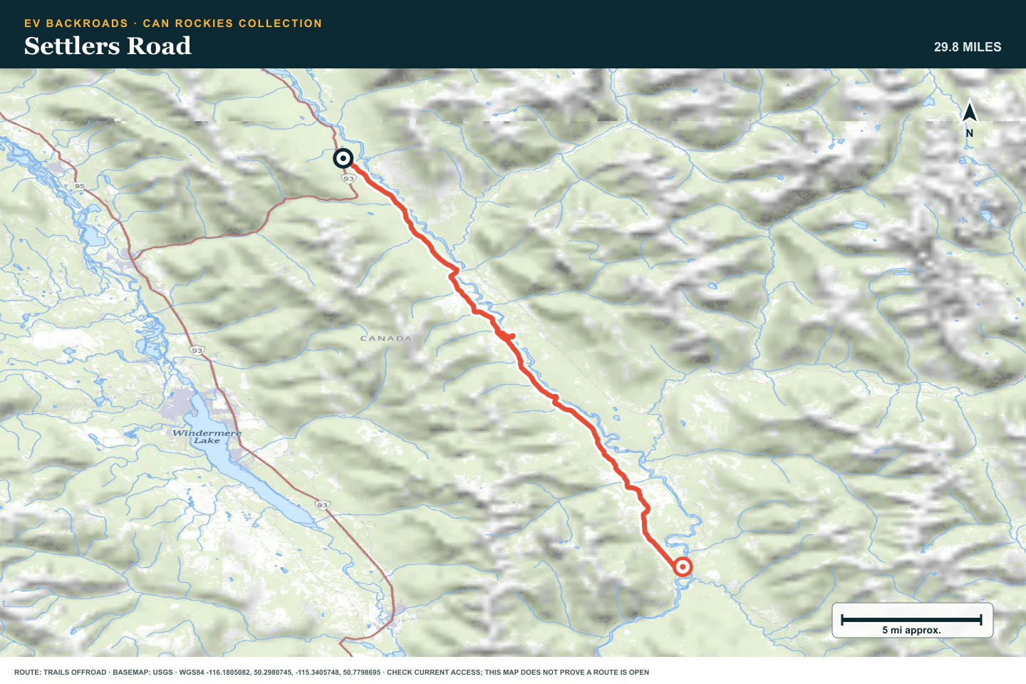
Settlers Road
- Route distance
- 29.9 mi
- Allow
- Half day
Add a valley road near Radium Hot Springs. Confirm the complete route and current access before travel.
Access note: Source snapshot: Open. Check the live source before travel.
TOPOGRAPHIC PROFILE
Settlers Road, from start to finish
- Climb
- +559 ft
- Descent
- −1,353 ft
Elevation sampled from AWS Terrain Tiles along the published route. Small terrain and GPS differences are normal.
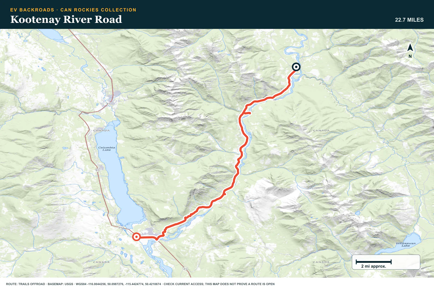
Kootenay River Road
- Route distance
- 22.8 mi
- Allow
- Half day
Use this river road to add distance and changing sightlines. Inspect wet or damaged sections before you continue.
Access note: Source snapshot: Open. Check the live source before travel.
TOPOGRAPHIC PROFILE
Kootenay River Road, from start to finish
- Climb
- +978 ft
- Descent
- −1,365 ft
Elevation sampled from AWS Terrain Tiles along the published route. Small terrain and GPS differences are normal.
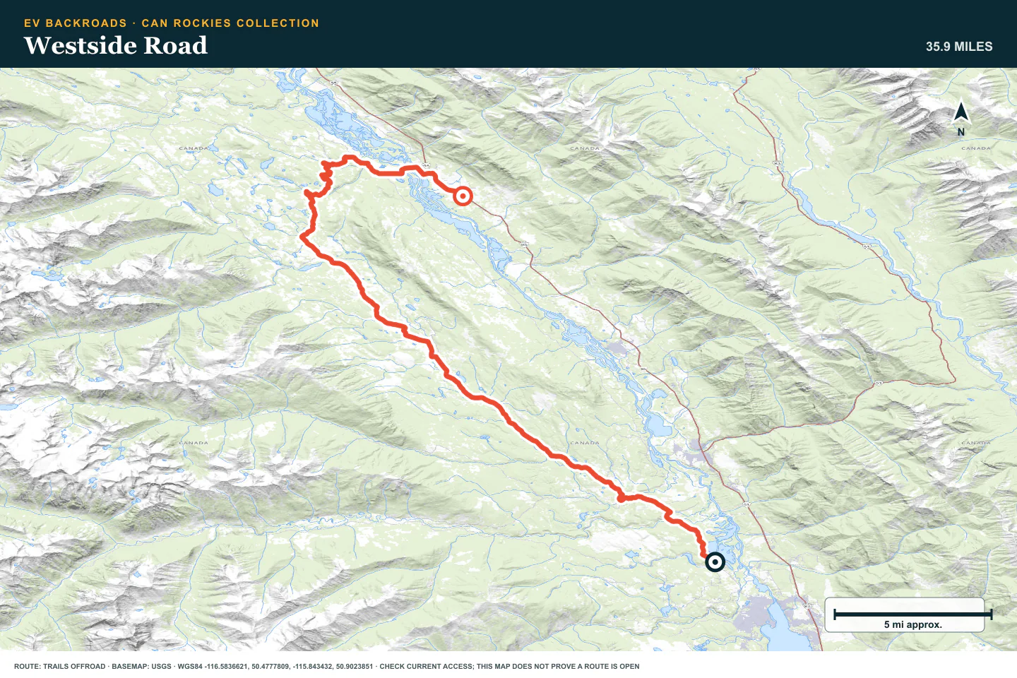
Westside Road
- Route distance
- 35.9 mi
- Allow
- Full day
Add a longer mountain-valley route. Keep enough time and battery for a slow return.
Access note: Source snapshot: Open. Check the live source before travel.
TOPOGRAPHIC PROFILE
Westside Road, from start to finish
- Climb
- +1,417 ft
- Descent
- −1,466 ft
Elevation sampled from AWS Terrain Tiles along the published route. Small terrain and GPS differences are normal.
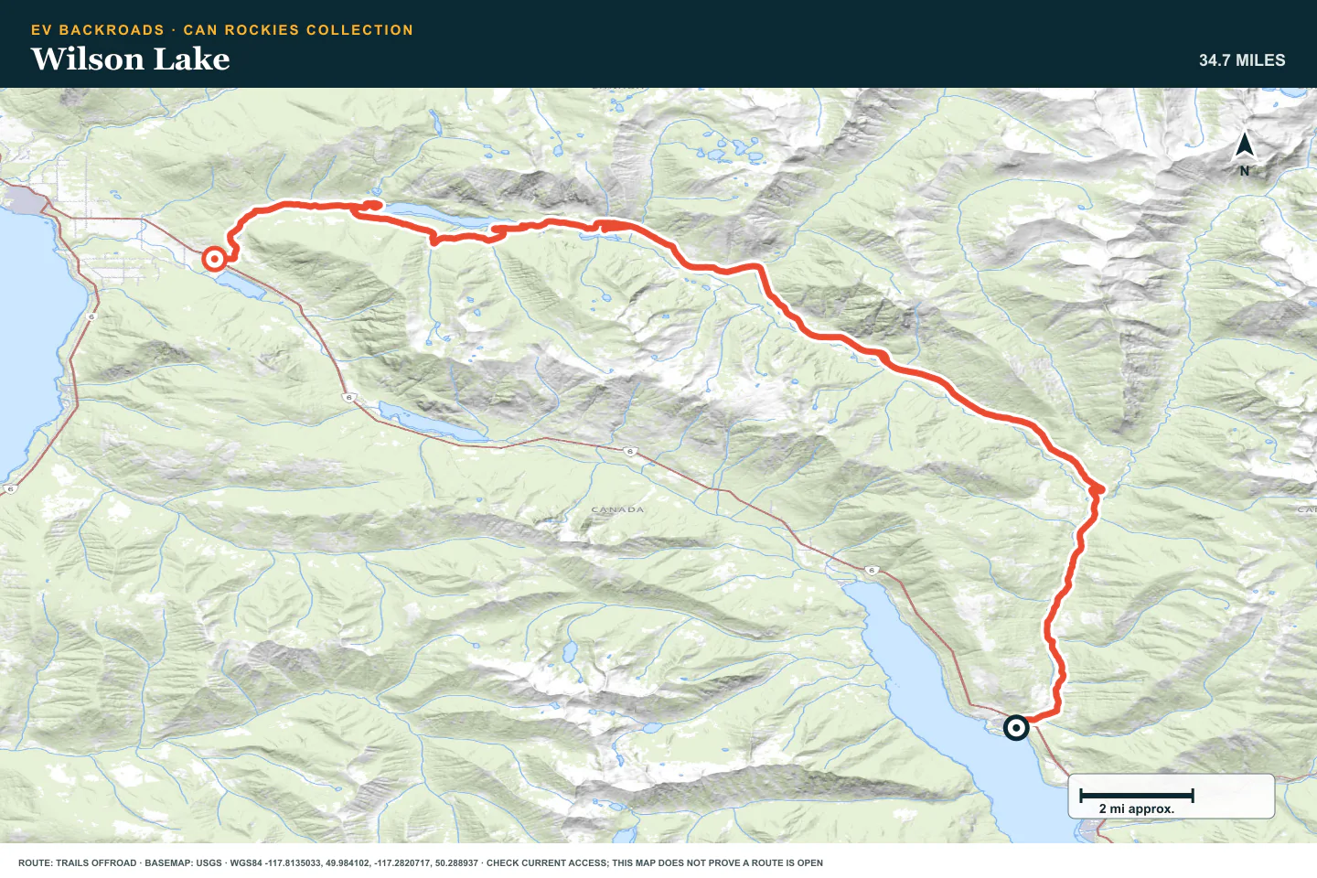
Wilson Lake
- Route distance
- 35.4 mi
- Allow
- Full day
Add a remote lake destination. Check water, tires, and communication before you leave the last service point.
Access note: Source snapshot: Open. Check the live source before travel.
TOPOGRAPHIC PROFILE
Wilson Lake, from start to finish
- Climb
- +2,593 ft
- Descent
- −2,272 ft
Elevation sampled from AWS Terrain Tiles along the published route. Small terrain and GPS differences are normal.
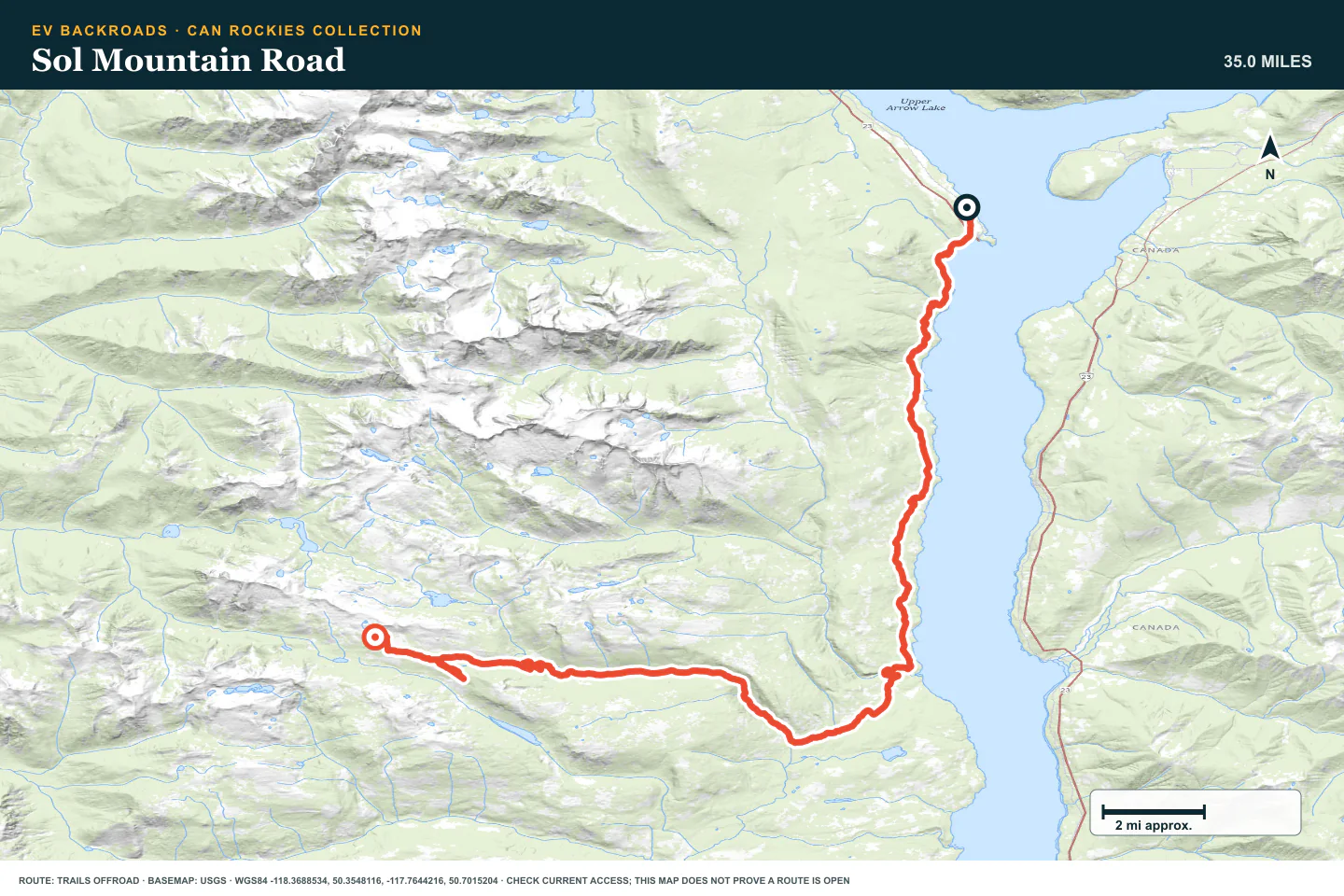
Sol Mountain Road
- Route distance
- 35 mi
- Allow
- Full day
Add a higher and longer forest road. Stop when snow, erosion, or a gate changes the route.
Access note: Source snapshot: Open. Check the live source before travel.
TOPOGRAPHIC PROFILE
Sol Mountain Road, from start to finish
- Climb
- +5,885 ft
- Descent
- −892 ft
Elevation sampled from AWS Terrain Tiles along the published route. Small terrain and GPS differences are normal.
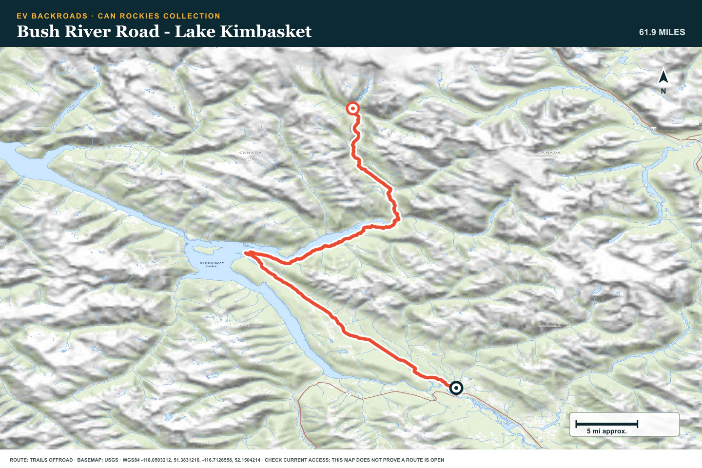
Bush River Road - Lake Kimbasket
- Route distance
- 62 mi
- Allow
- Full day
Plan this long lake road as a remote day. Use strict battery, tire, weather, and daylight limits.
Access note: Source snapshot: Open. Check the live source before travel.
TOPOGRAPHIC PROFILE
Bush River Road - Lake Kimbasket, from start to finish
- Climb
- +2,278 ft
- Descent
- −1,225 ft
Elevation sampled from AWS Terrain Tiles along the published route. Small terrain and GPS differences are normal.
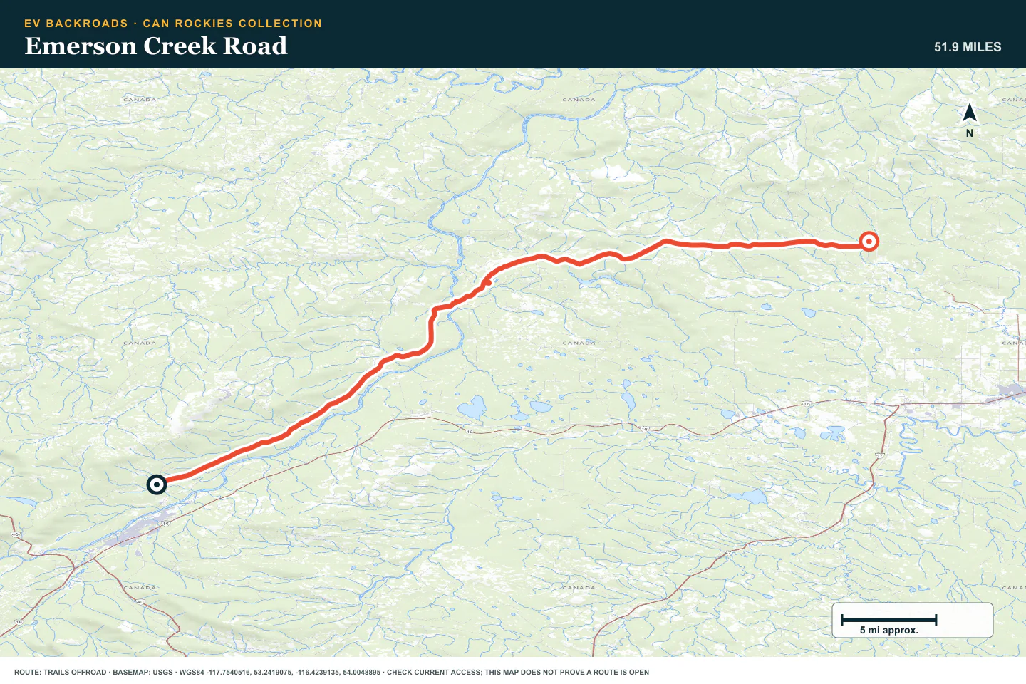
Emerson Creek Road
- Route distance
- 52 mi
- Allow
- Full day or overnight
Keep the northern route as the final stage. Use it only with current access information and a complete delay and charging plan.
Access note: Source snapshot: Open. Check the live source before travel.
TOPOGRAPHIC PROFILE
Emerson Creek Road, from start to finish
- Climb
- +1,595 ft
- Descent
- −1,772 ft
Elevation sampled from AWS Terrain Tiles along the published route. Small terrain and GPS differences are normal.
ROUTE READINESS
Do seven checks before you leave pavement.
surface
Mountain gravel, forest-service road, washouts, and long rough sections
clearance
Extra clearance and durable tires for later stages
remoteness
Transfers and remote roads require separate charging and recovery plans
charging
Verify every highway charging stop before each route day
cell Coverage
Carry all route, charger, and access data offline
weather
Snow, fire, rain, and cold can change the route quickly
turnaround
Skip a stage when access, weather, tires, or energy do not fit the written plan
BEFORE YOU GO
Make these decisions while you have a signal.
- Check Alberta and British Columbia access notices
- Plan highway transfers separately from trail energy
- Carry offline maps and a communication plan
TURN AROUND WHEN
Follow the limits that you set.
- A gate or official notice closes the road
- Snow or washout removes a firm route
- The planned return reserve is reached
CARRY
Prepare for common problems.
- Full tire repair and inflation equipment
- Rated recovery gear for the selected road
- Satellite communication, food, water, and warm shelter
OPEN THE LIVE MAP
Check the drive home.
See the route with open chargers and road-distance charging gaps. Planned stations do not change current coverage.