
ADVENTURE ROUTE COLLECTION · BRITISH COLUMBIA, CANADA
Columbia–Shuswap: Mountain Forest Roads
Use eight forest roads around Revelstoke and Shuswap Lake. Start with shorter valley routes. Add longer roads and more remote mountain travel later.
WHY IT FITS
Why this progression can fit your trip.
The routes form a western Canadian base region with several return options. The order adds distance, elevation, and remoteness without treating an open road as a guarantee of safe access.
ROUTE PROGRESSION
Add one skill at a time.
Drive only the stages that fit your vehicle, experience, weather, and current access. A later stage is not a required finish.
Crawford Road
- Route distance
- 12.9 mi
- Allow
- 2–3 hours
Start on a shorter forest road. Check navigation, tire pressure, and the condition of the first wash crossings.
Access note: Source snapshot: Open. Check the live source before travel.
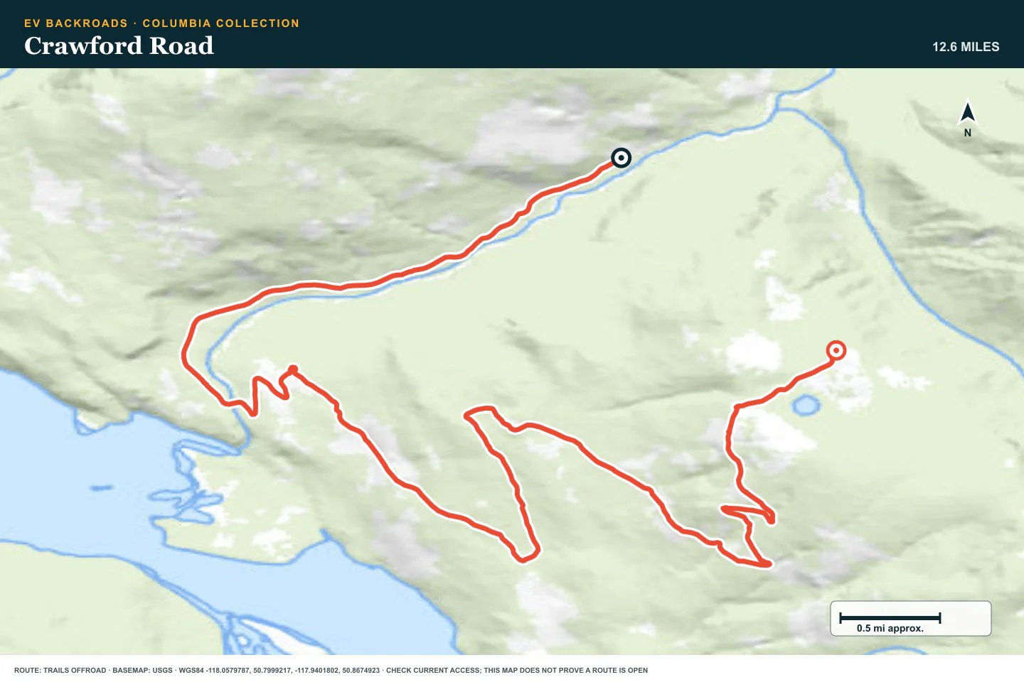
TOPOGRAPHIC PROFILE
Crawford Road, from start to finish
- Climb
- +4,077 ft
- Descent
- −258 ft
Elevation sampled from AWS Terrain Tiles along the published route. Small terrain and GPS differences are normal.
Frisby Creek Road
- Route distance
- 17.9 mi
- Allow
- Half day
Add elevation near Revelstoke. Turn back when snow, a gate, or damaged road changes the plan.
Access note: Source snapshot: Open. Check the live source before travel.
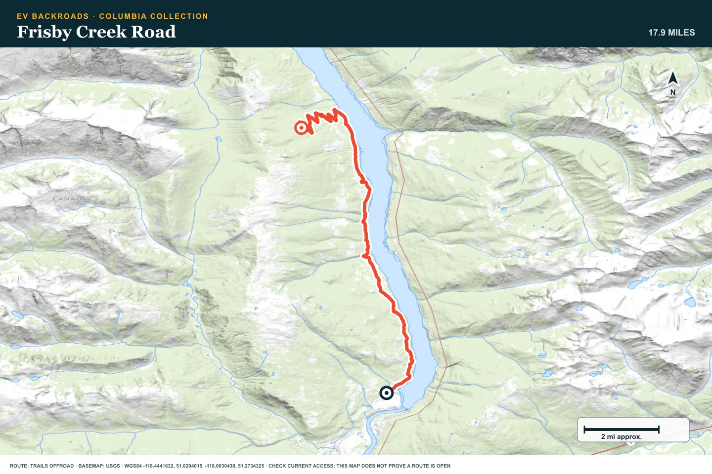
TOPOGRAPHIC PROFILE
Frisby Creek Road, from start to finish
- Climb
- +3,387 ft
- Descent
- −910 ft
Elevation sampled from AWS Terrain Tiles along the published route. Small terrain and GPS differences are normal.
Akolkolex River
- Route distance
- 21.8 mi
- Allow
- Half day
Add a longer valley route. Inspect wet ground and keep the river corridor clean.
Access note: Source snapshot: Open. Check the live source before travel.
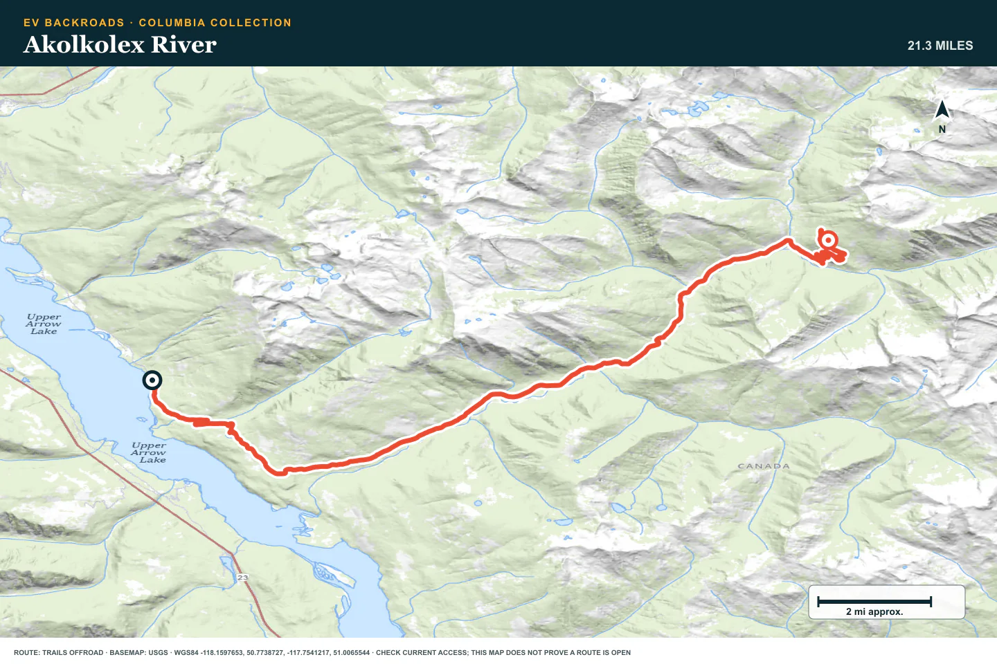
TOPOGRAPHIC PROFILE
Akolkolex River, from start to finish
- Climb
- +3,974 ft
- Descent
- −919 ft
Elevation sampled from AWS Terrain Tiles along the published route. Small terrain and GPS differences are normal.
Sorcerer Creek Road
- Route distance
- 12.1 mi
- Allow
- Half day
Use this route to add a more remote creek valley. Stop before water or erosion hides the firm line.
Access note: Source snapshot: Open. Check the live source before travel.
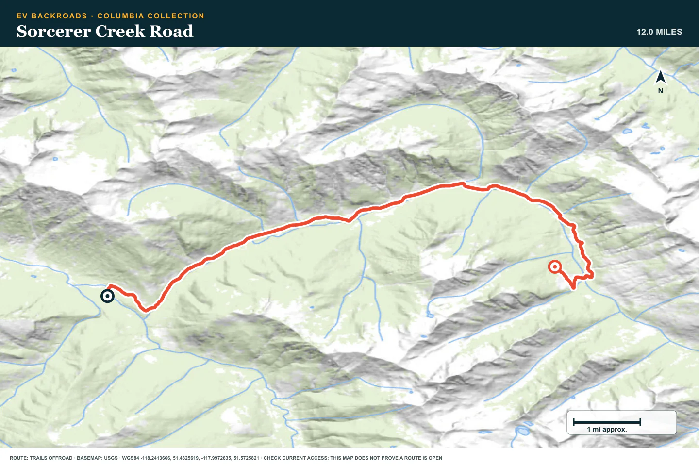
TOPOGRAPHIC PROFILE
Sorcerer Creek Road, from start to finish
- Climb
- +2,208 ft
- Descent
- −282 ft
Elevation sampled from AWS Terrain Tiles along the published route. Small terrain and GPS differences are normal.
Downie Creek Road
- Route distance
- 19.6 mi
- Allow
- Half day
Add a longer road north of Revelstoke. Confirm current industrial and public access before travel.
Access note: Source snapshot: Open. Check the live source before travel.
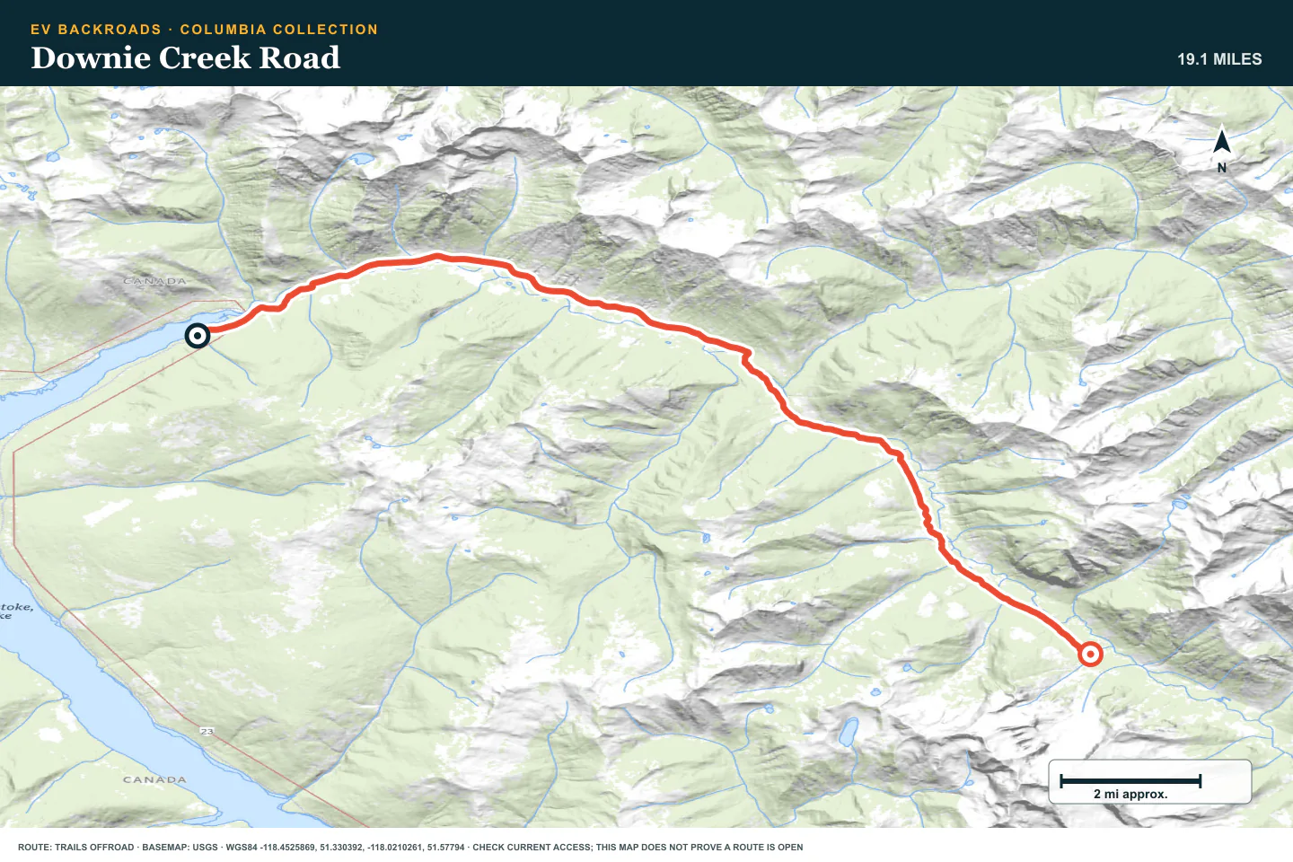
TOPOGRAPHIC PROFILE
Downie Creek Road, from start to finish
- Climb
- +1,138 ft
- Descent
- −363 ft
Elevation sampled from AWS Terrain Tiles along the published route. Small terrain and GPS differences are normal.
Seymour River Road
- Route distance
- 23.6 mi
- Allow
- Full day
Plan this as a remote road day. Keep enough time and energy for a slow return.
Access note: Source snapshot: Open. Check the live source before travel.
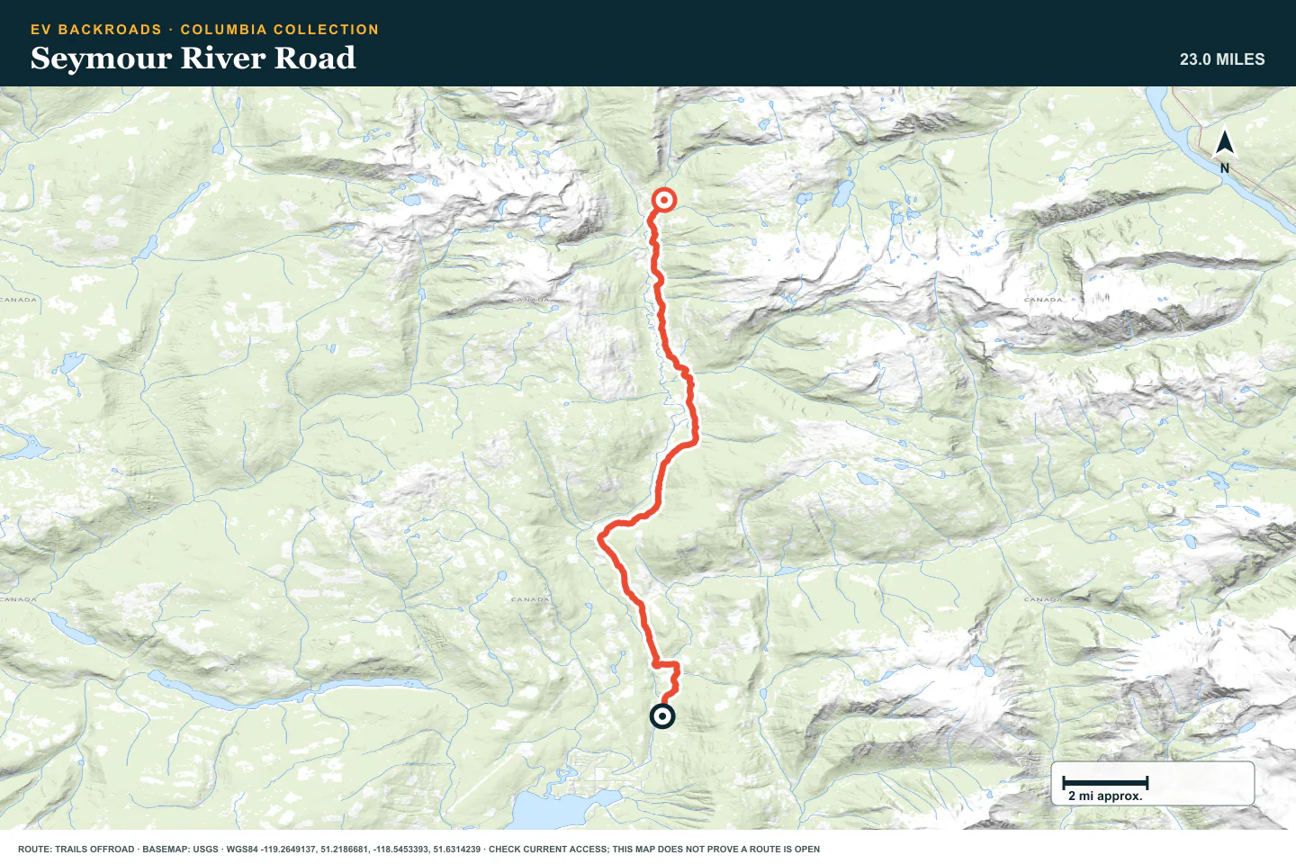
TOPOGRAPHIC PROFILE
Seymour River Road, from start to finish
- Climb
- +2,126 ft
- Descent
- −981 ft
Elevation sampled from AWS Terrain Tiles along the published route. Small terrain and GPS differences are normal.
Gorge Forest Road
- Route distance
- 46.8 mi
- Allow
- Full day
Add a longer forest road with few quick exits. Use strict battery, tire, and daylight checks.
Access note: Source snapshot: Open. Check the live source before travel.
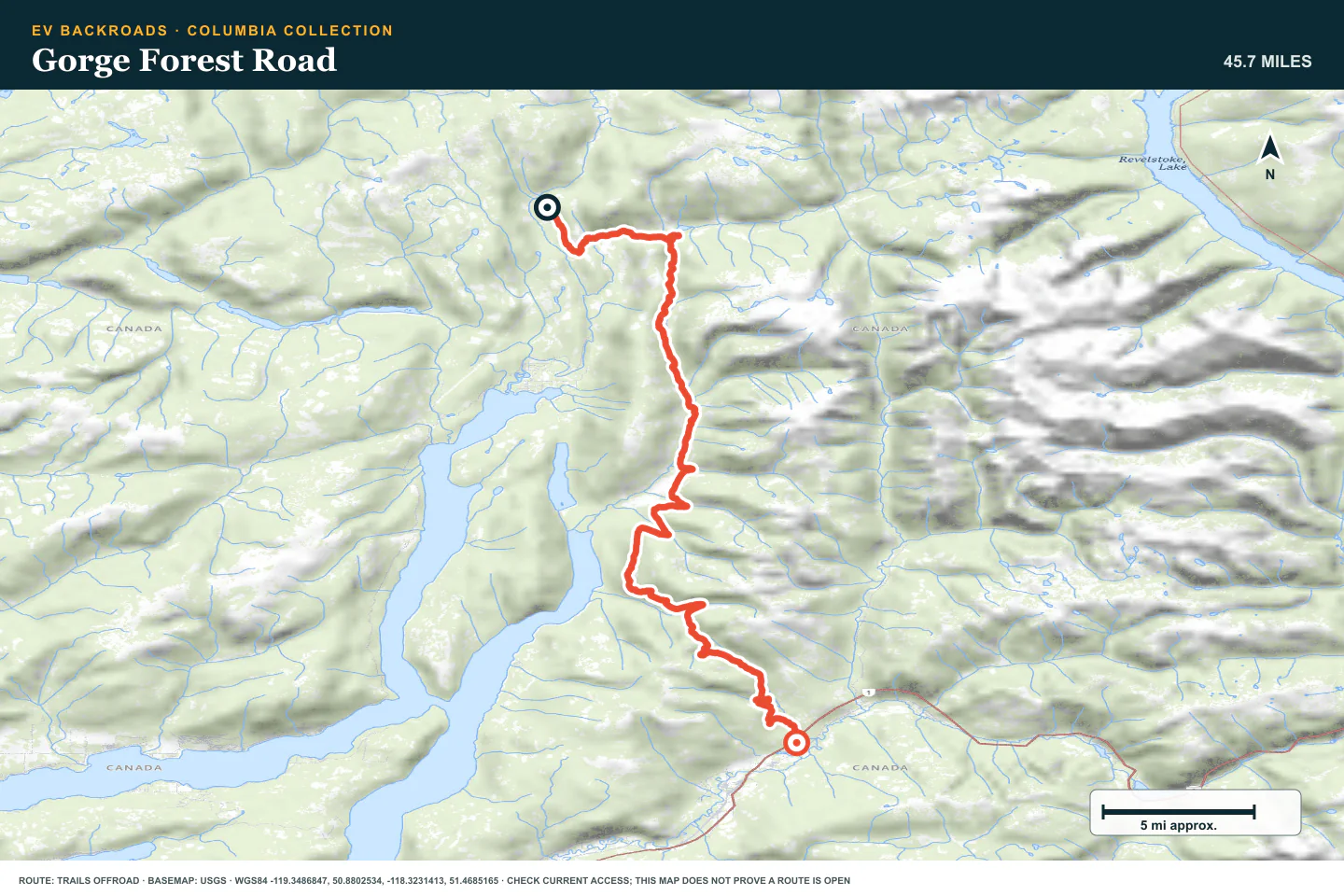
TOPOGRAPHIC PROFILE
Gorge Forest Road, from start to finish
- Climb
- +4,163 ft
- Descent
- −5,000 ft
Elevation sampled from AWS Terrain Tiles along the published route. Small terrain and GPS differences are normal.
Perry River Road
- Route distance
- 61.4 mi
- Allow
- Full day
Keep the longest route as the final stage. Use it only with current access information and a complete delay plan.
Access note: Source snapshot: Open. Check the live source before travel.
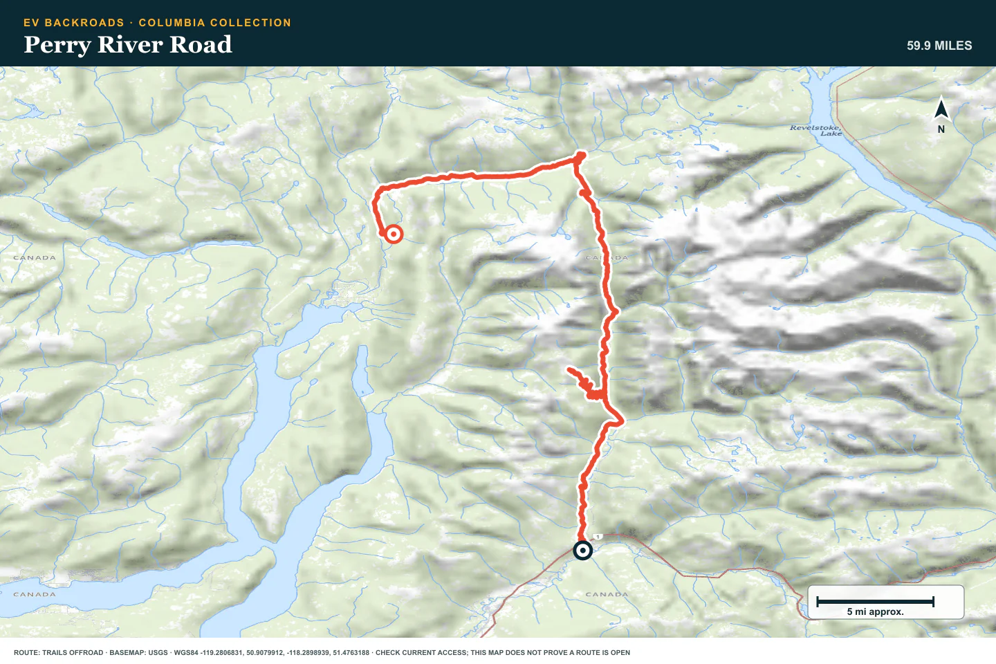
TOPOGRAPHIC PROFILE
Perry River Road, from start to finish
- Climb
- +6,216 ft
- Descent
- −5,934 ft
Elevation sampled from AWS Terrain Tiles along the published route. Small terrain and GPS differences are normal.
ROUTE READINESS
Do seven checks before you leave pavement.
surface
Forest-service dirt, gravel, washouts, and condition-dependent water
clearance
Extra clearance and strong tires for later stages
remoteness
Some routes have long gaps from services and recovery
charging
Verify each highway charger and the full return before the forest road
cell Coverage
Treat coverage outside towns as unavailable
weather
Snow, fire, and heavy rain can close the route
turnaround
Stop at a gate, washout, unknown crossing, or written return limit
BEFORE YOU GO
Make these decisions while you have a signal.
- Check British Columbia road and wildfire notices
- Confirm the route is open for public travel
- Download the road and charger plan
TURN AROUND WHEN
Follow the limits that you set.
- A gate, active work area, or closure blocks the route
- A washout removes a firm vehicle-width line
- The return reserve reaches its limit
CARRY
Prepare for common problems.
- Full tire repair and inflation equipment
- Rated recovery gear for the selected route
- Satellite communication, water, and warm shelter
OPEN THE LIVE MAP
Check the drive home.
See the route with open chargers and road-distance charging gaps. Planned stations do not change current coverage.