
ADVENTURE ROUTE COLLECTION · WASHINGTON
Dave's Special
Follow Dave's Washington wish list from Mountain Loop Highway to Slate Peak. Start on graded roads. Add distance, exposure, and remote terrain in clear stages.
WHY IT FITS
Why this progression can fit your trip.
The first six routes explore Mountain Loop Highway and the forest roads north of Darrington. Hart's Pass and Slate Peak form a separate North Cascades finish near Mazama. Use a pavement transfer between the two areas.
ROUTE PROGRESSION
Add one skill at a time.
Drive only the stages that fit your vehicle, experience, weather, and current access. A later stage is not a required finish.
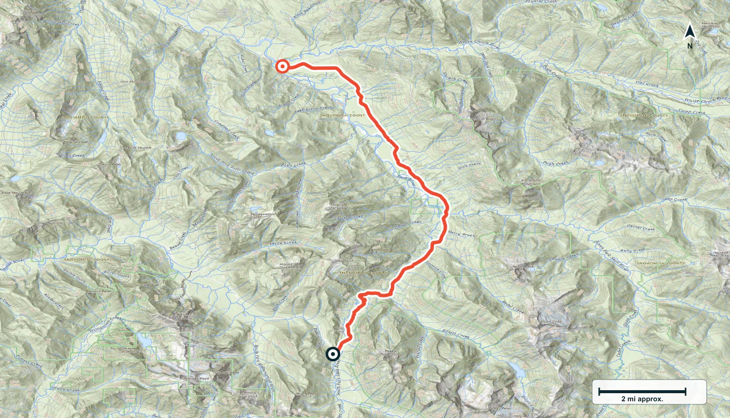
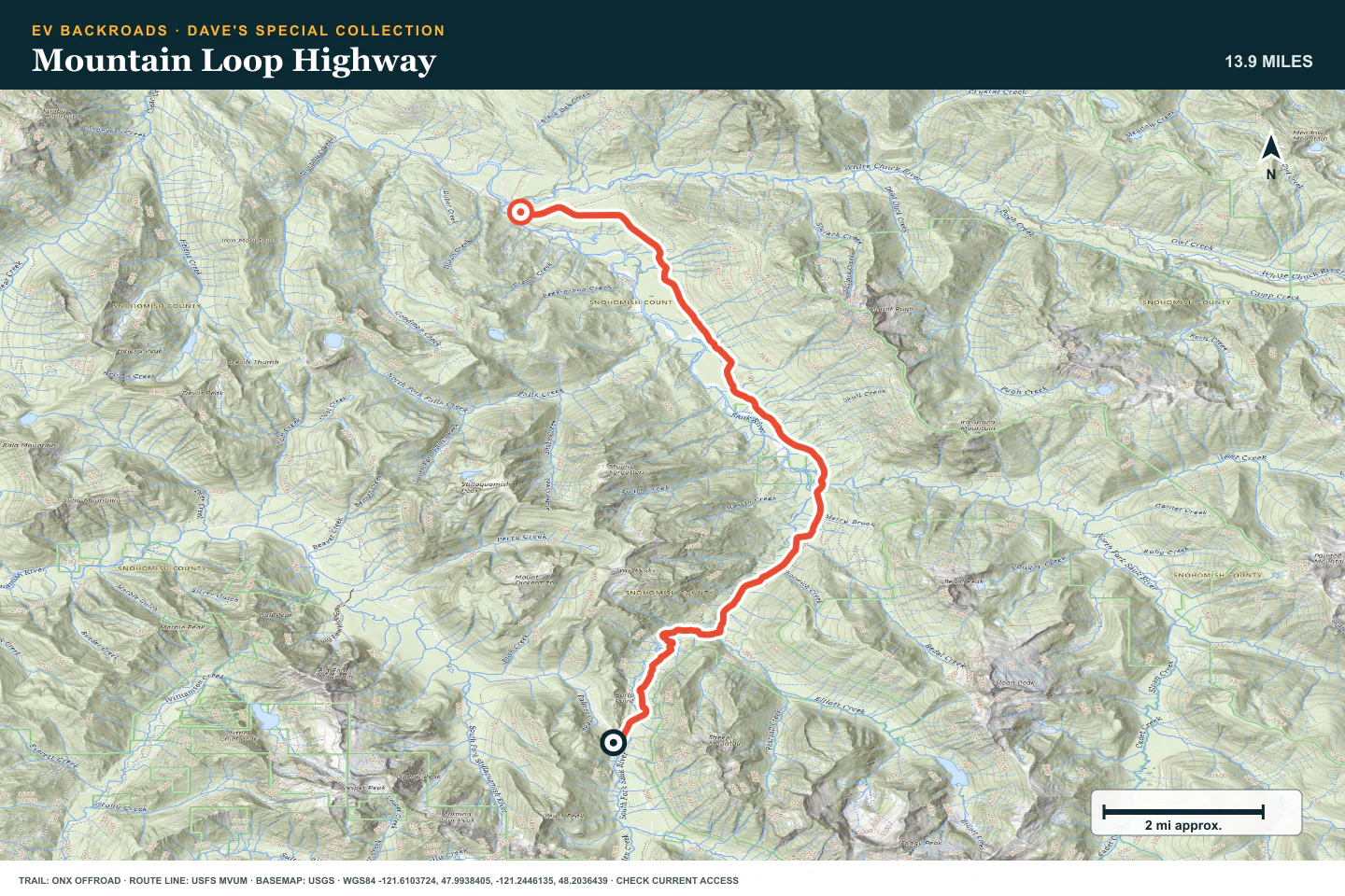
Mountain Loop Highway
- Route distance
- 14 mi
- Allow
- Half day
Start on the unpaved section of Mountain Loop Highway. Use the drive to check gravel braking, tire pressure, map use, and the return reserve.
Access note: Use the live source and Forest Service notices to confirm gates, washouts, and fire restrictions.
TOPOGRAPHIC PROFILE
Mountain Loop Highway, from start to finish
- Climb
- +288 ft
- Descent
- −1,584 ft
Elevation sampled from AWS Terrain Tiles along the published route. Small terrain and GPS differences are normal.
Coal Lake
- Route distance
- 4.7 mi
- Allow
- 1–2 hours
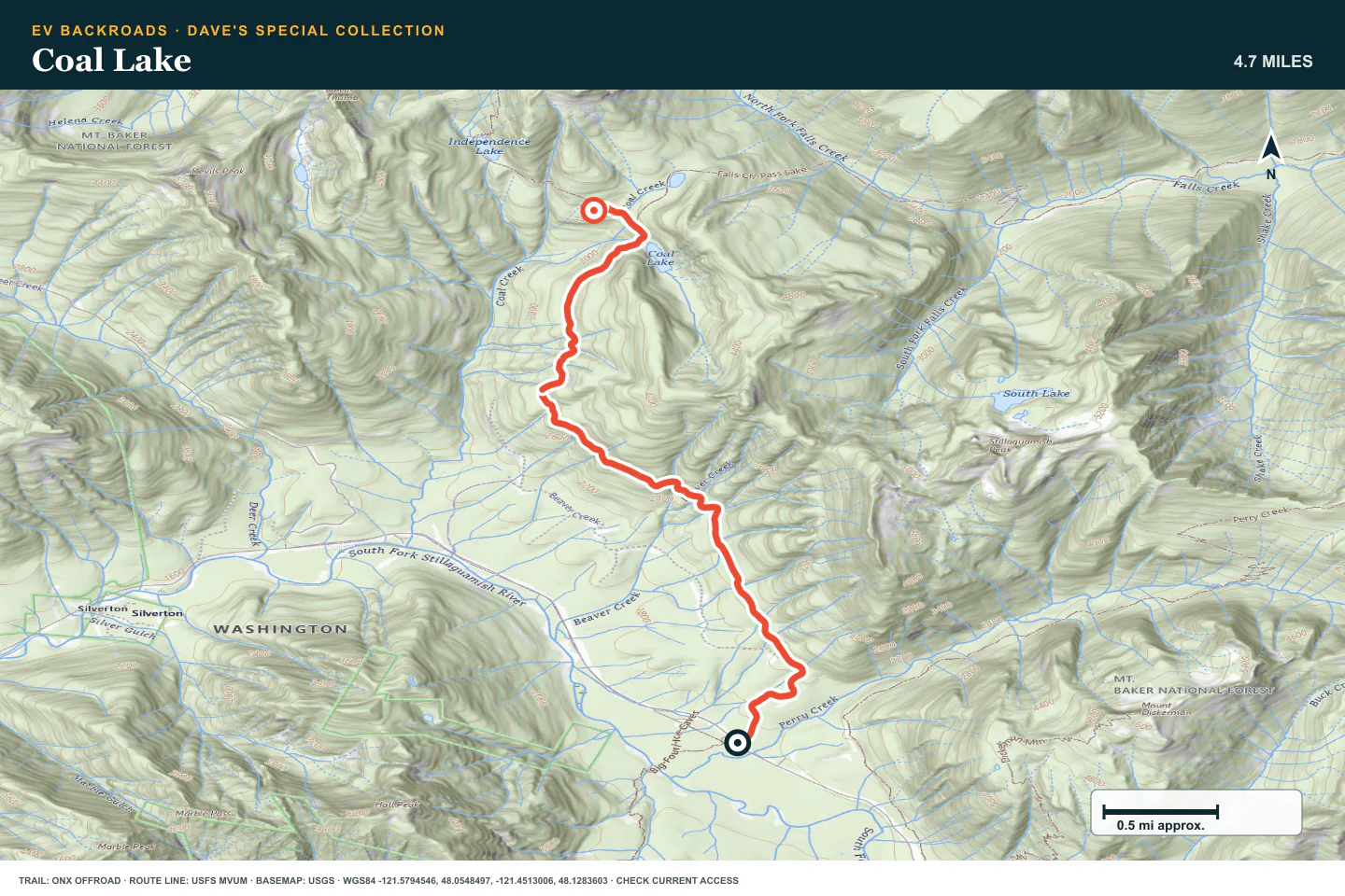
Add a short climb from Mountain Loop Highway. Slow down for potholes, ruts, and exposed edges. Expect weak cell service.
Access note: Potholes, ruts, exposure, and weak cell service can slow this short road. Check the live source before travel.
TOPOGRAPHIC PROFILE
Coal Lake, from start to finish
- Climb
- +1,785 ft
- Descent
- −24 ft
Elevation sampled from AWS Terrain Tiles along the published route. Small terrain and GPS differences are normal.
Clear Creek
- Route distance
- 6.8 mi
- Allow
- 2–3 hours
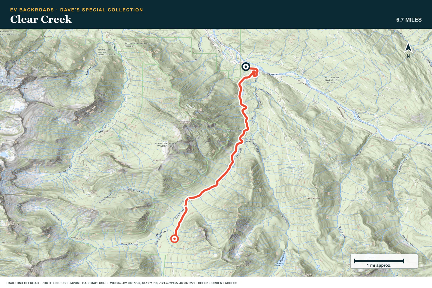
Drive only as far as the road remains open and controlled. Inspect the upper washout and rock before you continue.
Access note: The upper road can have washouts, rock, and narrow exposure. Confirm the current obstruction report before travel.
TOPOGRAPHIC PROFILE
Clear Creek, from start to finish
- Climb
- +1,306 ft
- Descent
- −63 ft
Elevation sampled from AWS Terrain Tiles along the published route. Small terrain and GPS differences are normal.
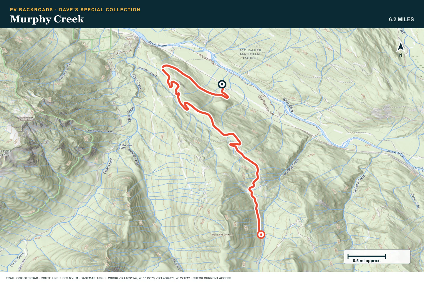
Murphy Creek
- Route distance
- 6.3 mi
- Allow
- 2–3 hours
Use Murphy Creek to practice judging brush, drainage damage, and turnaround space. Stop before the overgrown upper road threatens the vehicle.
Access note: The road becomes narrow and overgrown. Stop before brush, drainage damage, or a missing turnaround threatens the vehicle.
TOPOGRAPHIC PROFILE
Murphy Creek, from start to finish
- Climb
- +1,987 ft
- Descent
- −58 ft
Elevation sampled from AWS Terrain Tiles along the published route. Small terrain and GPS differences are normal.
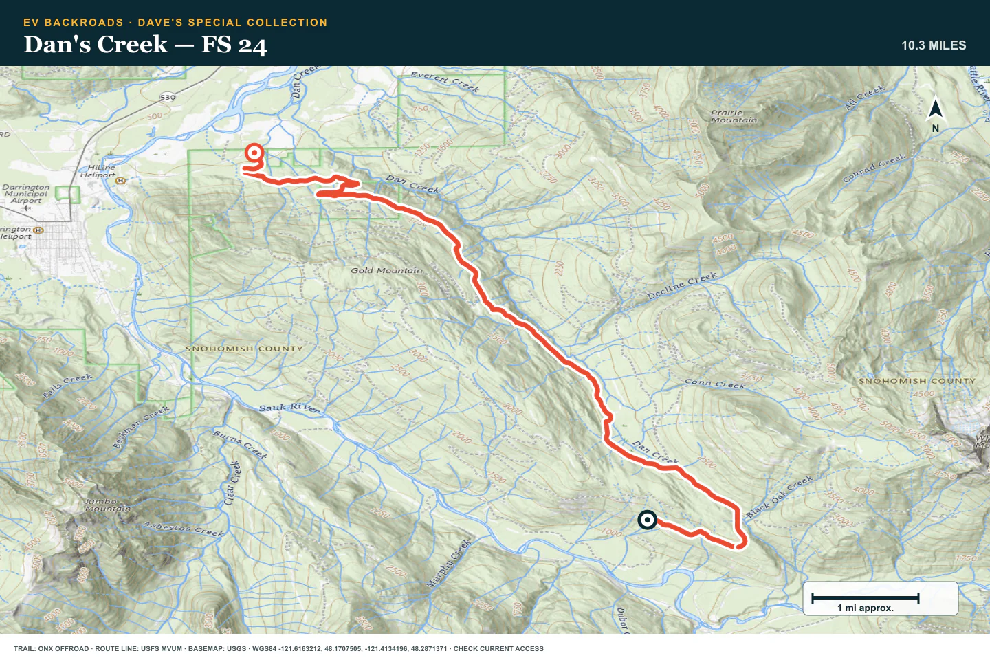
Dan's Creek — FS 24
- Route distance
- 10.4 mi
- Allow
- Half day
Travel north of Darrington on a longer forest road. Keep speed low around potholes and blind corners. Be ready for brush, snow, or fallen trees.
Access note: Potholes, brush, fallen trees, and snow can change this road. Carry a saw only where its use is legal.
TOPOGRAPHIC PROFILE
Dan's Creek — FS 24, from start to finish
- Climb
- +482 ft
- Descent
- −1,682 ft
Elevation sampled from AWS Terrain Tiles along the published route. Small terrain and GPS differences are normal.
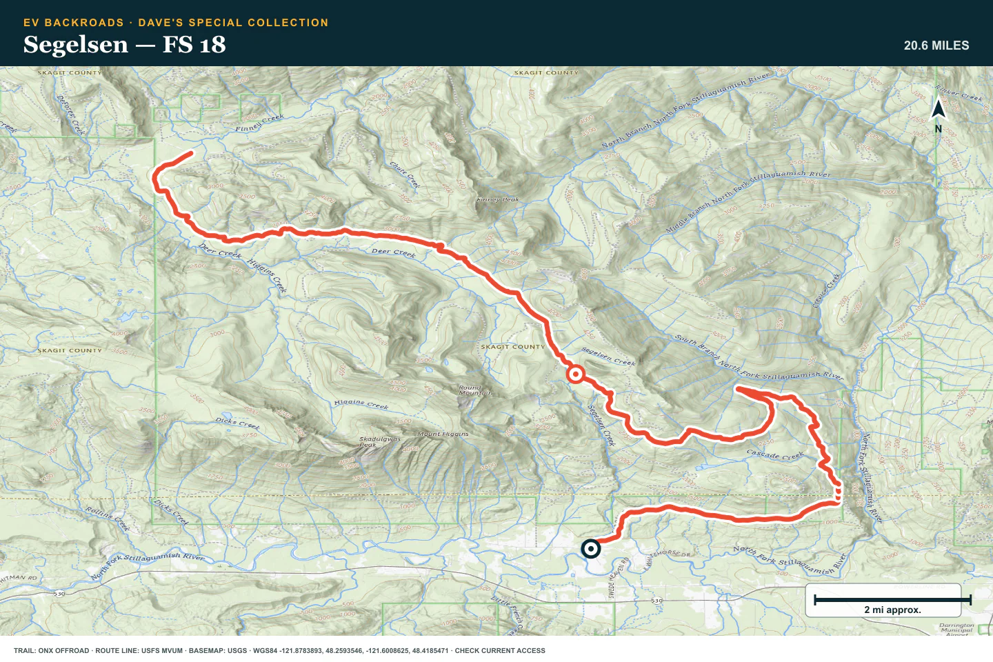
Segelsen — FS 18
- Route distance
- 20.8 mi
- Allow
- Full day
Use Segelsen as the long Darrington stage. Yield to logging traffic and confirm the exit because the road ends at another forest road, not at pavement.
Access note: Expect long gaps from services and active logging traffic. The route ends at another forest road, not at pavement.
TOPOGRAPHIC PROFILE
Segelsen — FS 18, from start to finish
- Climb
- +2,906 ft
- Descent
- −1,630 ft
Elevation sampled from AWS Terrain Tiles along the published route. Small terrain and GPS differences are normal.
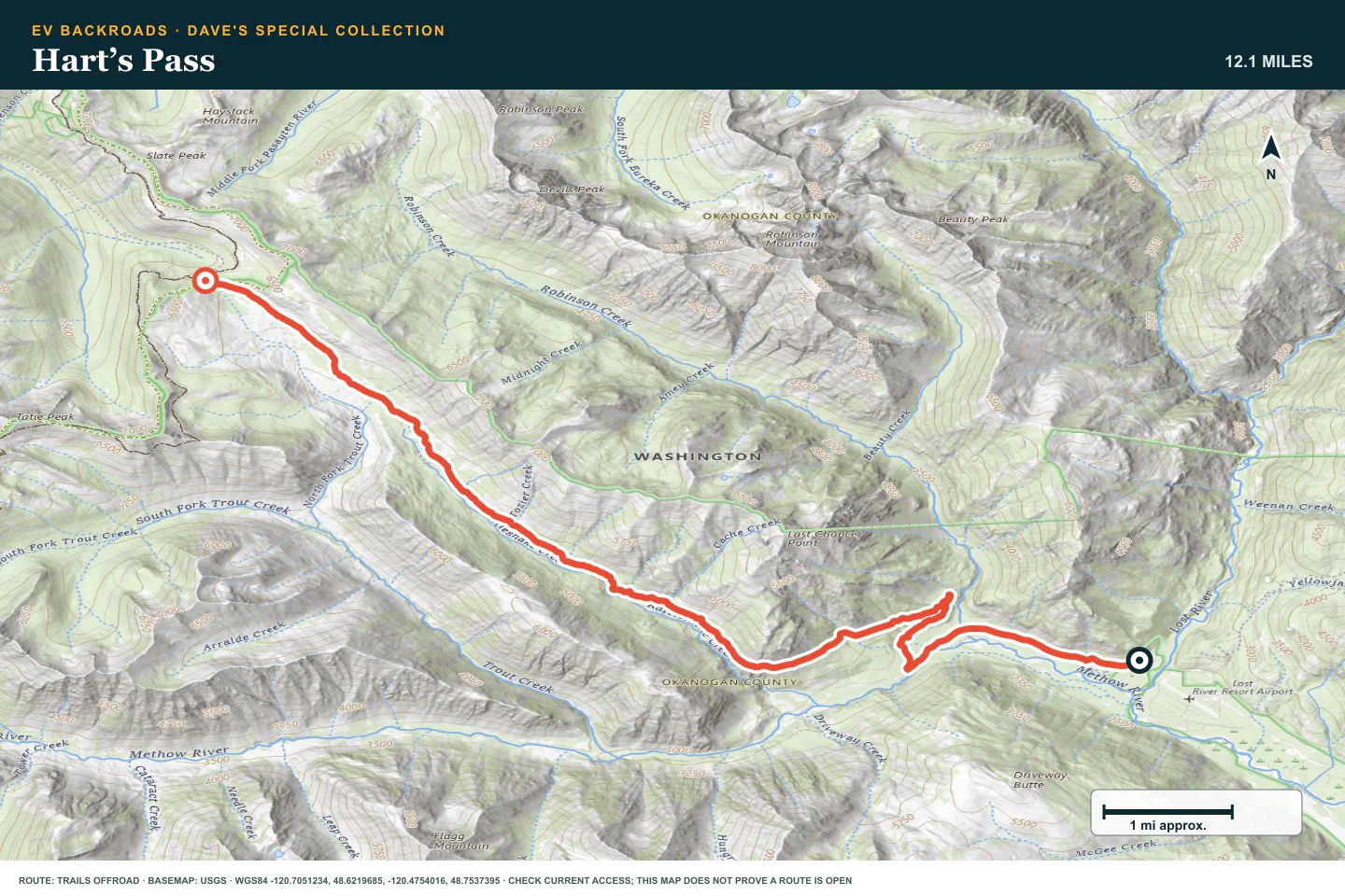
Hart’s Pass
- Route distance
- 12.3 mi
- Allow
- Full day
Move to the Mazama area for the high-country finish. Hart's Pass is narrow, exposed, and seasonal even when the driving surface looks easy. Confirm fire and repair status before you leave pavement.
Access note: Source snapshot: Seasonal Closure. Check the live source before travel.
TOPOGRAPHIC PROFILE
Hart’s Pass, from start to finish
- Climb
- +3,774 ft
- Descent
- −17 ft
Elevation sampled from AWS Terrain Tiles along the published route. Small terrain and GPS differences are normal.
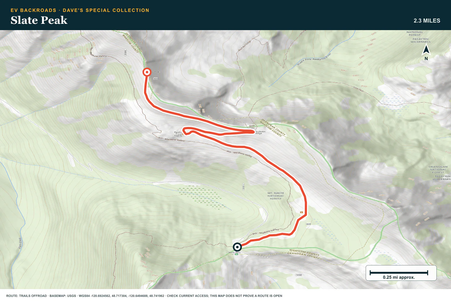
Slate Peak
- Route distance
- 2.3 mi
- Allow
- Full day
Continue to Slate Peak only when Hart's Pass is open and controlled. Use low speed, established pullouts, and a firm weather limit on the final high road.
Access note: Source snapshot: Seasonal Closure. Check the live source before travel.
TOPOGRAPHIC PROFILE
Slate Peak, from start to finish
- Climb
- +971 ft
- Descent
- −1 ft
Elevation sampled from AWS Terrain Tiles along the published route. Small terrain and GPS differences are normal.
ROUTE READINESS
Do seven checks before you leave pavement.
surface
Graded gravel, potholes, brush, washouts, and narrow shelf road
clearance
Standard clearance for the first stages; extra clearance and durable tires for the later forest roads
remoteness
Services and cell coverage become limited north of Darrington and near Hart's Pass
charging
Plan the Mountain Loop routes and the Mazama routes as two separate charging bases
cell Coverage
Download every route, closure notice, and charger stop before you leave pavement
weather
Avoid active fire areas, heavy rain, early snow, and low cloud on exposed roads
turnaround
Stop at the last wide, firm place before brush, washout, snow, or exposure removes a safe return
BEFORE YOU GO
Make these decisions while you have a signal.
- Check Forest Service alerts and fire closures
- Download both route groups and the pavement transfer
- Set an energy, daylight, and weather limit for each stage
TURN AROUND WHEN
Follow the limits that you set.
- A washout or fallen tree blocks a safe return
- Brush hides the road edge or can damage the vehicle
- Cloud, snow, fire, or battery use removes the planned margin
CARRY
Prepare for common problems.
- Tire repair kit, compressor, and recovery gear
- Offline maps and satellite communication
- Warm layers, food, water, and a legal hand saw where appropriate
OPEN THE LIVE MAP
Check the drive home.
See the route with open chargers and road-distance charging gaps. Planned stations do not change current coverage.