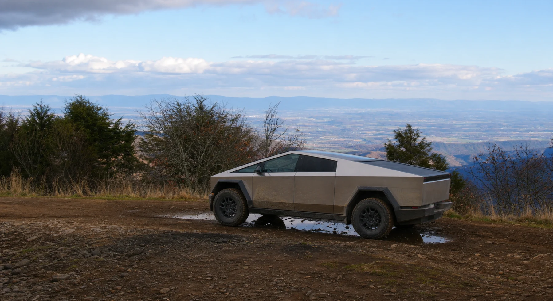

ADVENTURE ROUTE COLLECTION · VIRGINIA
Virginia Ridges: First Trail Skills Day
Use nine Shenandoah Valley routes to build forest-road skills. Start on simple access roads. Add Peters Mill Run before deeper ruts and larger obstacles.
WHY IT FITS
Why this progression can fit your trip.
The routes are close enough for one base area. Each stage adds rougher ground, longer ridge travel, or more demanding tire placement.
ROUTE PROGRESSION
Add one skill at a time.
Drive only the stages that fit your vehicle, experience, weather, and current access. A later stage is not a required finish.
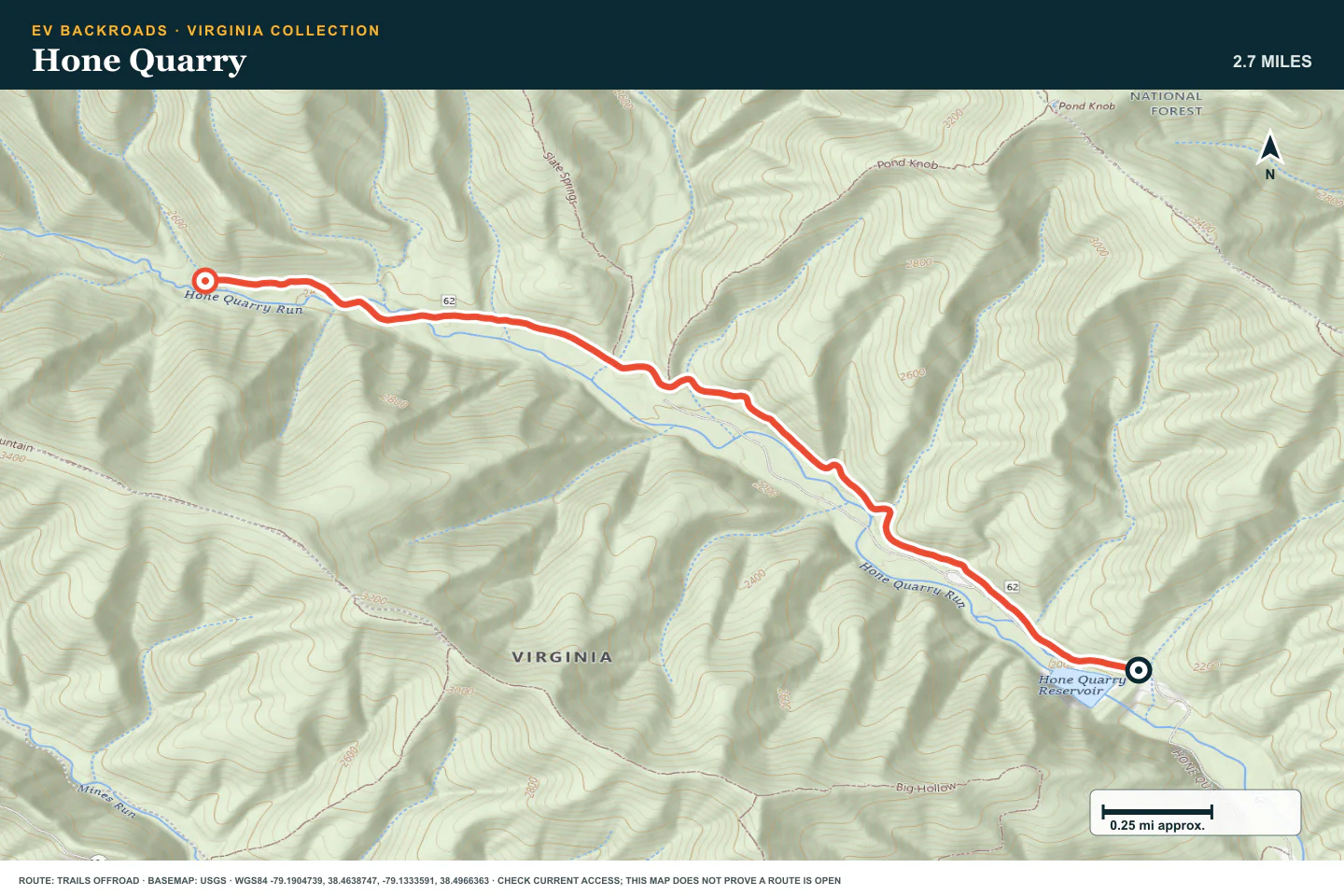
Hone Quarry
- Route distance
- 2.7 mi
- Allow
- 1–2 hours
Start with a short forest-road drive. Use the first firm pullout to check tires, maps, and the return reserve.
Access note: Source snapshot: Seasonal Closure. Check the live source before travel.
TOPOGRAPHIC PROFILE
Hone Quarry, from start to finish
- Climb
- +557 ft
- Descent
- −124 ft
Elevation sampled from AWS Terrain Tiles along the published route. Small terrain and GPS differences are normal.
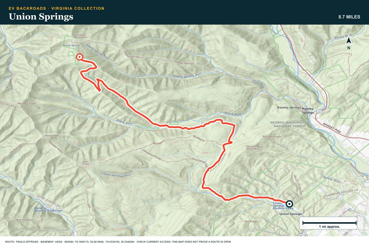
Union Springs
- Route distance
- 8.7 mi
- Allow
- 2–3 hours
Add uneven forest road and more route choices. Stay on the legal track and avoid wet damage.
Access note: Source snapshot: Open. Check the live source before travel.
TOPOGRAPHIC PROFILE
Union Springs, from start to finish
- Climb
- +2,562 ft
- Descent
- −325 ft
Elevation sampled from AWS Terrain Tiles along the published route. Small terrain and GPS differences are normal.
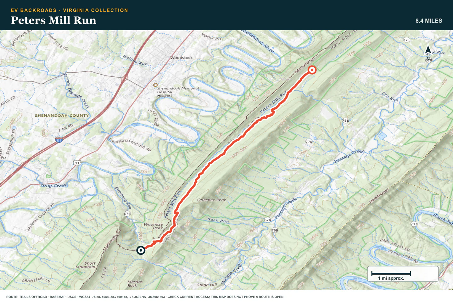
Peters Mill Run
- Route distance
- 8.4 mi
- Allow
- 2–4 hours
Use this well-known valley route to practice a steady pace over rock and uneven ground. Check the permit and current access rules before you enter.
Access note: Source snapshot: Open. Check the live source before travel.
TOPOGRAPHIC PROFILE
Peters Mill Run, from start to finish
- Climb
- +902 ft
- Descent
- −1,091 ft
Elevation sampled from AWS Terrain Tiles along the published route. Small terrain and GPS differences are normal.
Flagpole Knob
- Route distance
- 4 mi
- Allow
- 2–4 hours
Drive Flagpole Knob at a controlled speed. Stop before each uncertain rut or muddy climb. Use only a line that leaves a safe return.
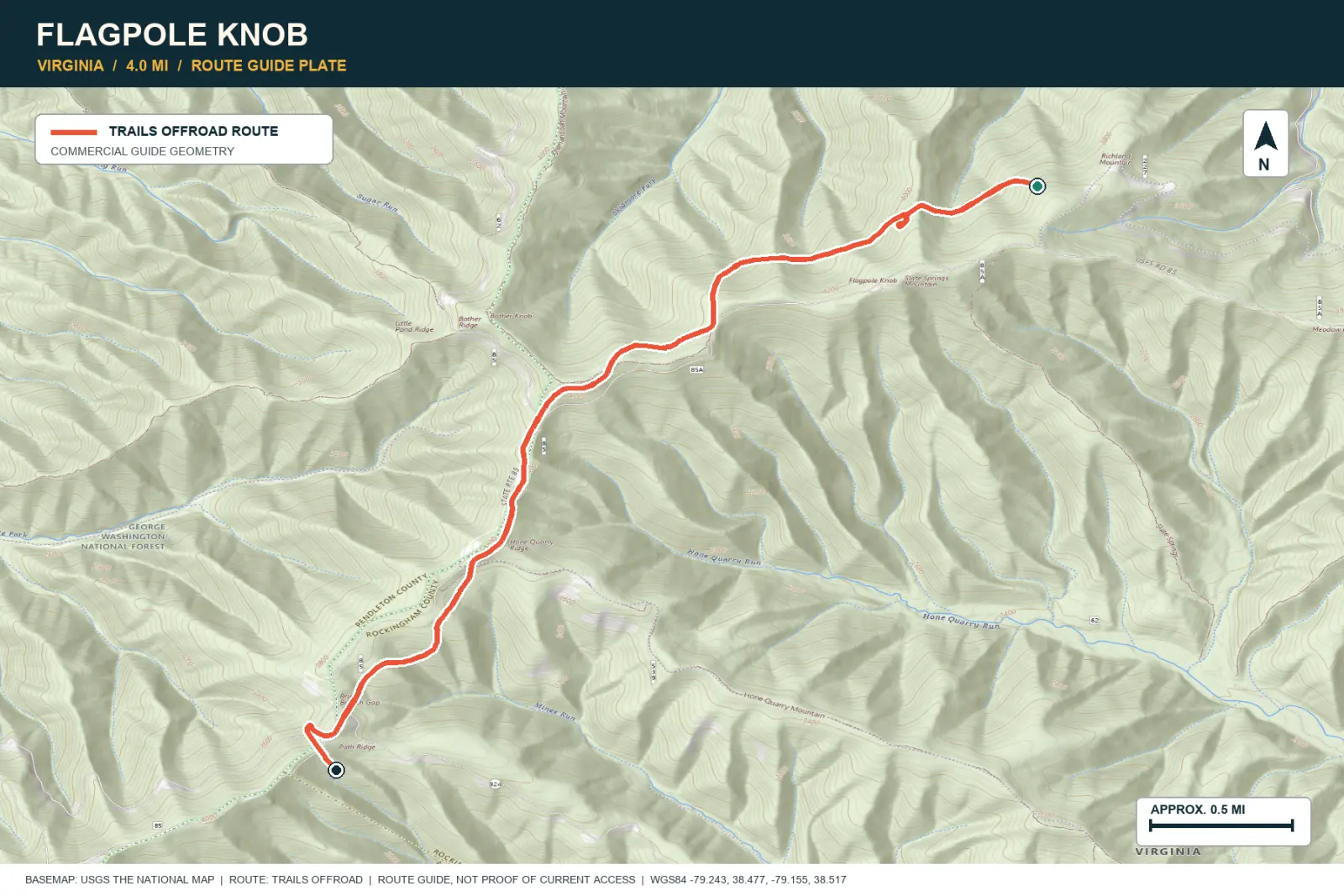
TOPOGRAPHIC PROFILE
Flagpole Knob, from start to finish
- Climb
- +252 ft
- Descent
- −741 ft
Elevation sampled from AWS Terrain Tiles along the published route. Small terrain and GPS differences are normal.
Skidmore Fork/Dunkle Hollow Road
- Route distance
- 8.2 mi
- Allow
- 2–4 hours
Add a longer forest connection with rougher sections. Keep the speed low where sightlines are short.
Access note: Source snapshot: Open. Check the live source before travel.
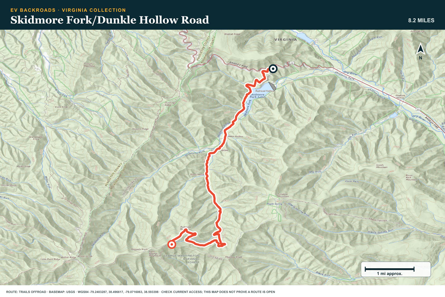
TOPOGRAPHIC PROFILE
Skidmore Fork/Dunkle Hollow Road, from start to finish
- Climb
- +1,946 ft
- Descent
- −477 ft
Elevation sampled from AWS Terrain Tiles along the published route. Small terrain and GPS differences are normal.
Reddish Knob
- Route distance
- 7.4 mi
- Allow
- Half day
Use the ridge climb to practice energy checks and weather decisions. Turn back before cloud or snow hides the road edge.
Access note: Source snapshot: Open. Check the live source before travel.
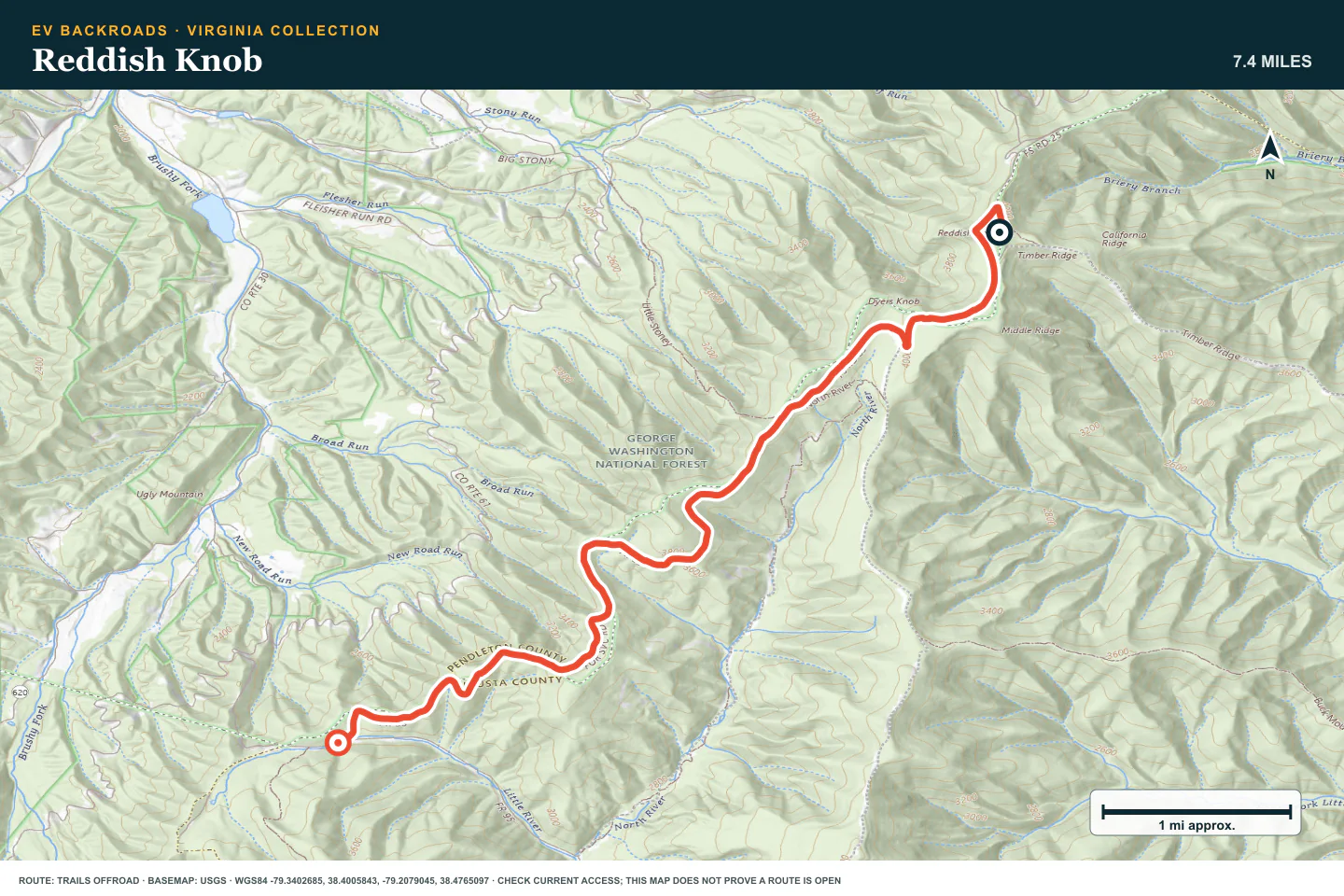
TOPOGRAPHIC PROFILE
Reddish Knob, from start to finish
- Climb
- +205 ft
- Descent
- −1,610 ft
Elevation sampled from AWS Terrain Tiles along the published route. Small terrain and GPS differences are normal.
Long Run Road
- Route distance
- 16.3 mi
- Allow
- Half day
Add a longer road day. Check the battery, tires, and daylight at the midpoint before you continue.
Access note: Source snapshot: Open. Check the live source before travel.
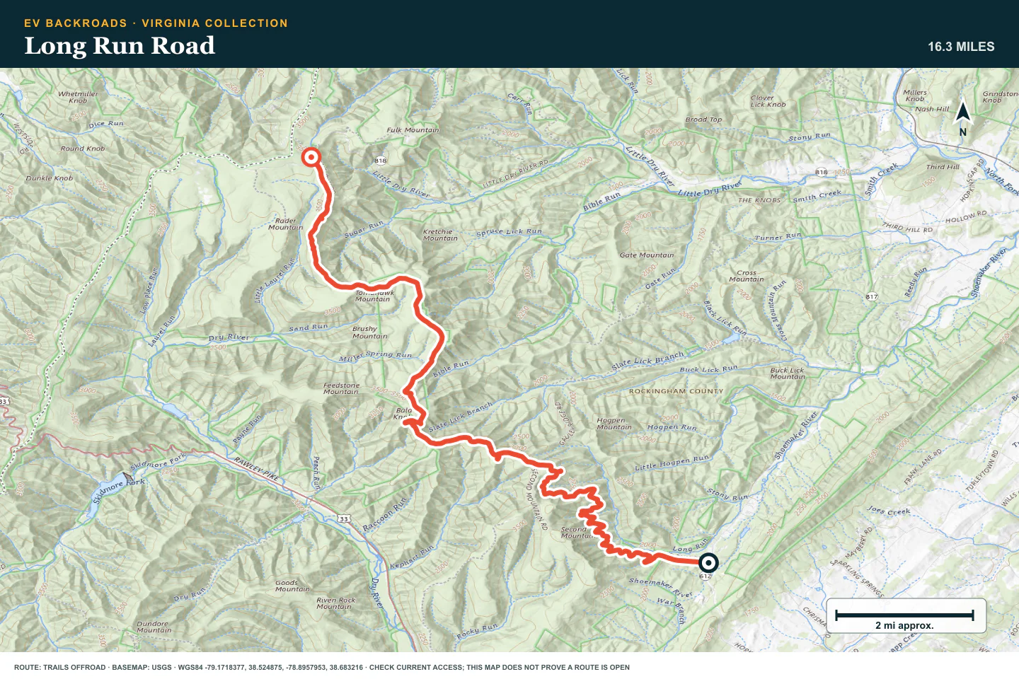
TOPOGRAPHIC PROFILE
Long Run Road, from start to finish
- Climb
- +2,661 ft
- Descent
- −869 ft
Elevation sampled from AWS Terrain Tiles along the published route. Small terrain and GPS differences are normal.
Stone Camp
- Route distance
- 3 mi
- Allow
- 2–4 hours
Use this stage only after the moderate routes feel controlled. Walk the larger rocks and protect the route surface.
Access note: Source snapshot: Open. Check the live source before travel.
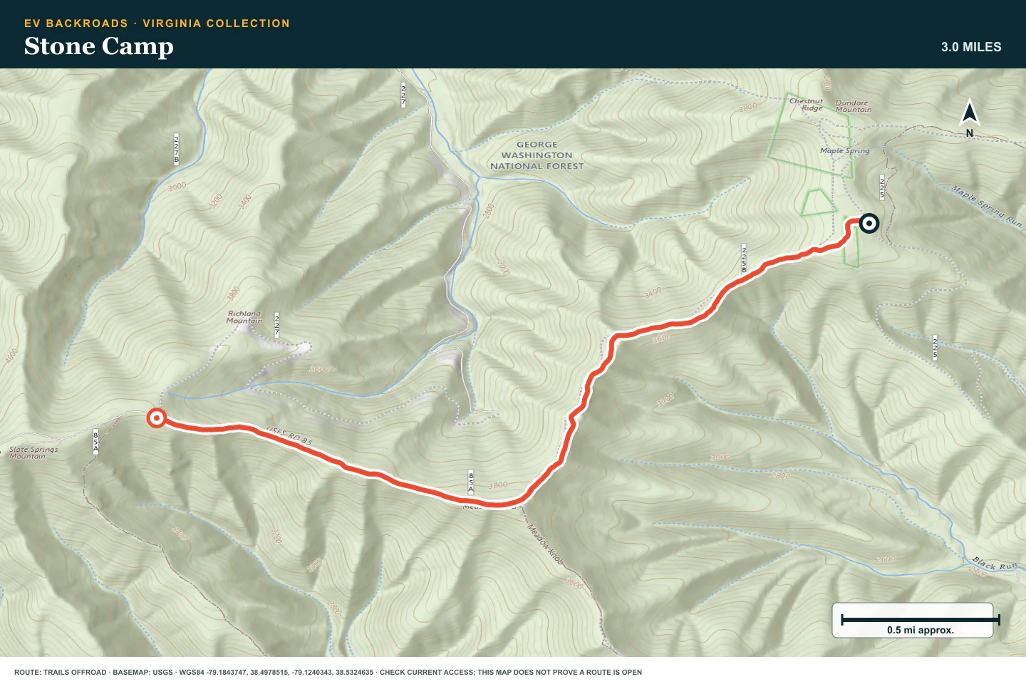
TOPOGRAPHIC PROFILE
Stone Camp, from start to finish
- Climb
- +799 ft
- Descent
- −496 ft
Elevation sampled from AWS Terrain Tiles along the published route. Small terrain and GPS differences are normal.
Bald Mountain Jeep Trail aka Big Levels
- Route distance
- 10 mi
- Allow
- Full day
Keep Big Levels as the final Virginia stage. Use a capable vehicle, current access information, and a complete recovery plan.
Access note: Source snapshot: Open. Check the live source before travel.
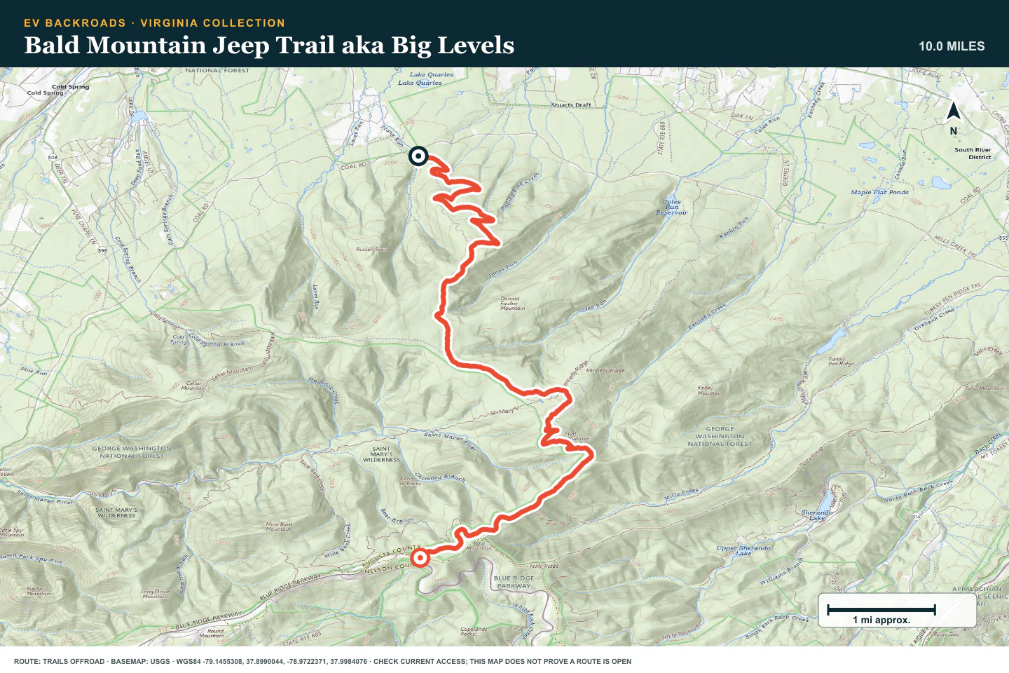
TOPOGRAPHIC PROFILE
Bald Mountain Jeep Trail aka Big Levels, from start to finish
- Climb
- +1,913 ft
- Descent
- −571 ft
Elevation sampled from AWS Terrain Tiles along the published route. Small terrain and GPS differences are normal.
ROUTE READINESS
Do seven checks before you leave pavement.
surface
Forest road with rock, ruts, and condition-dependent mud
clearance
Extra clearance and durable tires
remoteness
The routes are compact, but recovery can still take time
charging
Start with enough reserve to return without an unverified stop
cell Coverage
Treat ridge coverage as intermittent
weather
Use this pack in dry conditions
turnaround
Stop at the last wide, firm section before deep mud or a washed climb
BEFORE YOU GO
Make these decisions while you have a signal.
- Check forest access and recent rain
- Inspect tires and recovery points at the trailhead
- Share the route and check-in time
TURN AROUND WHEN
Follow the limits that you set.
- Ruts are deeper than the vehicle can straddle
- Tires spin and damage the road
- The planned return reserve is reached
CARRY
Prepare for common problems.
- Tire repair kit and compressor
- Traction boards and shovel
- Work gloves and offline map
OPEN THE LIVE MAP
Check the drive home.
See the route with open chargers and road-distance charging gaps. Planned stations do not change current coverage.