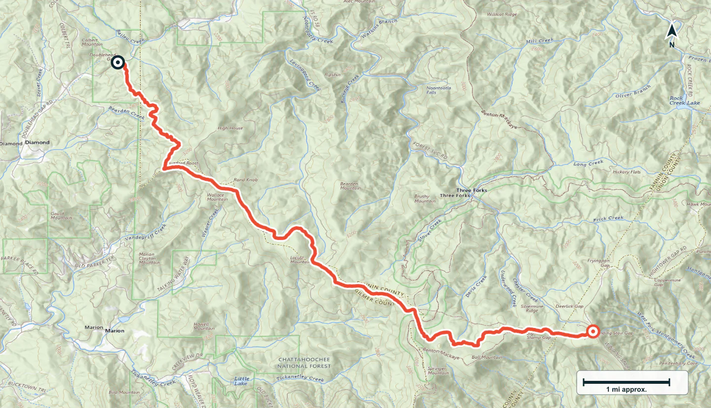

ADVENTURE ROUTE COLLECTION · GEORGIA
North Georgia: Blue Ridge Forest Roads
Use eight roads in north Georgia. Start on easy forest routes. Add longer ridges, rougher rock, and steeper mountain travel later.
WHY IT FITS
Why this progression can fit your trip.
The routes are close enough for one mountain base. The order adds surface, distance, and obstacle demands in small steps.
ROUTE PROGRESSION
Add one skill at a time.
Drive only the stages that fit your vehicle, experience, weather, and current access. A later stage is not a required finish.
Appalachian Blue Ridge Road
- Route distance
- 3.8 mi
- Allow
- 1–2 hours
Start on a scenic forest road. Check braking, tire pressure, and navigation at low speed.
Access note: Source snapshot: Open. Check the live source before travel.
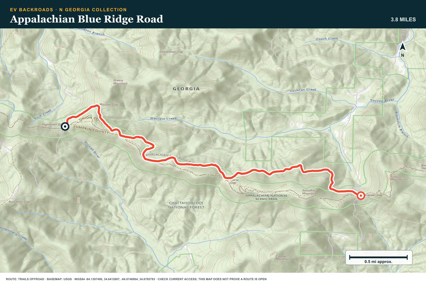
TOPOGRAPHIC PROFILE
Appalachian Blue Ridge Road, from start to finish
- Climb
- +530 ft
- Descent
- −576 ft
Elevation sampled from AWS Terrain Tiles along the published route. Small terrain and GPS differences are normal.
Bull Mountain Road
- Route distance
- 1.5 mi
- Allow
- 1–2 hours
Add another easy road with more elevation. Use pullouts and keep the return clear.
Access note: Source snapshot: Open. Check the live source before travel.
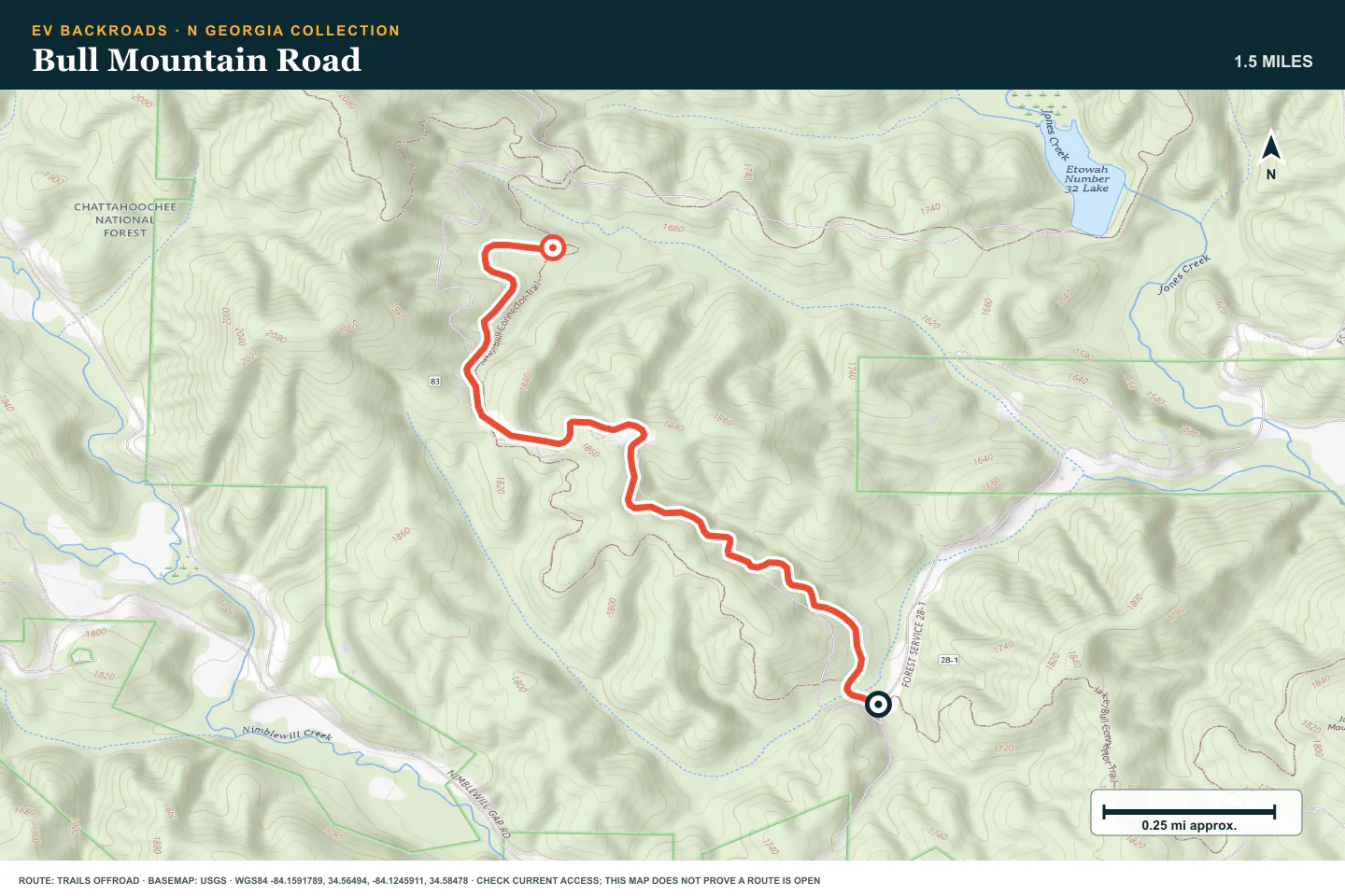
TOPOGRAPHIC PROFILE
Bull Mountain Road, from start to finish
- Climb
- +297 ft
- Descent
- −148 ft
Elevation sampled from AWS Terrain Tiles along the published route. Small terrain and GPS differences are normal.
Cooper Creek Road
- Route distance
- 8.7 mi
- Allow
- 2–3 hours
Add a forest road near camping and water. Inspect wet sections and protect the road surface.
Access note: Source snapshot: Open. Check the live source before travel.
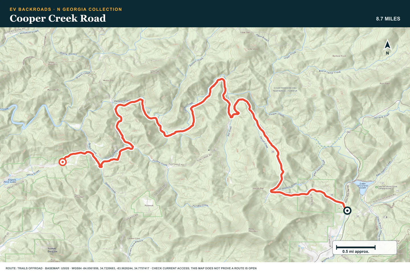
TOPOGRAPHIC PROFILE
Cooper Creek Road, from start to finish
- Climb
- +539 ft
- Descent
- −1,120 ft
Elevation sampled from AWS Terrain Tiles along the published route. Small terrain and GPS differences are normal.
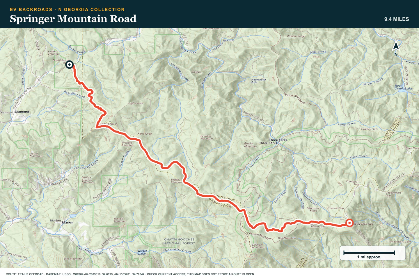
Springer Mountain Road
- Route distance
- 9.5 mi
- Allow
- 2–3 hours
Use this mountain route to practice junction checks and changing sightlines.
Access note: Source snapshot: Open. Check the live source before travel.
TOPOGRAPHIC PROFILE
Springer Mountain Road, from start to finish
- Climb
- +1,388 ft
- Descent
- −500 ft
Elevation sampled from AWS Terrain Tiles along the published route. Small terrain and GPS differences are normal.
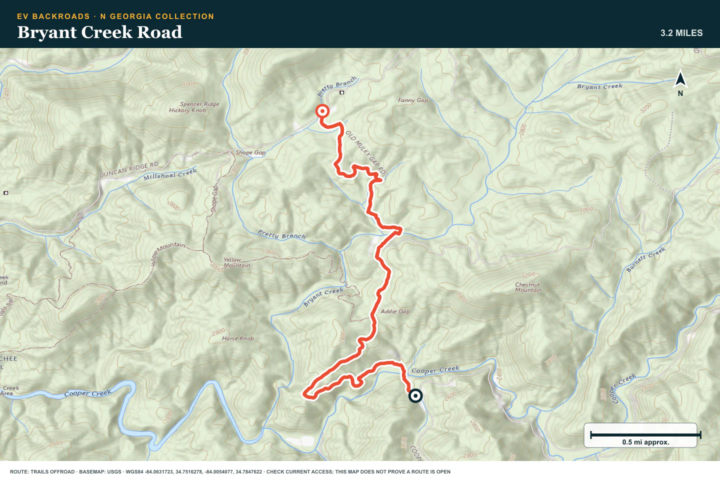
Bryant Creek Road
- Route distance
- 3.2 mi
- Allow
- 2–3 hours
Move to a rougher forest road. Walk ruts or erosion that hide the safe tire line.
Access note: Source snapshot: Open. Check the live source before travel.
TOPOGRAPHIC PROFILE
Bryant Creek Road, from start to finish
- Climb
- +662 ft
- Descent
- −240 ft
Elevation sampled from AWS Terrain Tiles along the published route. Small terrain and GPS differences are normal.
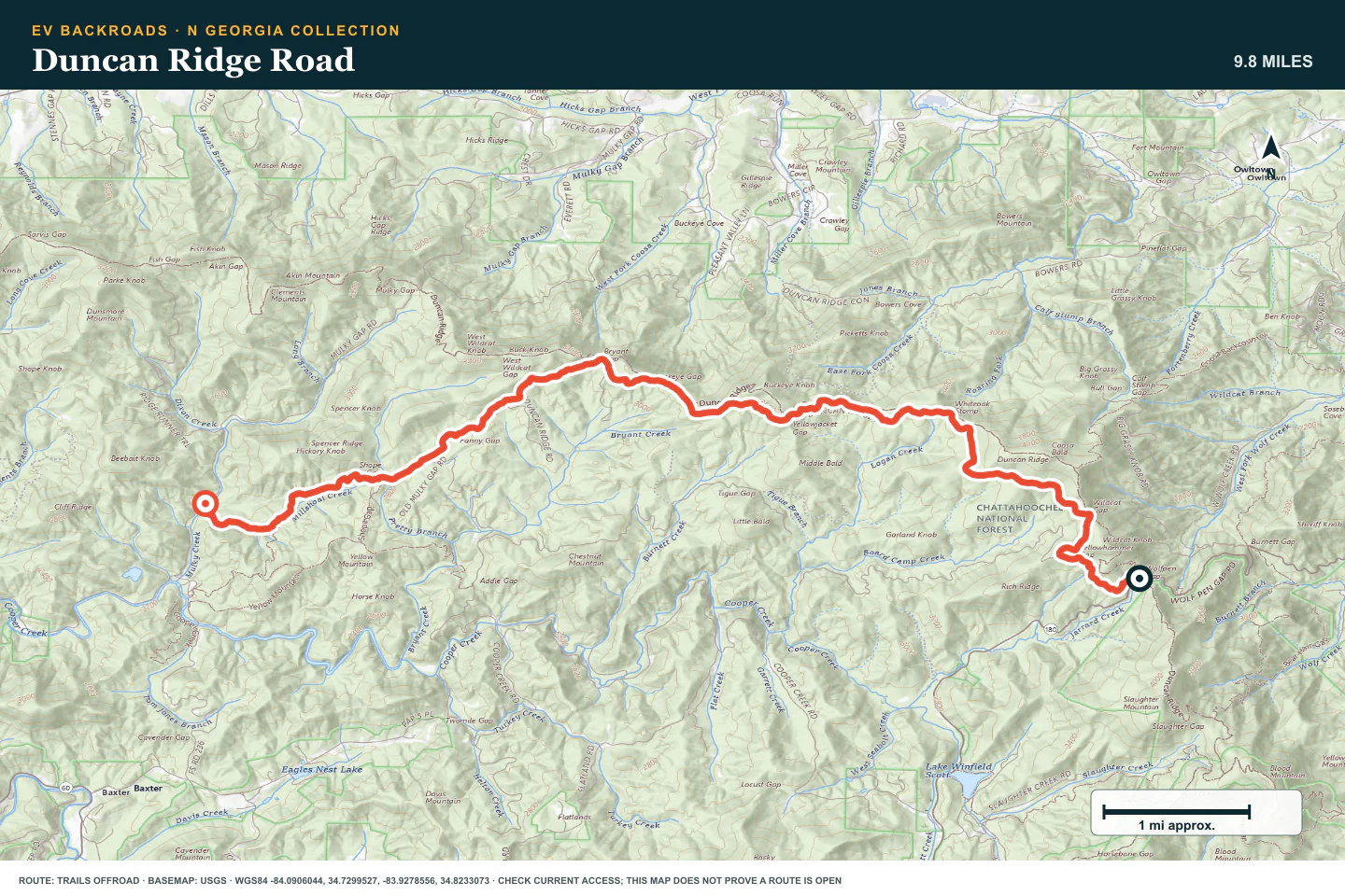
Duncan Ridge Road
- Route distance
- 9.9 mi
- Allow
- Half day
Add a longer ridge road. Keep enough time and energy for a slow return.
Access note: Source snapshot: Open. Check the live source before travel.
TOPOGRAPHIC PROFILE
Duncan Ridge Road, from start to finish
- Climb
- +613 ft
- Descent
- −1,751 ft
Elevation sampled from AWS Terrain Tiles along the published route. Small terrain and GPS differences are normal.
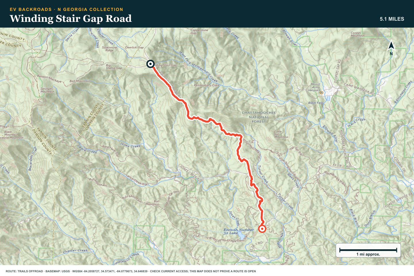
Winding Stair Gap Road
- Route distance
- 5.2 mi
- Allow
- Half day
Add rougher mountain ground and tighter route choices. Stop before rock or erosion exceeds the vehicle.
Access note: Source snapshot: Open. Check the live source before travel.
TOPOGRAPHIC PROFILE
Winding Stair Gap Road, from start to finish
- Climb
- +135 ft
- Descent
- −1,631 ft
Elevation sampled from AWS Terrain Tiles along the published route. Small terrain and GPS differences are normal.
Tray Mountain Road
- Route distance
- 8 mi
- Allow
- Half day
Keep Tray Mountain as the final stage. Use current access information and a suitable vehicle and recovery plan.
Access note: Source snapshot: Open. Check the live source before travel.
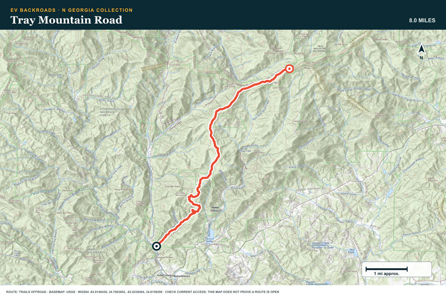
TOPOGRAPHIC PROFILE
Tray Mountain Road, from start to finish
- Climb
- +2,356 ft
- Descent
- −50 ft
Elevation sampled from AWS Terrain Tiles along the published route. Small terrain and GPS differences are normal.
ROUTE READINESS
Do seven checks before you leave pavement.
surface
Forest dirt, gravel, shallow water, ruts, and embedded rock
clearance
Standard clearance early; extra clearance for the final routes
remoteness
Towns are near, but ridge service and recovery can be limited
charging
Verify the mountain approach and return before you leave pavement
cell Coverage
Keep every route and charger stop offline
weather
Use dry conditions and avoid damaged roads
turnaround
Stop before deep ruts, moving water, or rock exceeds the plan
BEFORE YOU GO
Make these decisions while you have a signal.
- Check Chattahoochee-Oconee National Forest orders
- Download the route and return
- Set a weather and battery limit
TURN AROUND WHEN
Follow the limits that you set.
- A gate or sign conflicts with the route
- Water or mud hides the firm surface
- The vehicle needs wheelspin or contact
CARRY
Prepare for common problems.
- Tire repair kit and compressor
- Recovery strap, traction boards, and gloves
- Water, rain layers, and offline maps
OPEN THE LIVE MAP
Check the drive home.
See the route with open chargers and road-distance charging gaps. Planned stations do not change current coverage.