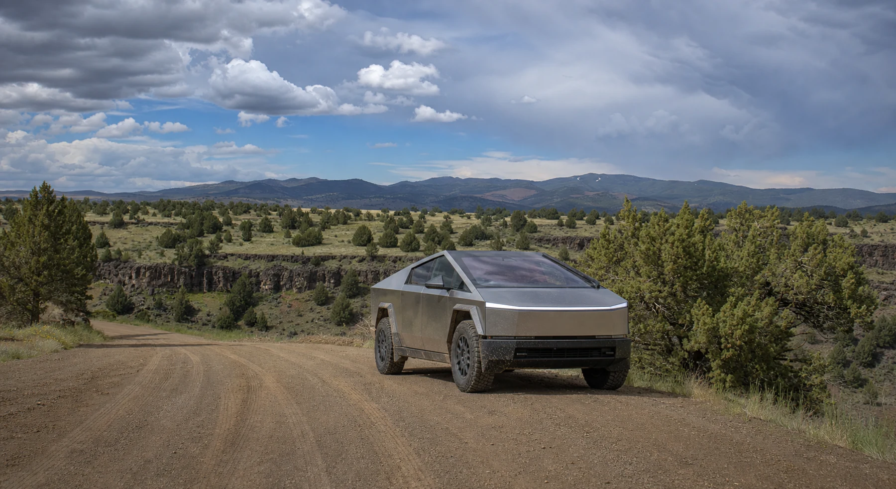

ADVENTURE ROUTE COLLECTION · IDAHO + OREGON
Great Basin: High Desert to Alpine Progression
Use seven Owyhee routes before the two alpine stages. Start on open desert roads. Add technical trails, mountain weather, and high elevation later.
WHY IT FITS
Why this progression can fit your trip.
The Owyhee stages form a regional route set, not one token byway. The Oregon and central Idaho stages then add elevation and longer transfers.
ROUTE PROGRESSION
Add one skill at a time.
Drive only the stages that fit your vehicle, experience, weather, and current access. A later stage is not a required finish.
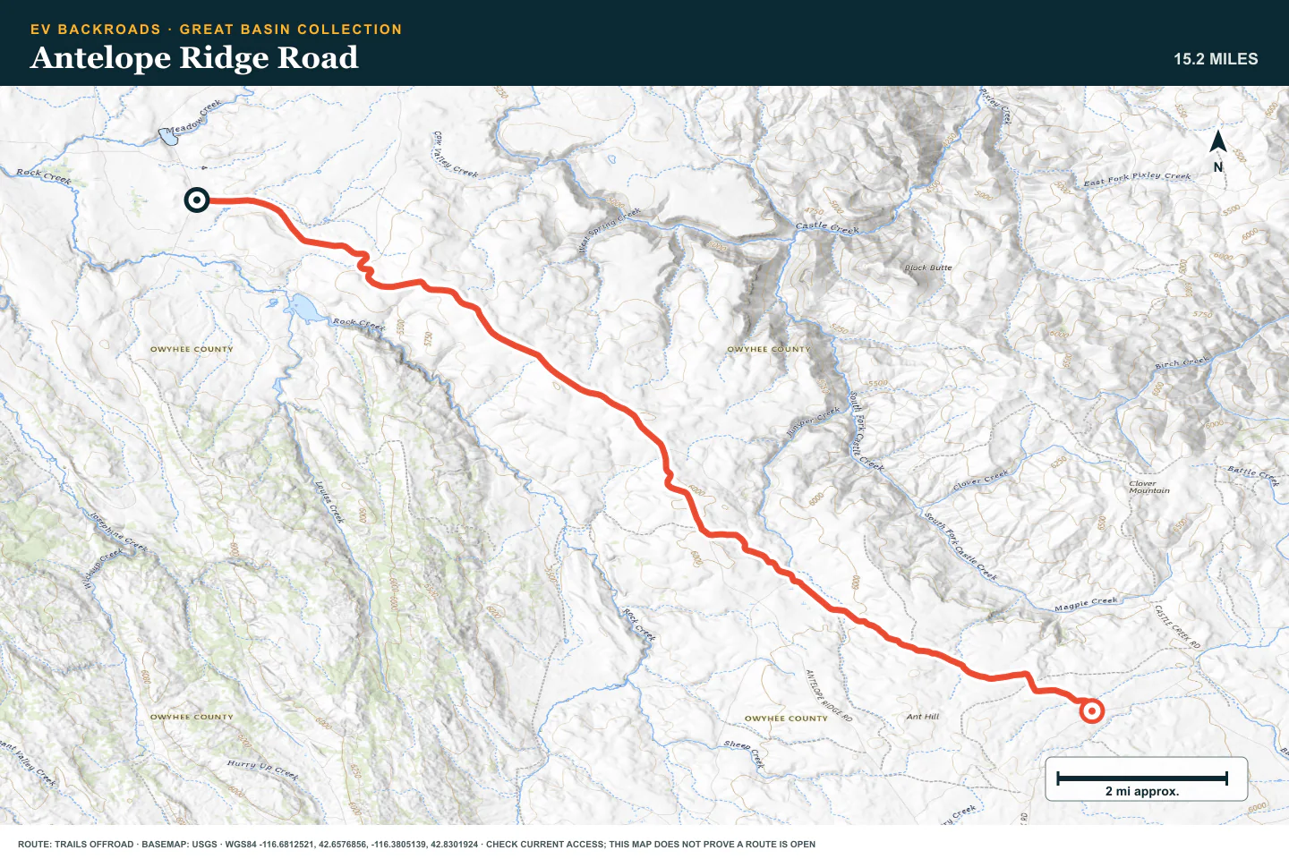
Antelope Ridge Road
- Route distance
- 15.2 mi
- Allow
- 2–3 hours
Start on an open high-desert road. Use it to test dust, heat, navigation, and tire settings.
Access note: Source snapshot: Open. Check the live source before travel.
TOPOGRAPHIC PROFILE
Antelope Ridge Road, from start to finish
- Climb
- +1,368 ft
- Descent
- −427 ft
Elevation sampled from AWS Terrain Tiles along the published route. Small terrain and GPS differences are normal.
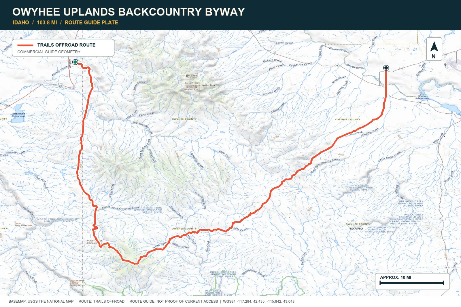
Owyhee Uplands Backcountry Byway
- Route distance
- 103.8 mi
- Allow
- Full day or overnight
Use the easy surface to practice long-range energy, navigation, and communication checks. Do not enter wet clay.
Access note: BLM lists a seasonal closure from first snowfall until Memorial Weekend; contact Owyhee County for current conditions.
TOPOGRAPHIC PROFILE
Owyhee Uplands Backcountry Byway, from start to finish
- Climb
- +2,640 ft
- Descent
- −4,567 ft
Elevation sampled from AWS Terrain Tiles along the published route. Small terrain and GPS differences are normal.
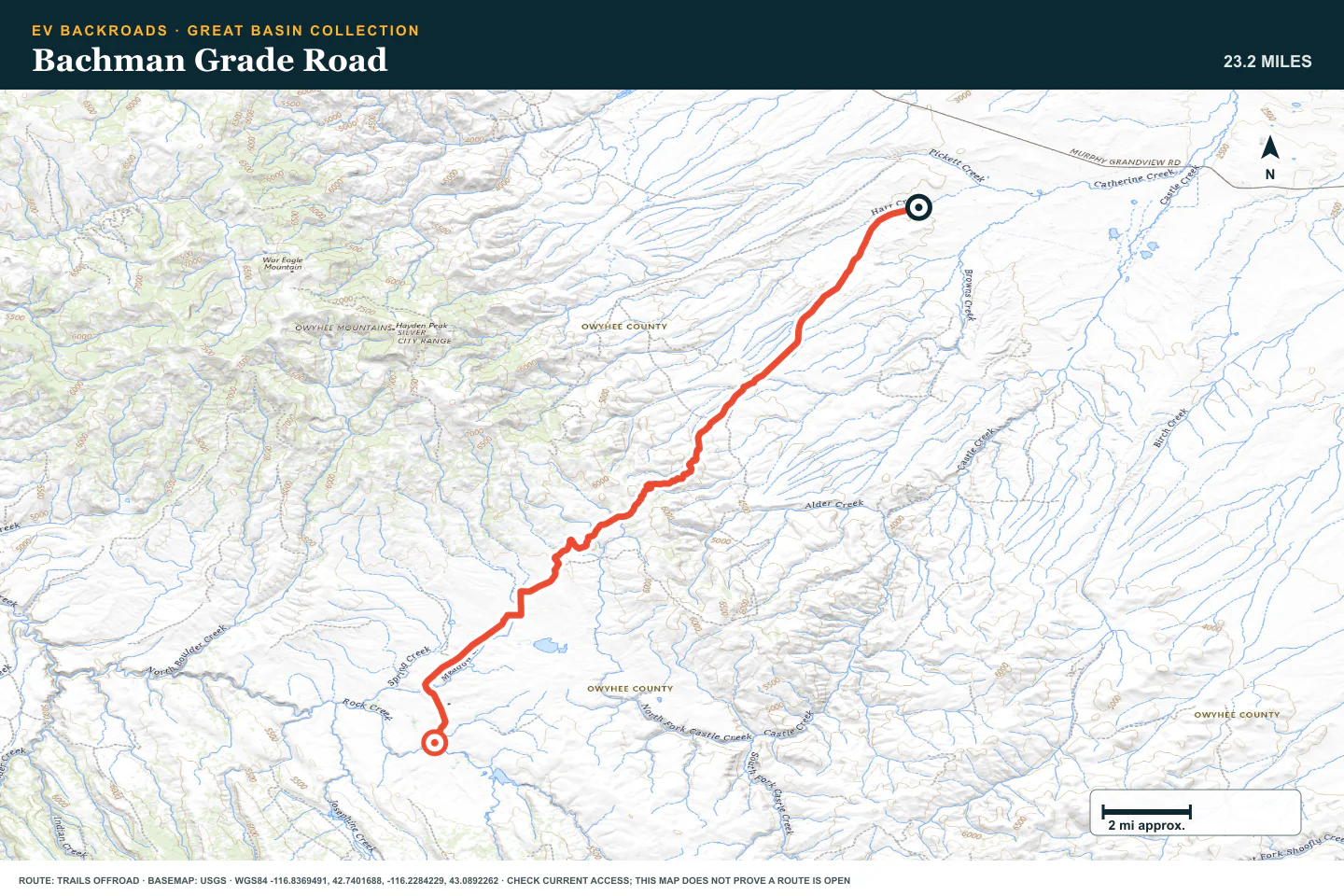
Bachman Grade Road
- Route distance
- 23.2 mi
- Allow
- Half day
Add a grade and more route-finding work. Stop if rain changes the road surface to clay.
Access note: Source snapshot: Open. Check the live source before travel.
TOPOGRAPHIC PROFILE
Bachman Grade Road, from start to finish
- Climb
- +2,942 ft
- Descent
- −770 ft
Elevation sampled from AWS Terrain Tiles along the published route. Small terrain and GPS differences are normal.
Jack's Creek Road
- Route distance
- 23.8 mi
- Allow
- Half day
Use this road to practice navigation across a wider desert area. Confirm every junction before you continue.
Access note: Source snapshot: Open. Check the live source before travel.
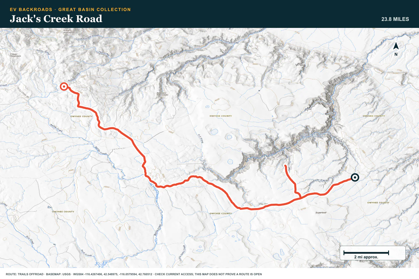
TOPOGRAPHIC PROFILE
Jack's Creek Road, from start to finish
- Climb
- +1,711 ft
- Descent
- −662 ft
Elevation sampled from AWS Terrain Tiles along the published route. Small terrain and GPS differences are normal.
C900 Trail System
- Route distance
- 8.1 mi
- Allow
- Half day
Add a trail system with more route choices. Keep the selected loop offline and avoid unplanned branches.
Access note: Source snapshot: Open. Check the live source before travel.
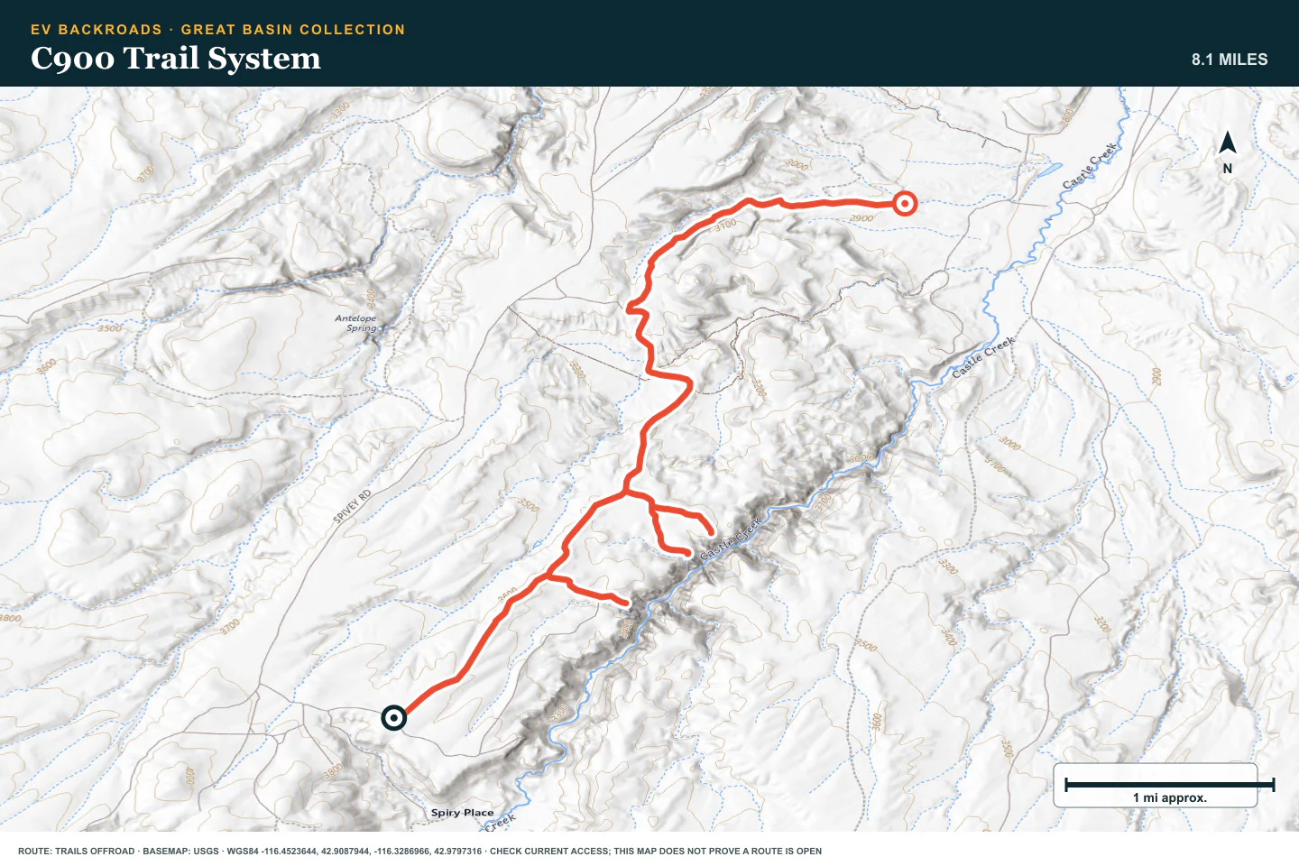
TOPOGRAPHIC PROFILE
C900 Trail System, from start to finish
- Climb
- +439 ft
- Descent
- −1,331 ft
Elevation sampled from AWS Terrain Tiles along the published route. Small terrain and GPS differences are normal.
Silver City Road
- Route distance
- 20.4 mi
- Allow
- Half day
Use the seasonal road only after you confirm access. Slow down for traffic and blind corners.
Access note: Source snapshot: Seasonal Closure. Check the live source before travel.
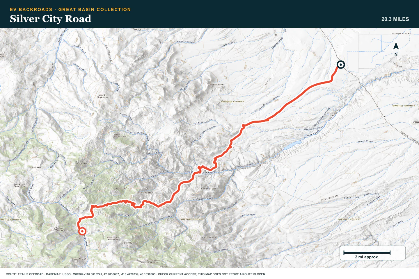
TOPOGRAPHIC PROFILE
Silver City Road, from start to finish
- Climb
- +3,795 ft
- Descent
- −941 ft
Elevation sampled from AWS Terrain Tiles along the published route. Small terrain and GPS differences are normal.
Lost Trail
- Route distance
- 7.5 mi
- Allow
- Full day
Keep Lost Trail as the technical Owyhee stage. Use a capable vehicle, experienced driver, and complete recovery plan.
Access note: Source snapshot: Open. Check the live source before travel.
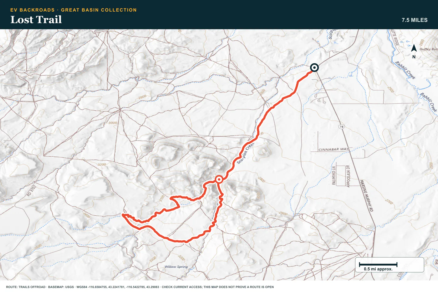
TOPOGRAPHIC PROFILE
Lost Trail, from start to finish
- Climb
- +839 ft
- Descent
- −509 ft
Elevation sampled from AWS Terrain Tiles along the published route. Small terrain and GPS differences are normal.
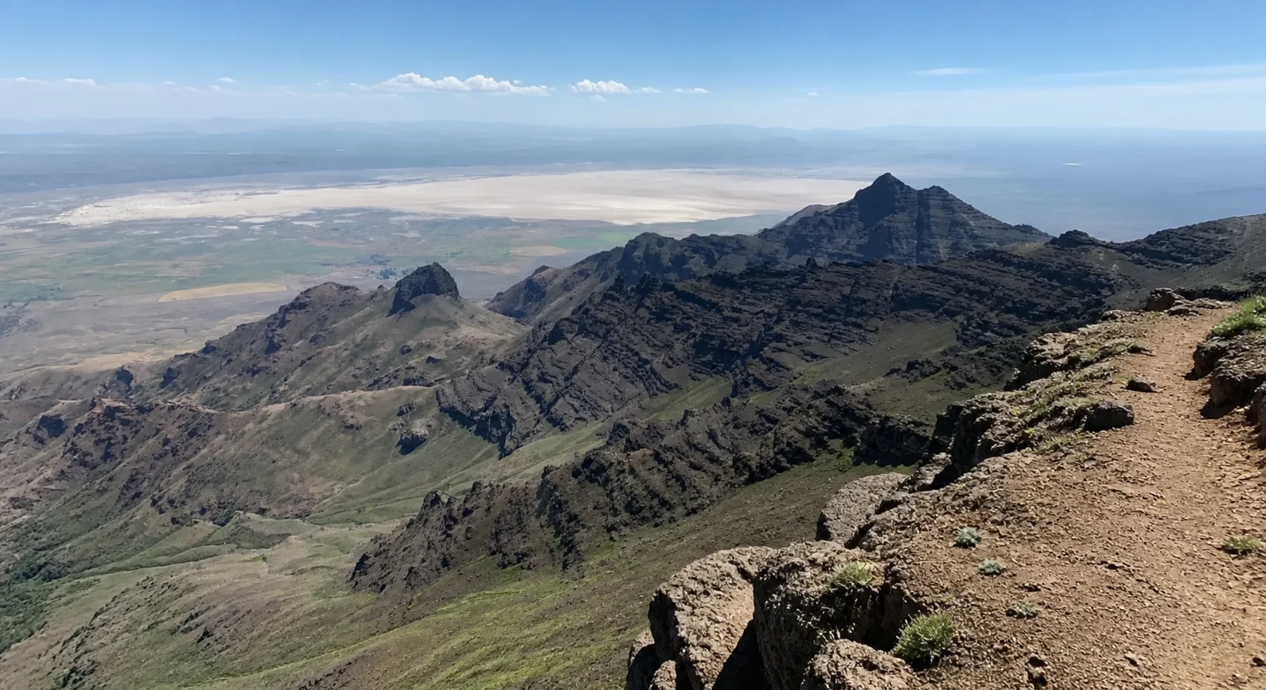
Steens Mountain Loop
- Route distance
- 55.7 mi
- Allow
- Full day
Add a seasonal mountain loop, large elevation change, and exposed high-country weather.
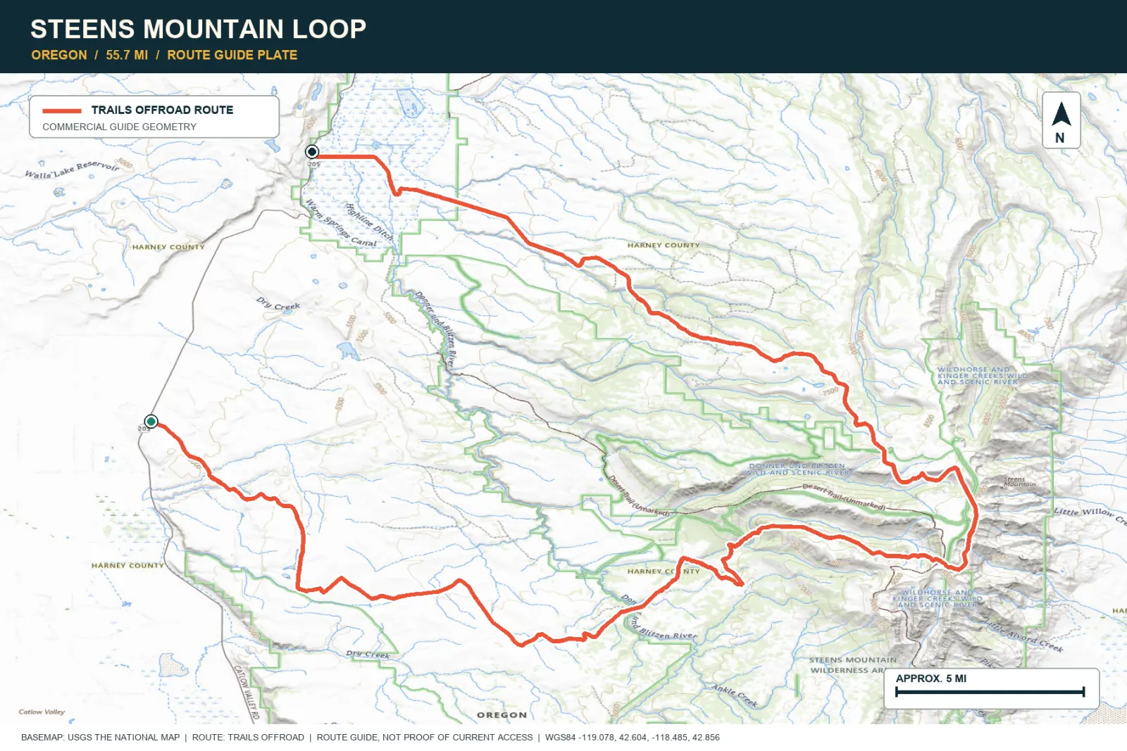
TOPOGRAPHIC PROFILE
Steens Mountain Loop, from start to finish
- Climb
- +5,177 ft
- Descent
- −5,690 ft
Elevation sampled from AWS Terrain Tiles along the published route. Small terrain and GPS differences are normal.
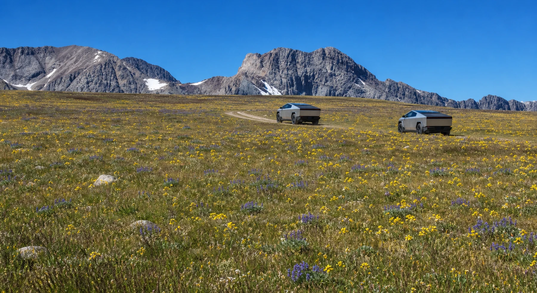
Railroad Ridge (Jim Creek-Livingston Mine)
- Route distance
- 6.4 mi
- Allow
- Half day
Use this short alpine road only when it is dry and open. Walk narrow or eroded sections before driving them.
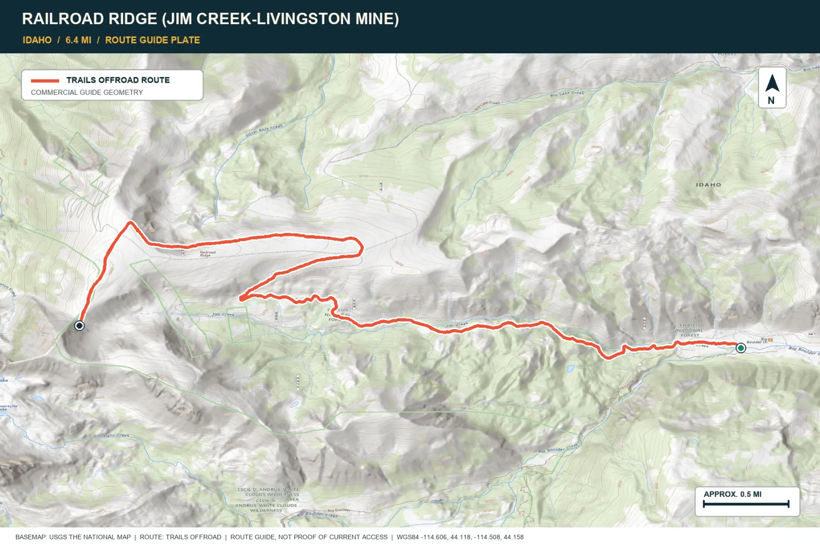
TOPOGRAPHIC PROFILE
Railroad Ridge (Jim Creek-Livingston Mine), from start to finish
- Climb
- +3,187 ft
- Descent
- −83 ft
Elevation sampled from AWS Terrain Tiles along the published route. Small terrain and GPS differences are normal.
ROUTE READINESS
Do seven checks before you leave pavement.
surface
Desert byway, seasonal mountain loop, and steep alpine two-track
clearance
Moderate clearance early; more clearance and tire strength later
remoteness
Long gaps from help are normal
charging
Plan the trail and the highway transfer as separate energy problems
cell Coverage
Carry redundant offline navigation and satellite communication
weather
Do not enter wet clay, extreme heat, or snow-covered high roads
turnaround
Use fixed mileage, weather, daylight, and energy checkpoints
BEFORE YOU GO
Make these decisions while you have a signal.
- Confirm the route is open and dry
- Plan chargers for every transfer
- Carry redundant navigation and communication
TURN AROUND WHEN
Follow the limits that you set.
- Clay starts to collect on the tires
- Snow or wind removes the visible road edge
- Consumption breaks the written checkpoint
CARRY
Prepare for common problems.
- Satellite communicator
- Complete tire and inflation system
- Water, food, layers, and emergency shelter
OPEN THE LIVE MAP
Check the drive home.
See the route with open chargers and road-distance charging gaps. Planned stations do not change current coverage.