
ADVENTURE ROUTE COLLECTION · PENNSYLVANIA
Pennsylvania: Ridge Road Progression
Use eight routes in central Pennsylvania. Start on state-forest roads. Add ruts, wet ground, and a managed off-road park only after the early stages feel controlled.
WHY IT FITS
Why this progression can fit your trip.
The forest stages are close enough for one base area. The final stage adds a managed technical setting with its own rules and fees.
ROUTE PROGRESSION
Add one skill at a time.
Drive only the stages that fit your vehicle, experience, weather, and current access. A later stage is not a required finish.
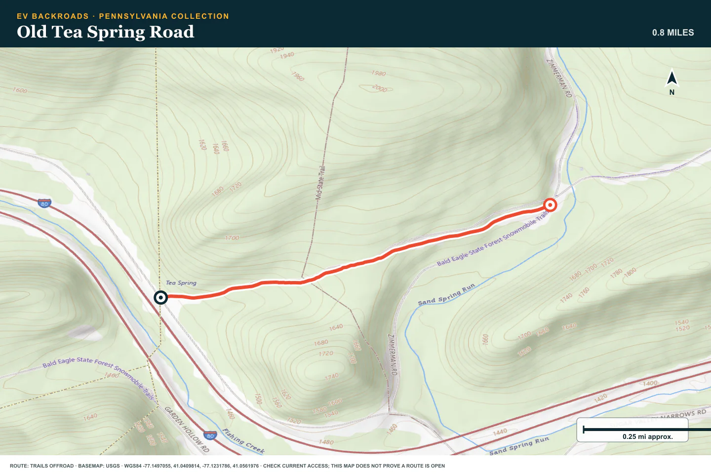
Old Tea Spring Road
- Route distance
- 0.8 mi
- Allow
- 1–2 hours
Start on a short forest road. Confirm the route, tire pressure, and return before you add rougher ground.
Access note: Source snapshot: Open. Check the live source before travel.
TOPOGRAPHIC PROFILE
Old Tea Spring Road, from start to finish
- Climb
- +161 ft
- Descent
- −64 ft
Elevation sampled from AWS Terrain Tiles along the published route. Small terrain and GPS differences are normal.
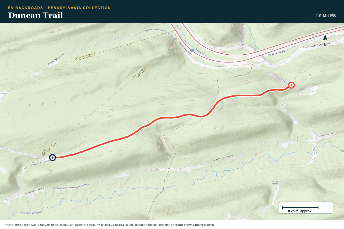
Duncan Trail
- Route distance
- 1.9 mi
- Allow
- 1–2 hours
Add a second easy route with small obstacles. Use low speed and stay on the legal track.
Access note: Source snapshot: Open. Check the live source before travel.
TOPOGRAPHIC PROFILE
Duncan Trail, from start to finish
- Climb
- +179 ft
- Descent
- −100 ft
Elevation sampled from AWS Terrain Tiles along the published route. Small terrain and GPS differences are normal.
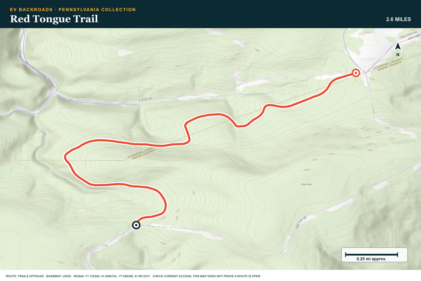
Red Tongue Trail
- Route distance
- 2.6 mi
- Allow
- 1–2 hours
Use this route to practice reading ruts and road edges. Stop if wet ground cannot support the vehicle.
Access note: Source snapshot: Open. Check the live source before travel.
TOPOGRAPHIC PROFILE
Red Tongue Trail, from start to finish
- Climb
- +151 ft
- Descent
- −150 ft
Elevation sampled from AWS Terrain Tiles along the published route. Small terrain and GPS differences are normal.
Little Poe Road
- Route distance
- 3.8 mi
- Allow
- 2–3 hours
Add distance on a forest road. Check the route at every junction and keep the return reserve.
Access note: Source snapshot: Open. Check the live source before travel.
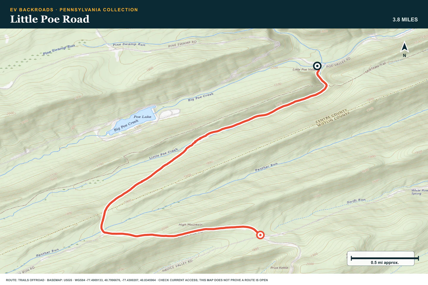
TOPOGRAPHIC PROFILE
Little Poe Road, from start to finish
- Climb
- +827 ft
- Descent
- −277 ft
Elevation sampled from AWS Terrain Tiles along the published route. Small terrain and GPS differences are normal.
High Top Trail
- Route distance
- 1.8 mi
- Allow
- 2–3 hours
Move to rougher ground. Walk any rock or rut that hides the safe tire line.
Access note: Source snapshot: Open. Check the live source before travel.
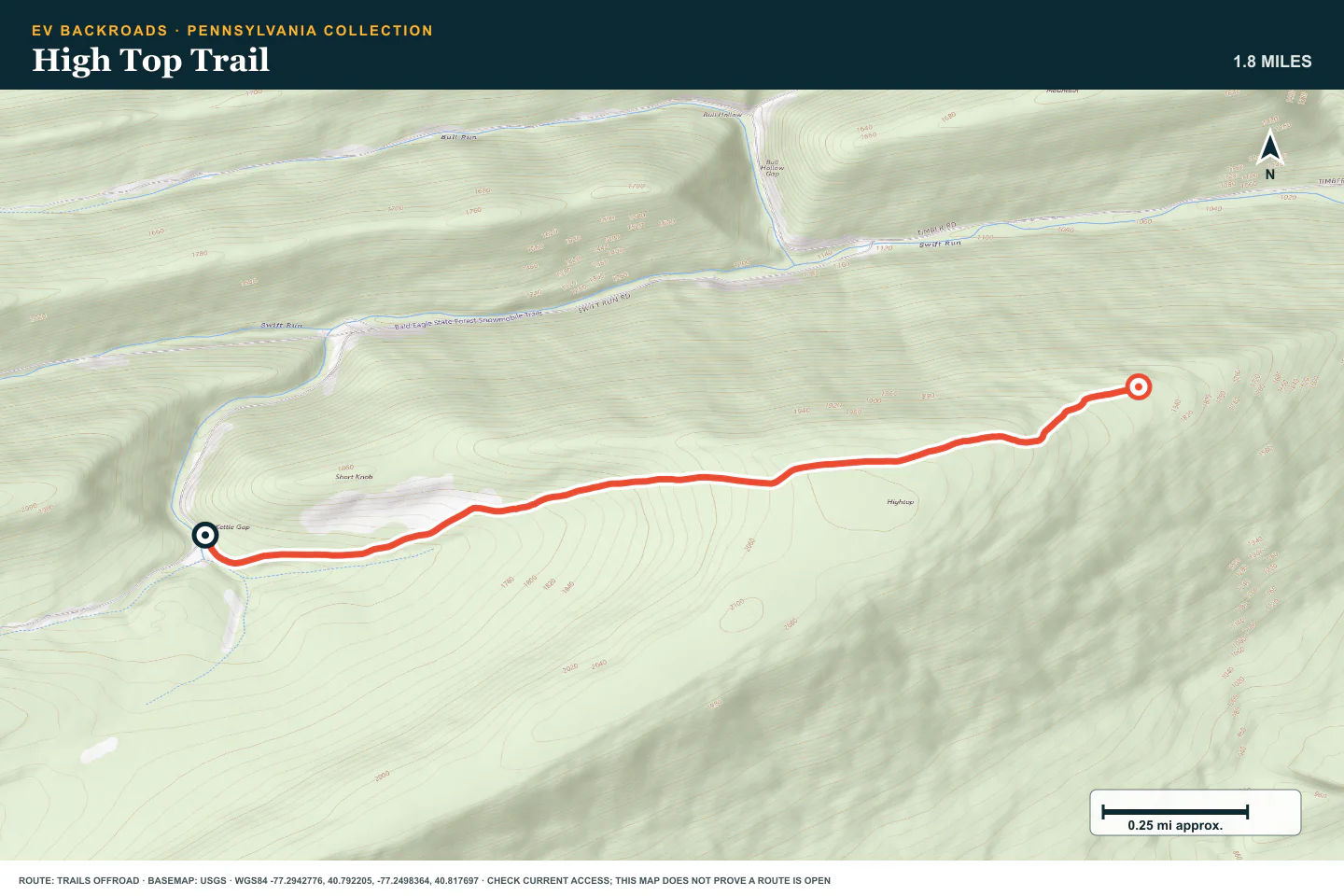
TOPOGRAPHIC PROFILE
High Top Trail, from start to finish
- Climb
- +504 ft
- Descent
- −232 ft
Elevation sampled from AWS Terrain Tiles along the published route. Small terrain and GPS differences are normal.
Strong Mountain Road
- Route distance
- 5.8 mi
- Allow
- Half day
Add a longer ridge road with more sustained rough sections. Use a firm weather and time limit.
Access note: Source snapshot: Open. Check the live source before travel.
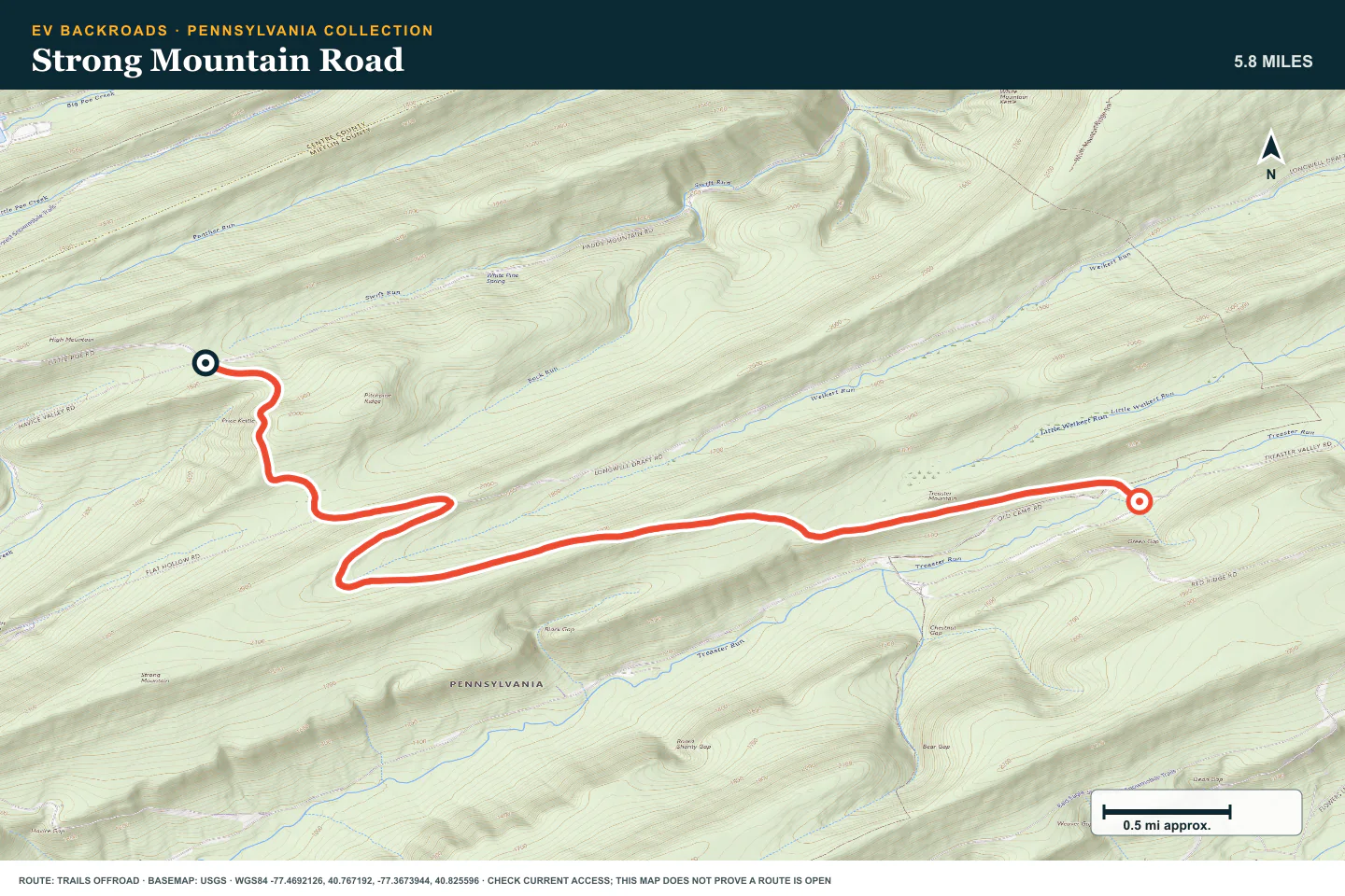
TOPOGRAPHIC PROFILE
Strong Mountain Road, from start to finish
- Climb
- +508 ft
- Descent
- −881 ft
Elevation sampled from AWS Terrain Tiles along the published route. Small terrain and GPS differences are normal.
Sharpback Hollow
- Route distance
- 4.5 mi
- Allow
- 2–4 hours
Use this stage only when dry enough to protect the route. Inspect mud and water before you continue.
Access note: Source snapshot: Open. Check the live source before travel.

TOPOGRAPHIC PROFILE
Sharpback Hollow, from start to finish
- Climb
- +140 ft
- Descent
- −479 ft
Elevation sampled from AWS Terrain Tiles along the published route. Small terrain and GPS differences are normal.
Fern Ridge - Anthracite Outdoor Adventure Area
- Route distance
- 1.1 mi
- Allow
- Half day
Keep the managed park route as the final stage. Follow current park rules and use a suitable vehicle and spotter.
Access note: Source snapshot: Open. Check the live source before travel.
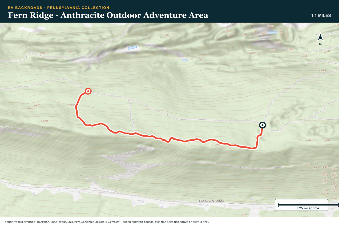
TOPOGRAPHIC PROFILE
Fern Ridge - Anthracite Outdoor Adventure Area, from start to finish
- Climb
- +129 ft
- Descent
- −188 ft
Elevation sampled from AWS Terrain Tiles along the published route. Small terrain and GPS differences are normal.
ROUTE READINESS
Do seven checks before you leave pavement.
surface
Forest dirt, rock, ruts, mud, and managed park obstacles
clearance
Standard clearance early; more clearance and protection later
remoteness
The forest is close to towns, but cell service and recovery vary
charging
Verify a working charger before the ridge roads
cell Coverage
Carry the routes offline
weather
Avoid saturated roads and active freeze-thaw damage
turnaround
Stop before mud, rock, or a park obstacle exceeds the prior stage
BEFORE YOU GO
Make these decisions while you have a signal.
- Check state-forest and park access
- Confirm permits, fees, and vehicle rules
- Download the route and charger plan
TURN AROUND WHEN
Follow the limits that you set.
- A gate or sign does not match the plan
- Ruts exceed the vehicle's clearance
- Tires spin and damage the road
CARRY
Prepare for common problems.
- Tire repair kit and compressor
- Recovery gear for the selected stage
- Offline maps, water, and weather layers
OPEN THE LIVE MAP
Check the drive home.
See the route with open chargers and road-distance charging gaps. Planned stations do not change current coverage.