
ADVENTURE ROUTE COLLECTION · MICHIGAN
Upper Peninsula: Forest and Shore Roads
Use eight forest and shore routes in Michigan's Upper Peninsula. Start on firm truck trails. Add sand, water, and longer remote roads later.
WHY IT FITS
Why this progression can fit your trip.
The routes build practical skills for northern forest travel. Later stages add soft sand, standing water, and a longer gap from services.
ROUTE PROGRESSION
Add one skill at a time.
Drive only the stages that fit your vehicle, experience, weather, and current access. A later stage is not a required finish.
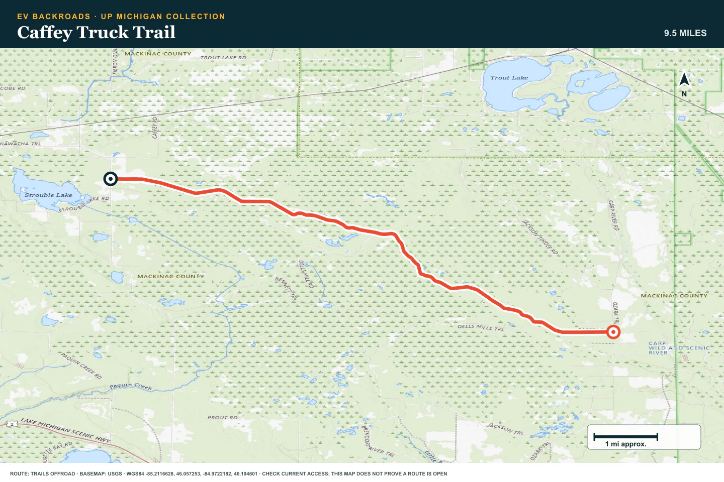
Caffey Truck Trail
- Route distance
- 9.6 mi
- Allow
- 1–2 hours
Start on a short truck trail. Use it to check tire pressure, maps, and braking on forest dirt.
Access note: Source snapshot: Open. Check the live source before travel.
TOPOGRAPHIC PROFILE
Caffey Truck Trail, from start to finish
- Climb
- +10 ft
- Descent
- −92 ft
Elevation sampled from AWS Terrain Tiles along the published route. Small terrain and GPS differences are normal.
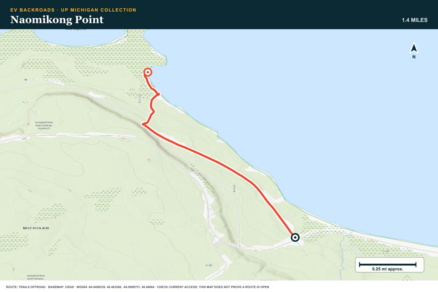
Naomikong Point
- Route distance
- 1.4 mi
- Allow
- 2–3 hours
Add a shore destination with sand. Turn back before the tires dig into soft ground.
Access note: Source snapshot: Open. Check the live source before travel.
TOPOGRAPHIC PROFILE
Naomikong Point, from start to finish
- Climb
- +26 ft
- Descent
- −46 ft
Elevation sampled from AWS Terrain Tiles along the published route. Small terrain and GPS differences are normal.
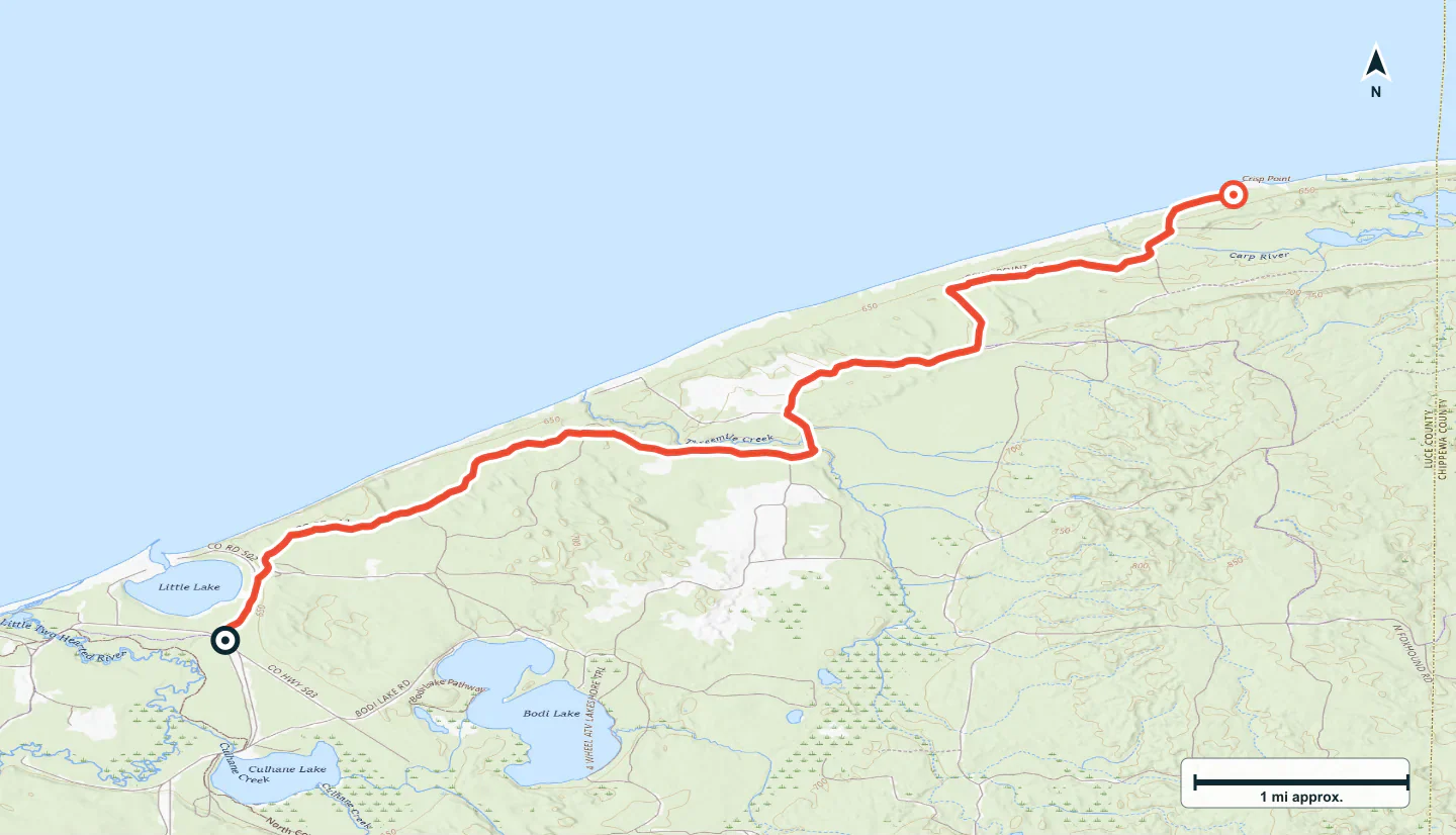
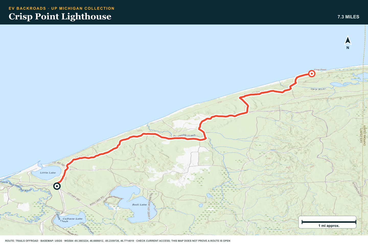
Crisp Point Lighthouse
- Route distance
- 7.3 mi
- Allow
- Half day
Use the lighthouse route to add distance and route finding. Confirm seasonal access before travel.
Access note: Source snapshot: Open. Check the live source before travel.
TOPOGRAPHIC PROFILE
Crisp Point Lighthouse, from start to finish
- Climb
- +155 ft
- Descent
- −174 ft
Elevation sampled from AWS Terrain Tiles along the published route. Small terrain and GPS differences are normal.
Charcoal Grade
- Route distance
- 5.8 mi
- Allow
- 2–3 hours
Add a forest grade with more junctions. Confirm the legal route at each turn.
Access note: Source snapshot: Open. Check the live source before travel.
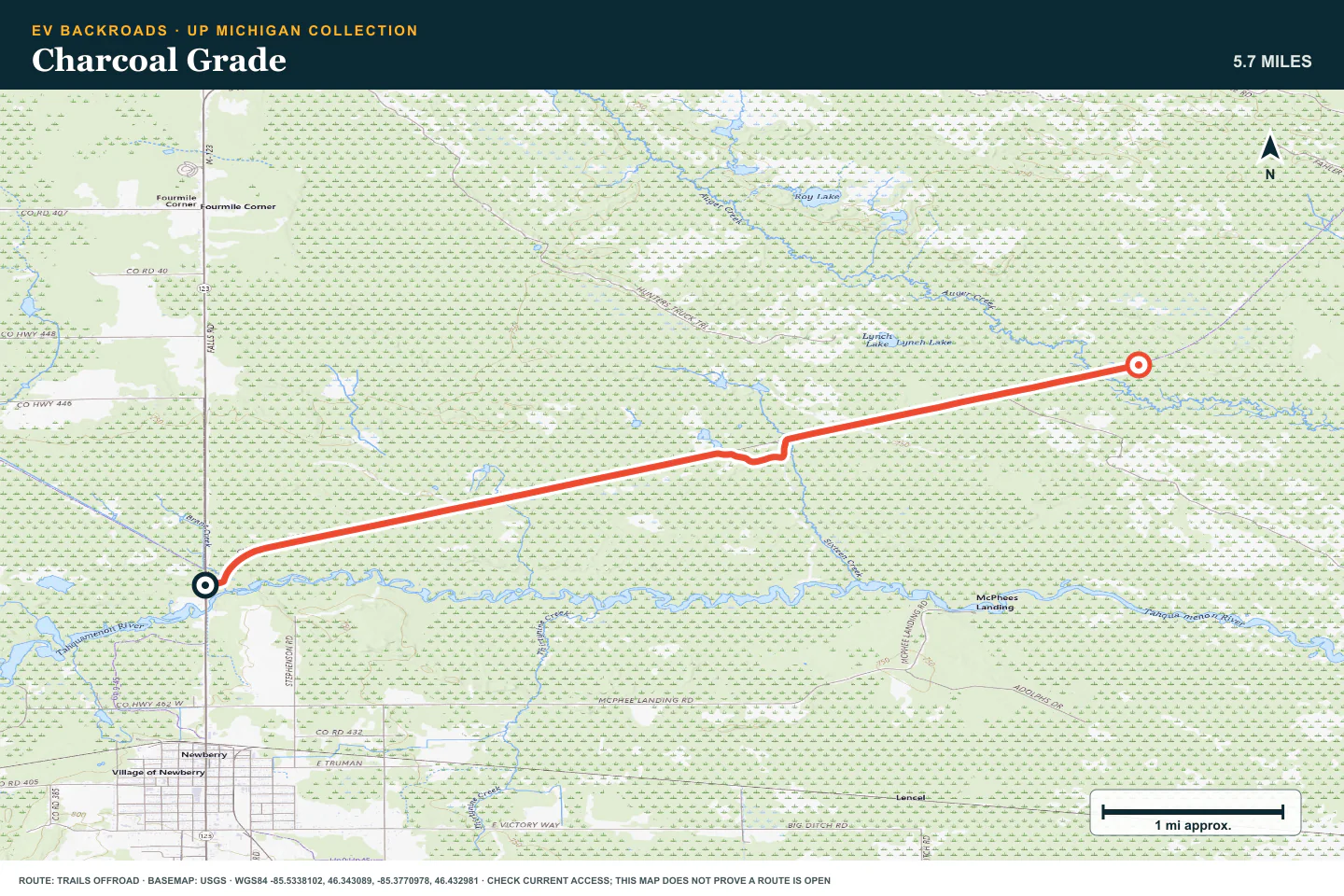
TOPOGRAPHIC PROFILE
Charcoal Grade, from start to finish
- Climb
- +69 ft
- Descent
- −64 ft
Elevation sampled from AWS Terrain Tiles along the published route. Small terrain and GPS differences are normal.
Tahquamenon River Access
- Route distance
- 1.1 mi
- Allow
- Half day
Add a river access road. Inspect wet sections and protect the soft road surface.
Access note: Source snapshot: Open. Check the live source before travel.
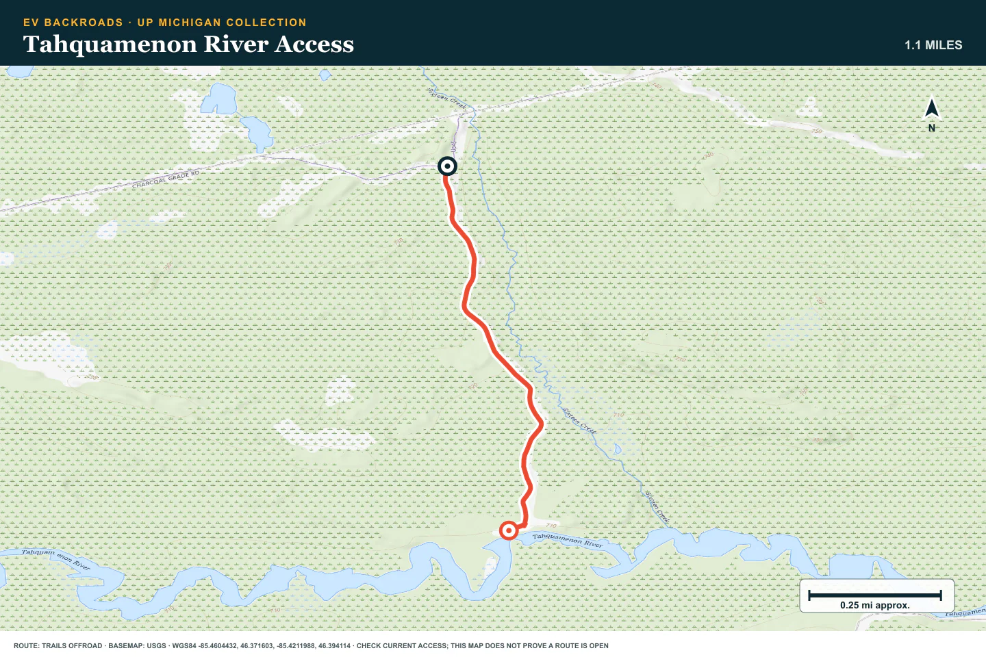
TOPOGRAPHIC PROFILE
Tahquamenon River Access, from start to finish
- Climb
- +16 ft
- Descent
- −34 ft
Elevation sampled from AWS Terrain Tiles along the published route. Small terrain and GPS differences are normal.
Fisher Road
- Route distance
- 2.7 mi
- Allow
- Half day
Use this stage to practice sand and water decisions. Do not enter water without a visible, firm exit.
Access note: Source snapshot: Open. Check the live source before travel.
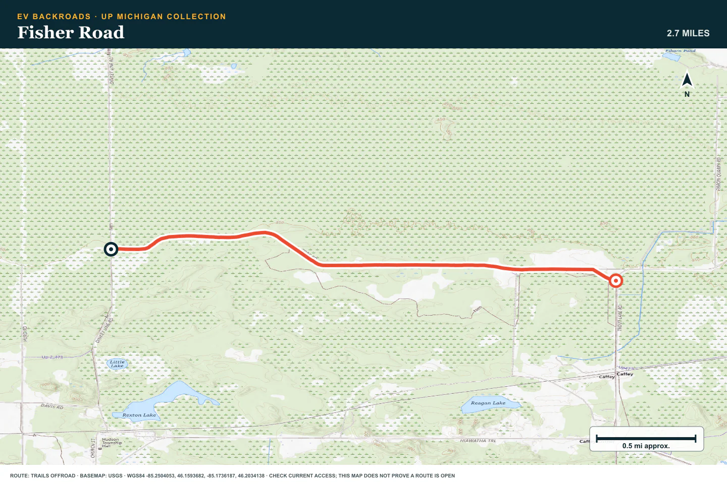
TOPOGRAPHIC PROFILE
Fisher Road, from start to finish
- Climb
- +66 ft
- Descent
- −59 ft
Elevation sampled from AWS Terrain Tiles along the published route. Small terrain and GPS differences are normal.
Two Hearted Landing
- Route distance
- 2.3 mi
- Allow
- Half day
Add a more remote shore route. Keep time and battery for a slow return on the same surface.
Access note: Source snapshot: Open. Check the live source before travel.
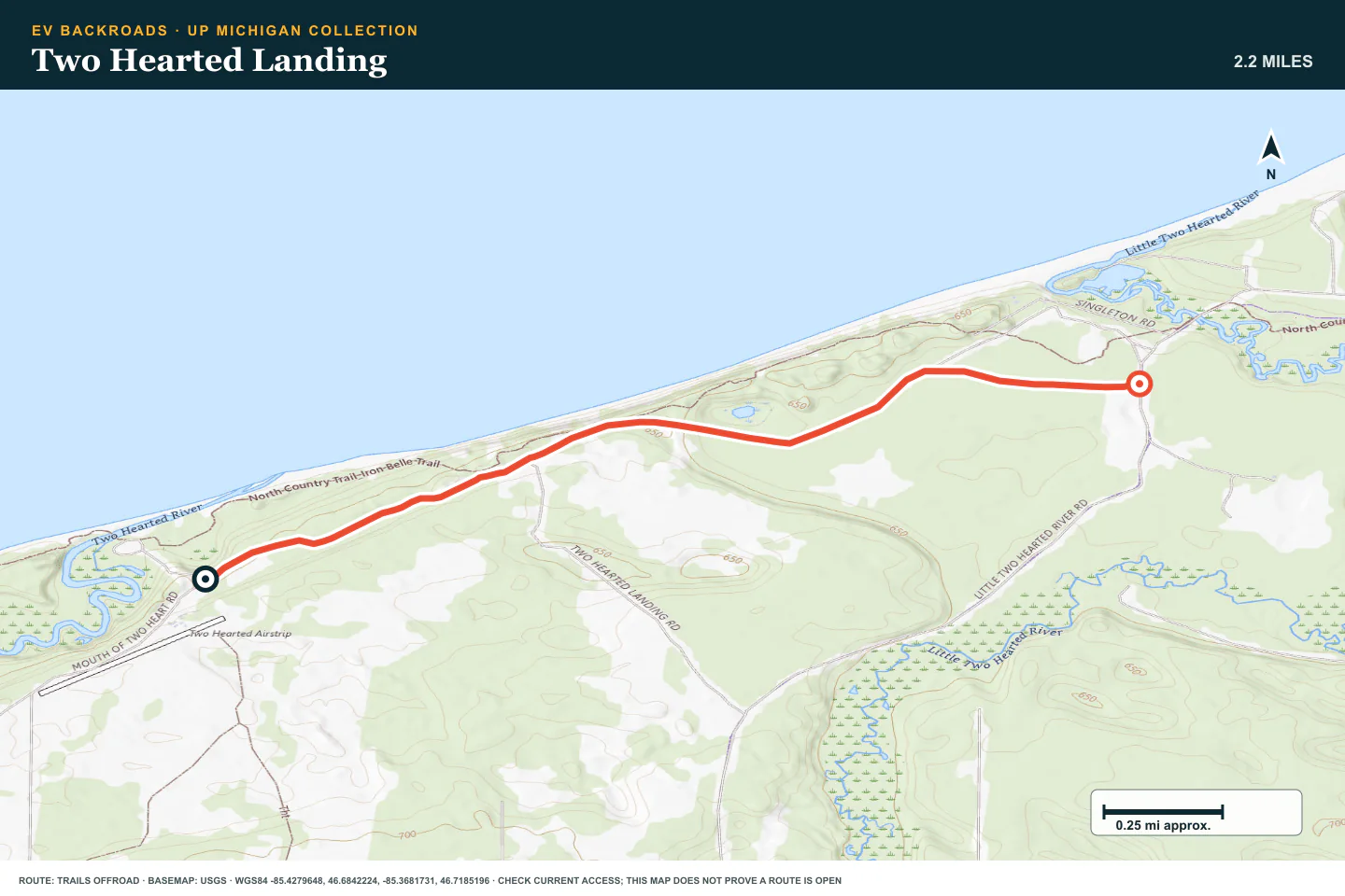
TOPOGRAPHIC PROFILE
Two Hearted Landing, from start to finish
- Climb
- +33 ft
- Descent
- −52 ft
Elevation sampled from AWS Terrain Tiles along the published route. Small terrain and GPS differences are normal.
County Road 500
- Route distance
- 11.7 mi
- Allow
- Full day
Use the final stage as a longer forest day. Check seasonal access and carry the equipment needed for a delay.
Access note: Source snapshot: Open. Check the live source before travel.
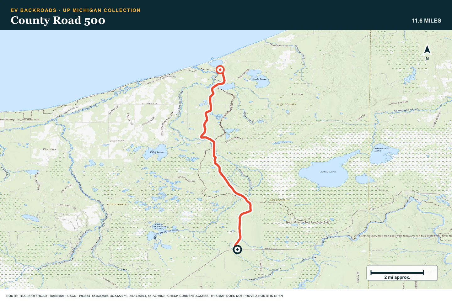
TOPOGRAPHIC PROFILE
County Road 500, from start to finish
- Climb
- +79 ft
- Descent
- −256 ft
Elevation sampled from AWS Terrain Tiles along the published route. Small terrain and GPS differences are normal.
ROUTE READINESS
Do seven checks before you leave pavement.
surface
Forest dirt, sand, roots, puddles, and shore access roads
clearance
Standard clearance on early roads; more clearance for ruts and water
remoteness
Fuel and charging can be far apart in the Upper Peninsula
charging
Verify the next charger before each forest section
cell Coverage
Download the route and return before you leave a town
weather
Wet ground and early snow can change the route quickly
turnaround
Stop before unmeasured water, deep sand, or an uncertain legal route
BEFORE YOU GO
Make these decisions while you have a signal.
- Check state and forest route notices
- Confirm the road is legal for your vehicle
- Plan charging for the full return
TURN AROUND WHEN
Follow the limits that you set.
- Water depth or bottom condition is unknown
- Sand needs wheelspin
- Snow or mud hides the firm route
CARRY
Prepare for common problems.
- Tire repair kit and compressor
- Traction boards and a shovel
- Warm layers, insect protection, and offline maps
OPEN THE LIVE MAP
Check the drive home.
See the route with open chargers and road-distance charging gaps. Planned stations do not change current coverage.